Places
36 places found.
Those places high-lighted have photos. All locations may have maps, books and memories.
- Bangor, County Down
- Newcastle, County Down
- Greyabbey, County Down
- Donaghadee, County Down
- Downpatrick, County Down
- Portaferry, County Down
- Dromore, County Down
- Hillsborough, County Down
- Downings, Republic of Ireland
- Killyleagh, County Down
- Ardglass, County Down
- Rostrevor, County Down
- Dundrum, County Down
- Newtownards, County Down
- Warrenpoint, County Down
- Ballygowan, County Down
- Ballywalter, County Down
- Ballyward, County Down
- Bishops Court, County Down
- Boardmills, County Down
- Culcavy, County Down
- Katesbridge, County Down
- Killough, County Down
- Millisle, County Down
- Portavogie, County Down
- Saul, County Down
- Seaforde, County Down
- The Diamond, County Down
- Audleystown, County Down
- Kearney, County Down
- Annaclone, County Down
- Ballyhalbert, County Down
- Ballymartin, County Down
- Clare, County Down
- Conlig, County Down
- Dollingstown, County Down
Photos
856 photos found. Showing results 1,601 to 856.
Maps
459 maps found.
Books
2 books found. Showing results 1,921 to 2.
Memories
8,167 memories found. Showing results 801 to 810.
Saturdays
I went to Ferndale nearly every Saturday with my Mum and brother to visit my grandparents and my Great Aunt and Uncle. My grandparents, the Gambles, lived in Brynhyfryd and we would get off the bus at the bottom of the hill on the Strand ...Read more
A memory of Ferndale by
Our Lives In Yapton 1982 2005
My family moved to Yapton, from Folkestone Kent, because my husband had a job there. It was a difficult time but I was expecting a baby and I had a 3 year old son so it was also an exciting time for us. Over the years ...Read more
A memory of Yapton in 1982 by
Ye Olde Gate House
This picture is of the Old Gate House, taken from the West Street side. The sign over the front door was "Ye Olde Gate House". It was a very old house and is shown on some of the old maps of Wilton. It had two addresses - The ...Read more
A memory of Wilton in 1920 by
Playing In The Corn Fields
I lived in the cottage next to the Chapel, and played with Wendy, we used to cycle to Upware and Wicken fen. At one point we would sit on the haystacks after the farmers had finished them. I would go horse riding ...Read more
A memory of Swaffham Prior in 1966 by
Old Port Bannatyne
This is a favourite view of photographers taken from McIntyre's Boatyard. In the distance you can see St Bruoc's church which burnt down in 1956. In the foreground is a boat hiring station, one of three in the village. ...Read more
A memory of Port Bannatyne by
St Mary School
At the top of the town towards the flats is St Mary's church. I used to attend St Mary's school which was situated behind the church. One day when everyone turned up for school it had been burned to the ground, I think I was ...Read more
A memory of Brierley Hill in 1965 by
Before They Were Built
WHEN I WAS A KID THIS WAS THE SITE OF A FARM IN THE 1940s ( I think it belonged to farmer Copley). THE BIG HOUSE IN THE BACKGROUND BELONGED TO DR MARJERY. THE HOUSE IS STILL THERE BUT THE SURGERY WAS KNOCKED DOWN, AND WAS RESITED NEXT TO ST THOMAS' CHURCH.
A memory of Featherstone in 1949 by
Roby Mill School
I attended Roby Mill School. Miss Simm was my teacher. She caught the bus to the monument (Vicarage Corner), and walked down College Road picking pupils up along the way. It was almost 1 mile in distance, she did this twice a ...Read more
A memory of Upholland Sta in 1949 by
Otley Revisited
I'd visited Otley the town in the 1960s, walking and rockclimbing as a lad of 18 /20 with friends I met at work in the woollen mills of Bradford and Shipley. My first memory is of looking down from the Chevin to this beautiful view of ...Read more
A memory of Otley in 2005 by
Captions
2,242 captions found. Showing results 1,921 to 1,944.
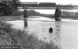
Today, it is quite hard to get down to the river in some places, but the Ribble is still there waiting to be reinvented.
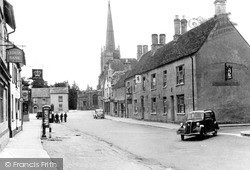
The Cotswold rivers of Coln and Leach join the Thames here, and the town is much influenced by them.
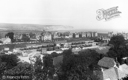
Ballard Down (top left) and the Victorian villas of Gilbert Road (middle distance) form the backdrop.
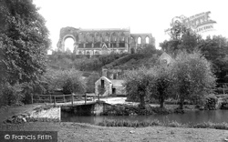
The impressive and imposing ruins of Malmesbury Abbey look down on the River Avon 60 feet below.
Once an important market town, Shefford was blighted this century by through traffic; its central T-junction was a bottleneck until the town was recently by-passed.
If we count four awnings down on the same side of the road, we will just be able to make out Boots.
We are looking down from the keep of Clitheroe Castle to the town below.
The Brown Cow public house is on the right, and the Black Bull Hotel can just be made out further down the road. The village is 400ft above sea level.
We are in the main part of the Hartings, nestling in the northern slopes of the Downs, on the pilgrims' route to Chichester.
Woodstock House is a country house hotel nestling in the Downs below the heights of Charlton Forest. We are near Goodwood racecourse, hence the racing scene on the hotel restaurant signboard.
This is a fine example of Bridport`s eastern countryside, with the Dorset Downs falling away into the Marshwood Vale (far left) from the heights of Eggardon Hill and woods of Knowle Hill (left), in
The main road leads down past Holy Trinity church, which was built in 1836. The scene is similar today but the road is very busy with motor traffic.
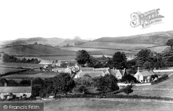
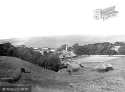
Here we see a rural scene in a fold of the Downs - now much more wooded and obscured by trees. A stack yard is in the foreground, with round and rectangular corn ricks.
The Angel Hotel (offering Good Stabling and Garage) was knocked down and replaced by a cinema. This in turn has become a nightclub. A pub built next door - The Bell - is now derelict.
The first stage of the Otley to Skipton Railway reached Ilkley on 1 August 1865 - the town was decorated with bunting, and merrymaking continued day and night.
This view looks down the High Street towards the clock tower. This was built as a market hall and lock up, or temporary prison, in 1842, but in 1870 the clocktower, belfry and spire were added.
The Victory Inn can be seen down the street, and round the corner, not visible in this picture, is The Bugle, Hamble's famous riverside inn, which probably dates from the 12th century.
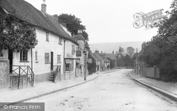
Here, looking down Main Street towards St Mary's Church with its horse mounting steps, we see the white Imperial Cottage (left). The chestnut tree has been removed, giving a view of Jubb's Farm.
Here we see the heart of what many claim is Kent's prettiest village: the tower of its 15th-century flintstone church of St Mary's looks down on this spacious square lined with half-timbered Tudor and
The reality is more down to earth.
Terraces extend down Mallams, and houses have reached Modbury Mead (centre).
Further down, towards Bancroft and Nightingale Road, the tannery and other industrial works poured their waste into the river. Only the lavender works may have offset the obnoxious smell of the Hiz!
The church of St Mary and St Hugh was badly damaged by fire in 1708, which burnt down the spire and melted the bells.
The gaps in the wooden weir were stopped with slats which enabled more water to be directed down the leat.
Places (198)
Photos (856)
Memories (8167)
Books (2)
Maps (459)

