Places
36 places found.
Did you mean: street or streetly ?
Those places high-lighted have photos. All locations may have maps, books and memories.
- Heathfield, Sussex (near Cade Street)
- Street, Somerset
- Chester-Le-Street, Durham
- Adwick Le Street, Yorkshire
- Scotch Street, County Armagh
- Friday Street, Surrey
- Potter Street, Essex
- Boughton Street, Kent
- Newgate Street, Hertfordshire
- Streetly, West Midlands
- Shalmsford Street, Kent
- Green Street Green, Greater London
- Boreham Street, Sussex
- Park Street, Hertfordshire
- Cade Street, Sussex
- Appleton-le-Street, Yorkshire
- Hare Street, Hertfordshire (near Buntingford)
- Romney Street, Kent
- Trimley Lower Street, Suffolk
- Streetly End, Cambridgeshire
- Hare Street, Hertfordshire (near Stevenage)
- Brandish Street, Somerset
- Colney Street, Hertfordshire
- Langley Street, Norfolk
- Silver Street, Somerset (near Street)
- Street, Yorkshire (near Glaisdale)
- Street, Lancashire
- Street, Devon
- Street, Cumbria (near Orton)
- Street, Somerset (near Chard)
- Bird Street, Suffolk
- Black Street, Suffolk
- Ash Street, Suffolk
- Broad Street, Wiltshire
- Brome Street, Suffolk
- Penn Street, Buckinghamshire
Photos
24,921 photos found. Showing results 3,641 to 3,660.


Your search returned a large number of results. Please try to refine your search further.
Maps
1,622 maps found.
Books
3 books found. Showing results 4,369 to 3.
Memories
6,667 memories found. Showing results 1,821 to 1,830.
Philip Streets
This is the photo in the distance of the house where I was brought up (from Dec 1952 to March 1964) with my three brothers, Michael, Alan and twin Roger, N° 1 Abbey Close. Our neighbours were Mr and Mrs Orchard with their ...Read more
A memory of Hythe in 1952 by
Childhood Memories
I started staying with my Aunt Reeves and Uncle Sam at about 2 years old. I remember we use to go for long walks across the hills which was the golf course, or we would meander through Cowdry Park. Aunt use to take me to ...Read more
A memory of Easebourne by
My Memories Of Wickford
My parents and I lived in North London near Hendon aerodrome. Because it was well known as an RAF base the German Luftwaffe raided the area regularly. My parents decided to move to somewhere safer and because my mother's ...Read more
A memory of Wickford in 1940 by
My Mother's Memories Of Ospringe
After a time Mother married Charles Gamble, we called him Pop. He left the Merchant Navy and went to work on the Estate for my Grandfather. We got a house at Ospringe it was next door to a water mill. The water ...Read more
A memory of Ospringe in 1910 by
High Street
I was born and lived in Christchurch for 10 years (1952-1962) but still count it as my home. Iremember walking down the High Street with Mum and my sister, when she stopped to talk to someone I looked around and saw them knocking down some building at the top of the street ready for the by-pass.
A memory of Christchurch in 1957 by
General Store, Hosier Street
Please can anyone help? Do you remember a general shop in Hosier Street on the left-hand-side going from St Mary's Butts in the name of F W Hawkins before the civic offices were built?
A memory of Reading in 1960 by
Sidcup High Street
Just looking at this photo brings a lump to my throat. We lived in Blackhorse Road just off the High Street. The shop in the photo is on the corner of Blackhorse Road. I was 15 yrs old in 1965 and the Beatles were topping the ...Read more
A memory of Sidcup in 1965
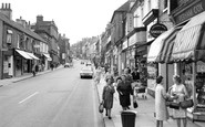
Shopping Memories.
This photograph shows two ladies chatting together in the foreground. On the right in the floral dress is my mother Mrs Beatrice Farnsworth. My family have been farmers in the locality for three generations. My mother's car is ...Read more
A memory of Worksop by
Captions
5,435 captions found. Showing results 4,369 to 4,392.

The boundary runs along the A45 and veers left by the Lawn Works to meet the A5, Watling Street.

The cobbled street to the immediate left, just beyond the chemists, is Lycette Road. The cobbles have long since been covered over, but there is still a pharmacy trading from the same premises.

in the 1950s Reginald Hine, the great Hitchin historian, wrote of the town, 'It is lamentable what we have lost during the last 100 years', he was complaining of the desecration of the buildings and streets

It is still possible to sit here and watch the world go by today, although this open area once had buildings lining the street between the Market Hall and the Mitre.

As well as being a holiday resort, Bournemouth was gaining a reputation as a smart shopping town, and by this time department stores were lining the main streets.

The initials of the former can still be seen on the premises of the NatWest in Westgate Street.

This photograph shows the statue of King Edward VII, the eldest son of Queen Victoria, at the corner of Union Street and Union Terrace.

On the junction with Westgate Street is the Theatre Royal, one of only three surviving Regency theatres in the country, built in 1819 by William Wilkins, architect of the National Gallery.

The boy on the swing is Norman Pearson, watched by his mother; Norman still runs a cycle shop in the High Street. Mount Noddy Cottage, nestling in the trees, was demolished in the 1950s.

Plaxtol is a pleasantly-situated hilltop village, with a long main street. There is a lovely group of cottages near the church, which date from the 17th century.

This is the corner of Piccadilly, where it meets the top of Market Street. On the left is one of Lewis's entrances. Pauldens, in the centre, moved here after a fire destroyed their store in 1957.

The cobbles of this street remain, but the shops have become houses. The church spire was demolished in 1947. Not medieval, it was installed in 1827, apparently using a design for another church.

When this picture was taken, Ripley consisted of just one street. The village was extensively remodelled in the 1820s, though parts of the parish church date from the 14th century.
When this picture was taken, Ripley consisted of just one street. The village was extensively remodelled in the 1820s, though parts of the parish church date from the 14th century.
 Stall, Greenwich 1884, London")
They look like ragged street urchins in their rumpled clothes and battered boots, and were probably bought their penny treats in return for posing for the photographer.

In South Street, Shodfriars Hall is an echo of the four friaries established in the medieval town.

In 1836 it became the premises of the wine merchant William Cunnington, and extensive cellars run under the road and the buildings on the opposite side of the street.

The old town, spread picturesquely round part of Mount's Bay, has delightfully narrow streets that ascend the hill from the fine esplanade at the edge of the sea.

This is a detail of the frontage of 34 West Street, which was the `Bridport News` office and West Dorset Printing Works in 1909.

This imposing, ornate gateway once stood where the Strand becomes Fleet Street, and was erected in 1672 to a design by Wren.The effigies portray Stuart monarchs.

This is taken from the north end of the Green, looking south towards Hall Street, showing the wide expanse of the Green, where fairs are still held.

This is one of Lancaster's main shopping streets. Note the radio shop on the right—in country districts, the radio, with its BBC Home and Light programmes, helped people to keep in touch.

At the other end of Frimley High Street, we cross the River Blackwater, which is the boundary between Surrey and Hampshire.

A delivery boy rests with his bicycle between rounds on the right, while down the street a policeman looks out for traffic to direct.
Places (385)
Photos (24921)
Memories (6667)
Books (3)
Maps (1622)

