Places
26 places found.
Those places high-lighted have photos. All locations may have maps, books and memories.
- Cemmaes Road, Powys
- Six Road Ends, County Down
- Road Weedon, Northamptonshire
- Severn Road Bridge, Gloucestershire
- Roade, Northamptonshire
- Berkeley Road, Gloucestershire
- Harling Road, Norfolk
- Road Green, Devon
- Builth Road, Powys
- Cross Roads, Yorkshire
- Steele Road, Borders
- Cross Roads, Devon
- Four Roads, Dyfed
- Road Green, Norfolk
- Biggar Road, Strathclyde
- Clarbeston Road, Dyfed
- Five Roads, Dyfed
- Eccles Road, Norfolk
- Grampound Road, Cornwall
- Morchard Road, Devon
- Wood Road, Greater Manchester
- Four Roads, Isle of Man
- St Columb Road, Cornwall
- Clipiau, Gwynedd (near Cemmaes Road)
- New Road Side, Yorkshire (near Silsden)
- New Road Side, Yorkshire (near Cleckheaton)
Photos
14,329 photos found. Showing results 3,761 to 3,780.
Maps
476 maps found.
Books
5 books found. Showing results 4,513 to 5.
Memories
11,058 memories found. Showing results 1,881 to 1,890.
Church Road
There were two cinemas in Church Road; the Granada and the Century, almost next door to each other. The Granada had Sat morning programmes for kids, and I was a regular.
A memory of Upper Norwood in 1951 by
Nostalgia
Greenfield Road was known as Greenfield Villas before World War II. I lived and grew up in 4 Greenfield Villas with my grandparents, Mr & Mrs W A Davies, my mother, Nancy, and sister, Gertrude, from 1937 until 1947. My father was ...Read more
A memory of Llanelli in 1940 by
Old Pictures
Got a pile of colour and B and W pics from late 60`s all of Drumcahel aroudf Pitmilly Road and Airegold place but am looking for info on an event which I think took place on the playing fields across from the Goodyear tyre factory. ...Read more
A memory of Drumchapel in 1969 by
Hard Times But Happy Days
We lived on Park View facing the library and Queens Park which had its own museum and everything a victorian park could offer two young brothers yearning for adventures. We would ride our guiders all over that park, and ...Read more
A memory of Harpurhey in 1960 by
Town Hall Roundabout
Living in Watford from the early 1950's, I well remember the Town Hall roundabout before they moved it. Can't recollect whether it was nearer or further away. I can recollect, not far from a pub called the OBH, or almost ...Read more
A memory of Watford in 1952 by
The Highway 1957
This is a photo full of memories for me, too. We lived in Tatling End (Brokengate Lane) from 1941 to 1954, so Gerrards Cross was more than familiar to me! In the photo on the right, you can see the garage/petrol station ...Read more
A memory of Gerrards Cross by
Watford's Lost Factories
Living in north Watford from 1952 to 78, I have fond memories of factories such as the British Moulded Hose. Not a nylon stockings factory as its title may sound, but an asbestos factory which I remember one day caught ...Read more
A memory of Watford by
Shepherd Street, Bow.
Does anyone remember Shepherd Street in Bow? The Widow's Son pub was on the corner (famous for its hot cross buns legend). The pub is still there but the road is now warehouses of some kind. I ask because my father lived down ...Read more
A memory of Barking by
Ccefn Fforest
My memories of Cefn Fforest were of Whitson marches in your new clothes and having sore feet where your new sandles rubbed your feet raw. Along with 'Thomas The Milk' was Pughs Farm who had a horse and cart delivering the ...Read more
A memory of Cefn by
The Brad
I was born in Coedybrain Rd in 1948 and my family moved to School St. I remember going to the school until I was 6, when we moved away to a new housing estate. The school had a stuffed squirrel in a glass case. I was in the nursery ...Read more
A memory of Llanbradach
Your search returned a large number of results. Please try to refine your search further.
Captions
5,036 captions found. Showing results 4,513 to 4,536.
The Black Lion public house on the right was originally on the opposite side of the road. In 1793, the site that now carries the name was known as the Sow and Pigs.
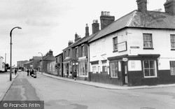
This architecture is not exciting, but very user-friendly: a corner shop with others adjacent, each with their good timber fronts, and on the opposite side of the road The Bell pub, making up a standard
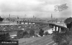
Cutting across the middle of the picture is the bridge carrying the Caledonian Railway, while on the far right is the Victoria Road bridge.
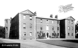
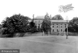
The old Infirmary, designed by John Wing and opened in 1803, fronted Ampthill Road; it was later expanded to be the Bedford General Hospital (South Site).
At the junction of Buckingham and Bicester Roads is the Royal Bucks Hospital.
In the closing stages of the war, a V2 nearly hit Commer Karrier's despatch shop in Biscot Road, destroying a house.
The field in the foreground, with its flint wall, lies to the south of East Blatchington Farm; the view looks south down Blatchington Hill, the village main street, with Belgrave Road passing in front
This view is taken at the north-west end of what is now the recreation ground, and the area beyond the carriage is now the teeming roundabout where the A24 London Road meets the A27 which runs from Eastbourne
The name of this lane, which runs north from the junction of High Street and Lewes Road, refers to Sackville College.
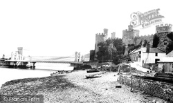
It was built for his Holyhead road and replaced a notorious ferry across the dangerous waters of the Conwy estuary.
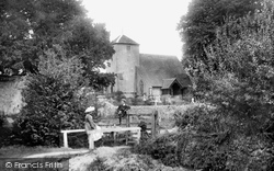
We are just below the South Downs on the road between Midhurst and Chichester; this view looks across a footbridge over the stream that feeds into the Rother near Midhurst.
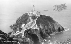
It is the point of destination of Telford's most famous road, now the A5, built to speed communication between London and Dublin.
Trade in the town increased dramatically once the Keighley to Kendal turnpike road opened, making Settle a premier coaching route.
Across the road can be seen one of Wisbech's familiar landmarks, the 'illuminated clock' on the clockmaker's shop, of Mr Dann.
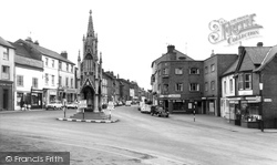
Today a wonderfully complicated tourist sign stands here, with arms pointing down each of the seven roads that leave the square.
This view on the London Road reflects the changes brought about by the by-pass. The Chequers ceased to be a pub, although traces of the painted signs on the front wall can still be seen.
The inner relief road, the John Adams Way, has made a tremendous difference to this scene, and only the River Witham is the same.
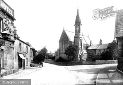
Close to the road, the solid but impressive ashlar tower dominates the immediate street scene with its substantial angled buttresses and crocketted finials; these are not 15th-century, but were added
The road sign points down South Street which is almost invisible between the public building and the shops. Colmer`s Hill (right of centre) forms the distant skyline.
The house at the far end of the road on the High Street is now the Birdcage. This is the route to the RAF Battle of Britain Memorial Museum.
The modern expansion of Groby as a Leicester suburb can be seen on the left, as the road swings towards Coalville.
Bakery (left) has long gone, and the building society on the extreme left in this photograph may be the old Anglian Building Society before they became the Nationwide and moved across the road
Here we have the old centre of the village, now by-passed by the main road. The Roman Catholic church of St Mary of the Angels with its free-standing spire dominates the centre of our photograph.
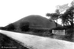
It predates the Roman road, now the A4, whose early track can be seen in the photograph. In 1883 it was the first site in Britain to be classified as an ancient monument.
Places (26)
Photos (14329)
Memories (11058)
Books (5)
Maps (476)


