Places
17 places found.
Those places high-lighted have photos. All locations may have maps, books and memories.
- Bridge End, Oxfordshire
- Bridge End, Lincolnshire
- Bridge End, Essex
- Bridge End, Bedfordshire
- Bridge End, Clwyd
- Bridge End, Warwickshire
- Bridge End, Surrey
- Bridge End, Durham (near Frosterley)
- Bridge End, Northumberland (near Hexham)
- Bridge End, Hereford & Worcester (near Tirley)
- Bridge End, Hereford & Worcester (near Bosbury)
- Bridge End, Shetland Islands
- Bridge End, Cumbria (near Carlisle)
- Bridge End, Northumberland (near Hexham)
- Bridge End, Devon (near Kingsbridge)
- Bridge End, Devon (near Sidmouth)
- West End, Yorkshire (near Pateley Bridge)
Photos
40 photos found. Showing results 581 to 40.
Maps
520 maps found.
Books
2 books found. Showing results 697 to 2.
Memories
1,925 memories found. Showing results 291 to 300.
Holidays In Northlew
Re the photo of Northlew Bridge, I am sure this is me, the tallest girl, my sister the smallest girl and the other is my cousin. My grandparents lived in Northlew and we went down from Bolton to visit for holidays.
A memory of Northlew in 1961 by
M2 Bridge Worker In St. Bart's Hospital
I remember being in St. Barts Hospital in 1961 or 1962, aged 11 or twelve, to have my appendix removed. At that time there was a construction worker recovering from a very serious injury received while ...Read more
A memory of Rochester in 1961 by
Days Gone By
It was lovely to browse through the Allendale pages, as I was sitting thinking about 'sunny' holidays in Allendale with mam and dad, who are sadly gone now. The Heatherlea was the favourite hotel, with the 'gong' for mealtimes, ...Read more
A memory of Allendale Town in 1961 by
The Boat
The Boat is the name of the Inn on the left of the picture. As children we used to walk across the top of bridge wall and, as a further dare, across the pipes which ran just below the parapet, above the water. Once, when I was serenely ...Read more
A memory of Gnosall in 1961 by
Rats, Rats And More Rats.
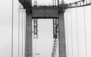
This photograph was obviously taken when the road bridge was nearing completion in 1961. My husband grew up nearby, and tells some gruesome stories about the plague of rats they experienced when the undergrowth was being ...Read more
A memory of Saltash in 1961 by
The Pub In The Centre Of Dartford
There was a pub near the railway bridge on Overy Street called 'The 3 Tuns' was that the one? I was born in a house in Dartford Road in 1955, the family moved to a new bungalow, no. 6 Tuffnail Road, tel. 23838, ...Read more
A memory of Dartford in 1961
Tideford's New Road
This photograph shows Tideford after the new A38 had been built through the middle of the village to serve the new Tamar road bridge. A number of properties had to be demolished for the new road. The shop in the foreground on ...Read more
A memory of Tideford in 1961 by
Steeper Than It Looks
It was every school summer holiday that my sister and I used to come with our parents to spend a week or so with grandma Annie Penhorwood. If we had any money we would go to the bakery shop near the bottom of the High Street ...Read more
A memory of Bideford in 1961 by
Post Office
I was born in Hereford in 1952 to Roland S G Hodges and Doreen his wife. I have fond memories of Kings Caple and Fawley. My grandmother ran the village post office for nearly 40 years right up to decimalization. She ran her Post ...Read more
A memory of King's Caple in 1960 by
School Days
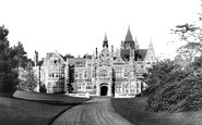
Before becoming the home of George Harrison of the Beatles, Friar Park was run as a school by sisters of the St. John Bosco order. This was my first school and I remember having to walk all the way to the main door along the ...Read more
A memory of Henley-on-Thames in 1960 by
Captions
1,770 captions found. Showing results 697 to 720.

Hidden among the trees in the centre of our photograph is a foot (and animal) bridge just a few miles outside Dunsop Bridge. The hill on the left is called Knot or Sugar Loaf.

Stirling is the last place where there is a bridge over the Forth before the river widens into an estuary. The town and its castle have therefore been fought over on numerous occasions.

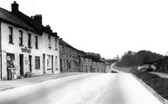
Petrol pumps and the small village shop stand next to another café advertising cigarettes and the ubiquitous Wall's ice cream. The signpost points to Casterton.

This magnificent stone bridge was built in the early 1800s to replace another that was washed away in the floods of 1797.

Uphill from the bridge are stone cottages. The Black Bull Inn became the Youth Hostel, and the Dog Inn is now the Hark to Bounty.

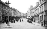
Two motor cars are visible, but few street markings and signs, apart from the one on the right by the bow-windowed shop in the stone-built terrace.

This view looks south-west along the canal past the last lock, No 16, Hills and Partridges Lock, to Park Street Bridge. (Hills and Partridges works have now long gone.)

Now we move two or three miles upstream to Colley Mill Bridge. This bridge is old and narrow, and was already controlled by traffic lights when this picture was taken.

There were two Littlehamptons, a busy port and fishing village about half a mile inland on the east bank of the Arun, and the seaside resort which grew up after 1800.

There were two Littlehamptons, a busy port and fishing village about half a mile inland on the east bank of the Arun, and the seaside resort which grew up after 1800.

A bridge, complete with a chantry chapel, has existed over the River Hull since the 13th century. It was rebuilt in 1803, when the toll was one shilling.

The view looking towards the bridge to Ray Mill Island (or, as some people call it, Boulters Lock Island) is the same that Edward Gregory painted in his famous 'Boulters Lock, Sunday Afternoon' (1882

This beautifully proportioned stone bridge (Y Bont Fawr means 'the big bridge'), built over the Afon Conwy in 1636, has been a well-known beauty spot and subject for artists for centuries.

The timbered toll-bridge carrying the York road over the Ouse was erected in 1791, and was one of the earliest of its type in the country.

Three hundred years ago, Bothwell was a strategically important village, its bridge being the only one over the Clyde apart from Glasgow Bridge.

Nearby is the site of the forthcoming 1930s Woolworth store and 1980s redevelopment. Down past the latticed railway bridge is the new road over the bridge to Middleton.

A double-decker bus can be seen crossing the Iron Bridge, which spans the River Loughor close to its estuary. In the background is the industrialised shoreline leading to Llanelli.

This famous bridge spans the Mawddach estuary. A train is heading south. The railway was built as part of the Cambrian railway, with two stations, Barmouth and Barmouth Junction.

Most of the traffic was coal, which was loaded in the harbour beyond the bridge and taken to the linen mills along the river, but there was also a steady flow of sand downstream to this wharf.

One in desperation has left his gear on the bank and has paddled into the river to assist the other hopefuls in an attempt to locate some fish.

This peaceful scene shows the 14th-century five-arched ragstone bridge, which is considered by some to be the finest in the south-east.

In 1792, a company was formed by Lancaster merchants to build a canal; they saw it as a way of getting cheap coal from Wigan and transporting other goods out into towns in the heart of Lancashire.

Newport Pagnell Services is now (2002) run by Welcome Break, but it is architecturally very little changed, with the glazed bridge a distinctive feature.

The attractive village of Bromham is now bypassed, so the old bridge over the Great Ouse is mercifully much quieter than it was a few years ago.
Places (17)
Photos (40)
Memories (1925)
Books (2)
Maps (520)

