Places
17 places found.
Those places high-lighted have photos. All locations may have maps, books and memories.
- Bridge End, Oxfordshire
- Bridge End, Lincolnshire
- Bridge End, Essex
- Bridge End, Bedfordshire
- Bridge End, Clwyd
- Bridge End, Warwickshire
- Bridge End, Surrey
- Bridge End, Durham (near Frosterley)
- Bridge End, Northumberland (near Hexham)
- Bridge End, Hereford & Worcester (near Tirley)
- Bridge End, Hereford & Worcester (near Bosbury)
- Bridge End, Shetland Islands
- Bridge End, Cumbria (near Carlisle)
- Bridge End, Northumberland (near Hexham)
- Bridge End, Devon (near Kingsbridge)
- Bridge End, Devon (near Sidmouth)
- West End, Yorkshire (near Pateley Bridge)
Photos
40 photos found. Showing results 101 to 40.
Maps
520 maps found.
Books
2 books found. Showing results 121 to 2.
Memories
1,925 memories found. Showing results 51 to 60.
Wooden Bridge
I am asking for some help of Swanley. There was a foot bridge built - I'm not sure what year. It was London bound end, just at now the Rainbow Inn chinese. I, as a child, loved that bridge, I think it was built for school children ...Read more
A memory of Swanley in 1976 by
The Friend I Never Knew
I hope this doesn´t distress anyone - that is not my intention, but does anyone recall the name of the young boy from east view who shot himself ? The reason I ask is, that for many years I lived and played there and hung ...Read more
A memory of Bargoed in 1976 by
Our Summer Holidays
Every year since the 1970s we went to Fairbourne for our holidays either with our mom and dad or our aunt and uncle. Our nan and grandad owned a bungalow in Llewellyn Drive. It was right next to the golf house across the road ...Read more
A memory of Fairbourne in 1976 by
Memories Of Risca
This shot brings back a hell of a lot of memories. We used to play on the canal bank here and fish for sticklebacks in the shallow bit under the bridge. I even had had my first real snog in the graveyard (nice!) over the bridge on ...Read more
A memory of Risca in 1976 by
Visits To Wareside 1964 Present
My dad was born at Hillside Cottages in Wareside in 1929 (I think). I remember visiting my Grandmother there up until she moved to Ware round about 1978/9. She lived in the house with the "Hillside Cottages" sign on ...Read more
A memory of Wareside in 1975 by
Oh And
King Street and its area was known as 'over the other side' to everyone on the Broadway side of the railway bridge - a mysterious place that adults would talk of to each other concerning pubs or the cemetery or the tax office. "Oh, he used ...Read more
A memory of Southall in 1975 by
Australians On The Cut 1975
Having left Australia on an open-ended working holiday to England in January, 1974 with my girlfriend, it was hard to imagine that within six weeks of arriving in London we'd be living on a leaky old narrow boat ...Read more
A memory of Leighton Buzzard in 1975 by
Back To The Mid 1970s
1974-1975 I was a French assistant at Westlands School, Plainmoor in Torquay. I would often rent a cottage located in Woodleigh Road in Gara Bridge. This cottage belonged then to Mrs Wadstein who had a charming son named ...Read more
A memory of Woodleigh in 1975 by
Feeding The Donkeys And Racing Pigeons.
The Crown, when I was a child was owned by my Aunty Denny's family. She married my Uncle Terry and they later ran The Firs at Dunhampstead, where I worked through my teen years. My late grandad Joseph ...Read more
A memory of Wychbold in 1975 by
Valley Boy
I went to work in Pontins holiday camp Little Canada in May 1975 and i met my future husband Chris who came from Wales we instantly liked each other and started to go out on dates mostly to the village and the sloop.So we met in ...Read more
A memory of Wootton Bridge in 1975 by
Captions
1,770 captions found. Showing results 121 to 144.
This view shows the junction of Boar Lane and Briggate, looking towards the Corn Exchange.
The road is named after the Tontine Hotel, which was built in 1783 to accommodate visitors coming to see the new bridge.
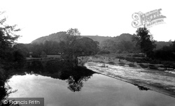
The weir, a mile up the river from Totnes Bridge, was built in 1581 to provide water for the town mills, and marks the end of the freshwater Dart - below here the river is tidal.
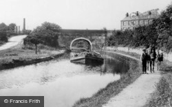
Its rugged stone bridges and its proximity to the Pennines make it a most picturesque line. Carnforth is towards the northern end; the top section was abandoned after the M6 motorway was built.
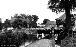
Cattle seek the summer shade and the cool waters of the Bourne at this ancient farm.
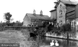
Both bridge and buildings survive. Witchampton was best known for its paper mill at the other end of the village, which dated back to at least 1786 and closed only a few years ago.
Its rugged stone bridges and its proximity to the Pennines make it a most picturesque line. Carnforth is towards the northern end; the top section was abandoned after the M6 motorway was built.
The 'Compton Castle', which we see here, was built by B Cox & Company of Falmouth in 1914; she originally had an open bridge which was enclosed in the 1920s.
The house at the end of the bridge is now painted cream, giving a lift to this view of the village.
The building on the right of the bridge was called the Custom House Hotel at this date - it was later named the Dolphin. The original Custom House was in Sandgate on the other side of the road.
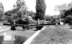
Of the 11 locks on the Chelmer & Blackwater Navigation, this is something of a halfway house. It stands just upstream of the road to Hatfield Peverel, in an area sometimes known as World's End.
Taken opposite Lower Quemerford Mill, this view shows Marden Bridge and the Mill House on the right.
Its 18th-century picturesque naturalistic park, designed by Bridgeman, Kent and Capability Brown, is dotted with Georgian temples, columns and garden buildings.
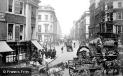
Here we are at the junction of Cannon Street and the approach to the new London Bridge; the street was opened by King William IV in 1831, and named after him.
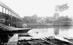
The celebrated village of Cookham, a mile or so south of Bourne End, is seen here from the boatyard on the Buckinghamshire bank, although curiously until 1992 a strip of about 30 feet along
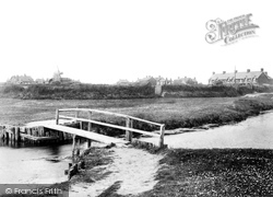
A well-worn path indicates a bridge frequently used by the locals.
The road to Harlow was a turnpike costing 1s for a coach and horses, and 1d for a horse.
On the Salisbury side of Harnham Bridge, De Vaux Place leads to The Close—the Harnham Gate is at the far end of the wall.
Cobbled Church Street leads to the church of St Michael and All Angels - the parish boundaries once extended to Chorley. At the end of this street is the ancient base of a restored preaching cross.
Here we are at the junction of Cannon Street and the approach to the new London Bridge; the street was opened by King William IV in 1831, and named after him.
Just above the left-hand end of the bridge in S177036 (page 70) and here in 72297 we can see buildings which in the 1920s housed Cooper & Hall, the engineers.
The bridge over the River Calder is no longer the main arterial road from the south, having been superseded by the new bridge of 1933.
Now the Humber Bridge has given Goxhill a new life as a commuter village for Hull, although the part we see here has retained its village feel.
At the other end of Frimley High Street, we cross the River Blackwater, which is the boundary between Surrey and Hampshire.
Places (17)
Photos (40)
Memories (1925)
Books (2)
Maps (520)


