

Historic Ordnance Survey Map of Llanrhaeadr-ym-Mochnant, 1897

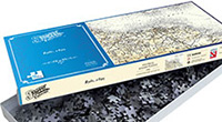
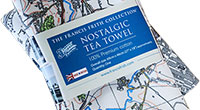
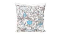
Taken from original individual sheets and digitally stitched together to form a single seamless layer, this fascinating Historic Ordnance Survey map of Afon Rhaeadr, Powys is available in a wide range of products, including prints, canvas prints, jigsaws, mugs, tea towels etc.

Buy a Print
Unframed, Mounted, Framed and Canvas prints in a range of sizes and styles.

View Sizes & Prices
Add to Album
You must be signed in to save to an album
Sign inCreate a Gift With This Map


About This Map
- Original scale: 50000
- Year drawn: 1897
- Series: Ordnance Survey Revised New Series
- Series survey years: 1893-1898
- Map reference: rne759047
- Learn about Revised New Series maps
Explore the Revised New Edition Series
Originally surveyed 1842-1893 and Revised 1893-1898. Scale is 1:50,000.
The late 19th-century was without doubt the age of the railway, and the Revised New Edition is the definitive record of its glory years. Another, quieter, technological revolution was also taking place at this time: the development of colour printing. Information could now be displayed in more subtle and varied ways, and at a reasonable cost. The government, the military and, increasingly, the public were demanding that the map-makers responded to this.

The growth of the railways
In February 1804 the Cornish engineer Richard Trevithick, in order to win a bet, built and successfully operated the first steam locomotive to run on rails. He was unable to capitalise on this achievement and it was left to others, notably George Stephenson, to refine and develop this new technology over the next 20 years. The result was a railway-building boom that was to transform the country.
Fewer than 100 miles of track existed in 1830; this had grown to 1,500 miles by 1840, and to 10,400 miles by 1860. This revolution helped drive Britain’s increasing prosperity and industrialisation during the rest of the century, and contributed to numerous social changes including the growth of trade unionism, the advent of tourism and the standardisation of national time.
Railways enabled goods and people to be quickly transported to and from large towns and cities, so hastening the existing trend towards urbanisation. In 1800, around 75% of the population had lived in the countryside and the rest in the towns; by 1880, these proportions had been reversed. As a result, many long-familiar aspects of the landscape were changing for good – and changing far more quickly than they could be mapped.
The "New Edition" (surveyed 1842-1893)
The government and the Ordnance Survey took several measures to address this issue. From the 1840s surveys were carried out at increasingly detailed scales and were used for many purposes including railway construction, geological survey and sanitary reform. In order to ensure complete and accurate coverage, the 1841 Survey Act had already given surveyors the right to ‘enter into and upon any land’ in the course of their duties. Having moved into new premises in Southampton after a fire in 1841 had destroyed their overcrowded Tower of London headquarters, the Ordnance Survey, armed with its new powers and instructions, began work on re-surveying the country. The results, published at the one-inch scale between 1876 and 1896, were later to be known as the New Edition.
The Revised New Edition (surveyed 1893-1898)
In 1893 a more thorough revision was undertaken which resulted in the publication of 346 sheets, between 1895 and 1899, of what became known as the Revised New Edition (later sheets were merely the same with hachured hills added). Improvements in reproduction and printing techniques helped these to be even clearer and more accurate than their predecessors. By this time, however, another change was being demanded; for from the early 1890s, the military was pressing for a one-inch map in colour. Financial, technical, aesthetic and political considerations as to how this could best be accomplished were hotly debated between the numerous interested parties.
The Revised New Map Edition is an immaculate record of a vibrant society on the threshold of a still greater period of development and urbanisation. It records countless reminders of the past, many of which were about to be swept away for good. For local historians, this is the final record of your part of the country before the changes brought by the motor car. If your interest is genealogical, the Edition coincides with the 1901 Census, showing the landscape your ancestors inhabited. Whatever your reason for being interested in your area’s past, prepared to be entranced by these maps – enlarged and combined to match the present-day OS Landrangers, they will reveal secrets of a familiar landscape you never knew existed.