Places
20 places found.
Those places high-lighted have photos. All locations may have maps, books and memories.
- Hinkley Point Power Stations, Somerset
- Lyne Station, Borders
- Perranwell Station, Cornwall
- Ferryhill Station, Durham
- Nantyronen Station, Dyfed
- Station Hill, Cumbria
- Station Town, Durham
- Widdrington Station, Northumberland
- Eggesford Station, Devon
- Bedlington Station, Northumberland
- Meopham Station, Kent
- Mintlaw Station, Grampian
- Ratho Station, Lothian
- Uphall Station, Lothian
- Alne Station, Yorkshire
- Hart Station, Cleveland
- Otterham Station, Cornwall
- Udny Station, Grampian
- Balfron Station, Central Scotland
- Ruthwell Station, Dumfries and Galloway
Photos
2,456 photos found. Showing results 781 to 800.


Maps
73 maps found.
Books
Sorry, no books were found that related to your search.
Memories
3,079 memories found. Showing results 391 to 400.
Jarmans Station Road
My mum, Irene White, worked in Jarmans on Station Road - just where it joins Crouch Oak Lane. It was probably in the very early 1940s before she joined the WAAFs. She told the story that her boss said you can eat as many ...Read more
A memory of Addlestone in 1941 by
Coffee And Doughnuts
A friend from work, and I took courses at the Neath Technical Institute. I left Swansea about 7:30am, and had to run down Mount Pleasant to the bus station in order to get to the Institute. For lunch we walked up town to a little ...Read more
A memory of Neath in 1947
My Holidays In Llandanwg
I was visiting Llandanwg from 1958 until 1965. We used to stay in Dorwyn, which then was a green shed bungalow owned by Mrs Pearce, she used to work with my father and we used to go down sometimes twice a year. We used to ...Read more
A memory of Llandanwg
Cookridge Once Fields And Farms
I moved from Holbeck in 1948 into one of the first estates to be built in North West Leeds, Ireland Wood (Raynels). In 1950 I went to Cookridge School, then a wooden hut right slap bang opposite where Cookridge ...Read more
A memory of Cookridge in 1950 by
Barking
If I remember rightly, coming round the corner from Ripple Road into East Street, there was a hole in the ground courtesy of the German bombers. Later, Timothy Whites was built there. Anyway, as youngsters, we used to head for the Capitol ...Read more
A memory of Barking by
Station Road
My Mother has traced her family to a shop down Station Road, an ironmongers, which is still an ironmongers we believe. He was Richard Snowdon Beal and lived with his wife Lydia at number 1-3 where his shop is - anyone know of anymore?
A memory of Eckington by
Pennyburn
The house on the right of the picture, I lived in in 1963, and was then called Pennyburn. The house next door on the corner was the local doctor whose name escapes me. I attended Holyhead Grammer School and went by train everyday from ...Read more
A memory of Rhosneigr in 1963 by
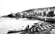
Old Port Bannatyne
This is a favourite view of photographers taken from McIntyre's Boatyard. In the distance you can see St Bruoc's church which burnt down in 1956. In the foreground is a boat hiring station, one of three in the village. ...Read more
A memory of Port Bannatyne by
193940 School Days
I remember the Town Hall at Cowbridge. In those days there was no one way system around it like today. The school boy interest was the Merryweather Fire Engine that was kept in a garage at the side of the Town Hall. Great fun ...Read more
A memory of Cowbridge in 1940 by
Happy Days
i was born in Algers Road, Loughton in 1942 and moved to Chigwell in 1944, then back to Buckhurst Hill in 1947. My dad worked as a lorry driver for W.C.French. My brother Chris and friends used to walk up to Buckhurst Hill High ...Read more
A memory of Buckhurst Hill in 1947 by
Captions
1,403 captions found. Showing results 937 to 960.

This is recalled in the name of The Hundred Stationers. This square was once busy with the sounds and smells of a cattle market, but now it has been marked out for parking.

Hartnoll Brothers (right), stationers and printers at Burlington House, were the proprietors of the Newquay Guardian and the Handbook to Newquay and North Cornwall.

In the distance towards the right are the twin chimneys of the Hayle power station, since demolished, while to the left are the long sands of Hayle Towans.

Centre left is the combined police and fire station in Tower Street, referred to earlier. Note the six-storey tower.

The Clayton West railway station operated between 1879 and 1983; it was later reopened, and provides a thrilling steam train experience for children and their parents.

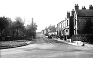
The River Don flows under Station Lane bridge on the Duke of Norfolk's land. Cottages in the village date from 1845; just to the right was the old Forge Mill.

The Black Bull Inn is off to the right, and further left is the railway station on the Sheffield/Penistone line.

At the bottom end of the High Street is The Vale, a park formally opened in 1937 in fields between the now vanished London and North Western Railway station (demolished in 1960) and the gas works, also

On the extreme left is the Station Garage, then an Austin dealership. Behind that is the Station Hotel, a replacement of an earlier building of the same name built in 1936.

'Ilchester' evolved on the tongues of servicemen stationed nearby during the last war, but the old name survived in the hotel until it was 'modernised' quite recently by a transient landlord

As we leave the station, the first street we see is Dorridge Road. Broad and leafy, it retains a handful of older houses like the mock-Tudor one we can just see on the left in this photograph.

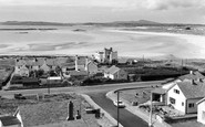
The photograph shows the old pumping station. In August 1981 the Holland Dredging Company brought the dredger 'Holland XXIV' to Anchorsholme to lay a pipe line well out to sea.

away from the coastline, our seaside resort tour peters out with busy Victorian terraces and the taller 1927 building on the right; beyond is the footbridge across the now dismantled railway, with the station

Situated one and a half miles north of Blythe Bridge railway station in Staffordshire, Caverswall's history certainly goes back to at least 1275 when Walter de Caverswell was granted a licence to crenellate

By the beginning of the 20th century, the town's population of 16,800 was served by no fewer than four railway stations; Altrincham & Bowdon, Hale, Broadheath, and West Timperley.

Over to the right are the railway station and the old corn mill.

When Richard I was away fighting in the Crusades, the mount was seized for John; Richard I subsequently retook it, and stationed a garrison here.

Much of Colwall developed in late Victorian times as a result of the building of the railway line and its station.

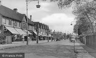
Diverging from High Street at the junction with Station Road, Wellington Avenue led directly to the 'Cathedral Church of the British Army'.

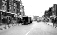
The bus station was built on the site where the amusement fairs used to set up when they came to town.

Much of Colwall developed in late Victorian times as a result of the building of the railway line and its station.

The bus station was built to incorporate a parade of shops, seen here beneath the canopy.

It was a stationer's, but was described as a 'fancy repository' in early advertisements.

The growth of the urban one- stop convenience store and filling station unexpectedly reflects a return to the situation found here, where F & F Hawell's shop is located next to the village
Places (20)
Photos (2456)
Memories (3079)
Books (0)
Maps (73)

