Places
17 places found.
Those places high-lighted have photos. All locations may have maps, books and memories.
- Bridge End, Oxfordshire
- Bridge End, Lincolnshire
- Bridge End, Essex
- Bridge End, Bedfordshire
- Bridge End, Clwyd
- Bridge End, Warwickshire
- Bridge End, Surrey
- Bridge End, Durham (near Frosterley)
- Bridge End, Northumberland (near Hexham)
- Bridge End, Hereford & Worcester (near Tirley)
- Bridge End, Hereford & Worcester (near Bosbury)
- Bridge End, Shetland Islands
- Bridge End, Cumbria (near Carlisle)
- Bridge End, Northumberland (near Hexham)
- Bridge End, Devon (near Kingsbridge)
- Bridge End, Devon (near Sidmouth)
- West End, Yorkshire (near Pateley Bridge)
Photos
40 photos found. Showing results 1,121 to 40.
Maps
520 maps found.
Books
2 books found. Showing results 1,345 to 2.
Memories
1,928 memories found. Showing results 561 to 570.
Pitlake Bridge
I was born in Cuthbert Road, West Croydon, next to Pitlake Bridge, and have a vivid memory of when the manholes on the bridge exploded. Wandle Park was our playground, and a fairground or circus had its winter storage next to the ...Read more
A memory of Croydon in 1959 by
Creek Side
I was born in Seacombe, Wallasey. When we were kids, say 1948/1952, we used to visit Creek Side near Duke Street Bridge and Dawbarns offices. There was some sort of smallholding there and we used to go and look at the pigs. How ...Read more
A memory of Wallasey in 1949 by
Catching The Train To Leeds
I was born in 1960 within a short walk of this photo. The scene is still clearly recognisable, although the wooden station building spanning the bridge and the steps leading down to the station were demolished and ...Read more
A memory of Horsforth in 1964 by
River Irwell
This is the weir on the River Irwell where it swings round and is bridged by the road up to Peel Brow. The mills on the right are on Kenyon Street. There were cotton weaving mills, towel mills and soap works. The Church spire is St. ...Read more
A memory of Ramsbottom in 1955 by
Growing Up In Moniaive 1954 1969
I was born and brought up in Moniaive, and my mother owned the local hairdresser's salon (JACIE'S) at 3 Ayr Street. I lived with my mother (Janet), sister (Jenny) and maternal grandparents (who also had a house in ...Read more
A memory of Moniaive in 1954 by
School Holidays
I feel I could write a book as the memories were brilliant! We used to spend the whole summer there and I cried when I had to leave. I remember the boatyard which was run by Mr May, his son was called Billy and he was my ...Read more
A memory of Potter Heigham in 1964 by
Everret's Corner (1)
This the South Est Corner of the junction on the A4 known as Everret's Corner. Just around to the right from this position are some lock-up shops that I remember from the early 1950s which included a Gents Barbers. Further ...Read more
A memory of Cippenham in 1965 by
Wonderful Childhood
I used to live in Churchfield, my old house is the only one left standing amongst a maze of flats. It was a council house in those days and we shared it with another family, the Caines. I went to Churchfields Primary ...Read more
A memory of South Woodford in 1950 by
Worcester Park From The Bridge
I lived in Worcester Park from when I was born (1939) until early 1956 when I joined the RAF as an apprentice. The lad in the picture (W455012) could so easily have been me (it isn't) because I was often there ...Read more
A memory of Worcester Park in 1955 by
Memories Of My Childhood In Rossington.
My story starts on the 1st of March 1950, the date of my birth at Doncaster Royal Infirmary. My parents Jack & Mary Flather lived in Old Rossington at 65 Haigh Crescent, living with relatives (Guy) ...Read more
A memory of New Rossington in 1950 by
Captions
1,770 captions found. Showing results 1,345 to 1,368.

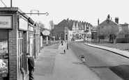
Aveley is a small village situated a few miles to the east of Rainham and close to the Thames and Essex Marshes.The parked bicycles on the right, no cars to be seen and the crowd waiting for the bus

The bridge started to show its age soon after our photograph was taken, and by the mid 1960s it was declared unsafe.

This seven-arched road bridge was built in 1775 to carry the Great North Road over the river. It replaced earlier crossings dating from 1190.

The far, tall building marks Bridge Street, the spot where the first bridge upstream was located.

Just along the canal from Bridge 104, the boat is emerging from a turning point in the canal basin.

The bridge immediately beyond the lock used to take a railway into Pirbright army camp, just behind the trees to the right.

Bathpool is now very much a suburb of Taunton, with the spread of the Somerset town on one side and the M5 motorway on the other.

An RAC patrolman guides an early Austin saloon around the junction of Church Street and the High Street, as a 408C double-decker bus emerges from the top of Bridge Street.

The rustic bridge parapets over the brook also look like John Hicks's work.

The rustic bridge parapets over the brook also look like John Hicks's work.

The bus in the distance has just passed Ford Bridge. Once called Stratford (the `street ford`), this was where the Roman road crossed the River Chelmer.

A packed steamer is kept firmly alongside the pier as the Master on the bridge plots her progress carefully. She is either about to put warps ashore or has just taken them aboard.

At the time of the herring fleet's arrival from Scotland, the boats completely filled the harbour, and it used to be said that one could walk right across the river without using the
Just along the canal from Bridge 104, the boat is emerging from a turning point in the canal basin. The bank to the right, where the car is parked, now houses a boat hire firm, Castle Narrowboats.

Mayburgh Henge is one of a group of three prehistoric monuments near Eamont Bridge.

In this view the medieval bridge is on the left and the former Crepe Mill of 1814, now the Dulverton Laundry, dominates the centre.

The `Star Inn` on the left is being given a fresh lick of paint in this view from the railway bridge.

The five-arch later 19th-century red-brick bridge still rather pompously carries a narrow roadway across the pond in the south west angle of the Heath.

A packed steamer is kept firmly alongside the pier as the Master on the bridge plots her progress carefully. She is either about to put warps ashore or has just taken them aboard.

Gretna stands on the Scottish/English border, and so it became popular for runaway marriages of English couples following the passage of Lord Hardwicke's act in 1754.

This important mid 15th-century bridge at the lowest crossing point of the River Fowey links the two parts of Lostwithiel.

Beyond the scrum of pleasure boats for hire in this view looking downstream from Richmond Bridge is the three-storeyed White Cross pub.

Looking down the lane, towards Cannock Chase, note the railway bridge which carried the line between Colwich junction and Macclesfield.

The Circus at the top of Bridge Street is now a pedestrianised area. The buildings behind the bus have been totally redeveloped, and incorporate a lovely open shopping area known as Golden Square.
Places (17)
Photos (40)
Memories (1928)
Books (2)
Maps (520)

