Places
9 places found.
Those places high-lighted have photos. All locations may have maps, books and memories.
Photos
20 photos found. Showing results 1 to 20.
Maps
1,296 maps found.
Memories
613 memories found. Showing results 1 to 10.
Memories Of My Widnes School Days
Having lived the first 25 years of my life in Widnes ,I have many happy memories of my school days there. Born in Dundalk Lane in 1940, from 1943 until 1945, I attended the Nursery,situated next to Ditton County Infants’ ...Read more
A memory of Widnes by
Childhood Memories
Knutsford holds a special place in my heart as I was born there in 1956 and spent nearly eight years of my childhood growing up in this then safe and close community. I have very strong memories of family, home, school and friends ...Read more
A memory of Knutsford in 1962 by
Memories Of Benson
My memories of Benson started in 1946/7 when we moved to Sunnyside, which in those days did not have the recreation field. Nor did the village have street lighting apart from a couple in the High Street, one of which was on the wall ...Read more
A memory of Benson in 1947 by
Lancing In The Fifties And Sixties
My family moved to Lancing when I was six months old, living first in Orchard Avenue and then Tower Road, which had a bad reputation - totally undeserved! I liked the fact that there were always children to play with, ...Read more
A memory of Lancing by
Living In Teddington 1950s To 1980s
We moved from 76 Princes Road in 1957 to the other end of Teddington, to 143 High Street, opposite Kingston Lane. My parents bought the house for about £1400 (yes fourteen hundred) as a refurb project. It still had ...Read more
A memory of Teddington
More Memories From A Boy Growing Up In Burghfield
Back in Burghfield around 1962, I clearly remember one day during the School Summer Holiday seeing a Huge Red and Green Steamroller coming towards me with a whole host of Road Tar making ...Read more
A memory of Burghfield Common by
Those Were The Days
I moved to Ireland Wood from Portsmouth when I was 4 years old with my Mum and dad who was in the navy. We lived at 42 Raynel Way. The house was built by the Council. Most of the houses like ours were made of prefabricated concrete ...Read more
A memory of Cookridge by
Living On Reynolds Drive : 1964 To 1983
My name was Donna Francis and I lived at 106 Reynolds Drive with my mum, Diane Francis, dad Donald Francis, brother Colin and sister Tina. Our neighbours were Vera and George Monk, Ted and Helena Weatherly ...Read more
A memory of Queensbury by
So Many Memories
My family arrived in Wargrave just after the war. We moved into a flat above the Post Office/ Telephone Exchange. Dad was a caretaker operator. Things I remember about the village were of course the nearby river, the houses so ...Read more
A memory of Wargrave by
Yesterday's Birch
I REMEMBER BIRCH IN 1960'S. THE VILLAGE SHOP WAS RUN BY A JEWISH MAN CALLED MR WOLFE. WHEN YOU CROSSED THE ROAD ON TO WHITTLE LANE THERE WAS A ROW OF HOUSES THAT WERE ATTACHED TO THE WHITE HART PUB . AS YOU WALKED UP THE LANE ...Read more
A memory of Birch by
Captions
157 captions found. Showing results 1 to 24.
Until 1964, Mill Lane was a picturesque street of brick and half-timbered cottages, some of them medieval.
this mundane street as it drops down towards Pinner Underground Station, under the railway bridge and on towards Harrow-on-the-Hill, there is little to herald the wonderful surprise of turning into the High
Until 1964, Mill Lane was a picturesque street of brick and half-timbered cottages, some of them medieval.
The older houses are mostly along the High Street, Church Lane and Abingdon Road. Church Lane runs north from the High Street towards its eastern end, with St Peter's Church a short way along it.
Dating from the 1500s (and possibly earlier), the half- timbered building on the left fronting both the High Street and Hickmans Lane has had a chequered history.
A similar view to H85002, a little further along the High Street, framed by some lovely trees on the left and showing the impressive three-storey bay windows of a fine private residence.
Runswick Lane leads out of Hinderwell High Street to Runswick Bay, a local beauty spot much beloved by many Clevelanders.
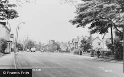
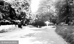
The beautiful mature trees make an attractive setting in high summer along High Road at its junction with White Hill, extreme left, and Hogscross Lane.
Originally the village extended no further than Back Lane, Coldstream Lane, the High Street and the houses in the vicinity of the green, which we see in this photograph.
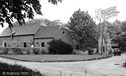
A little north of the High Street Junction, off Abingdon Road, is Gravel Lane, which has a number of farm buildings on each side at its west end.
Bounded by Hazelwood Lane and High Road, the property appears in title deeds going back to the 17th century.
From the High Street, Ferry Lane leads down to the river and the former ferry point. We are looking back up the lane with the river behind us.
In the medieval manorial rolls there are references to ancient roads and lanes that carry the same names today.
In the medieval manorial rolls there are references to ancient roads and lanes that carry the same names today.
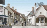
The lane leads to the White Hart, which does remain, but it is out of picture round the corner.
Medrose is a small hamlet within the famous slate-quarrying village of Delabole, down a lane off the main street.
On Cove Lane there was an ancient chapel. The lane also led to Jenny Brown's Point, where an old lady of that name lived in the 18th century.
The next photographs follow the High Street from north to south.
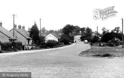
Close to the junction of Runswick Lane with the High Street, we see a number of what appear to be recently completed bungalows - very much in vogue in the 1950's and 60's.
The Market Square is at the junction of the High Street, Abbey Street and Chapel Lane. Chapel Lane was formerly Hogmarket, and is now called St John's Place.
Donkey Lane and Dormouse Cottage (right) can be seen here in the northern end of the High Street (centre) which bends to the west beside Pound House (centre) to become Barr Lane as
Donkey Lane and Dormouse Cottage (right) can be seen here in the northern end of the High Street (centre) which bends to the west beside Pound House (centre) to become Barr Lane as it carries
This view on High Road looks south past the Starrock Lane turning towards the Hazelwood Lane turning to the right.
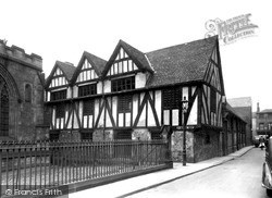
Situated among the somewhat reduced remains of the buildings of Georgian Leicester, now tightly grouped in New Street, Peacock Lane and Friar Lane, the Guildhall is overshadowed by St Martins Cathedral
Places (9)
Photos (20)
Memories (613)
Books (2)
Maps (1296)


