Places
26 places found.
Those places high-lighted have photos. All locations may have maps, books and memories.
- Cemmaes Road, Powys
- Six Road Ends, County Down
- Road Weedon, Northamptonshire
- Severn Road Bridge, Gloucestershire
- Roade, Northamptonshire
- Berkeley Road, Gloucestershire
- Harling Road, Norfolk
- Road Green, Devon
- Builth Road, Powys
- Cross Roads, Yorkshire
- Steele Road, Borders
- Cross Roads, Devon
- Four Roads, Dyfed
- Road Green, Norfolk
- Biggar Road, Strathclyde
- Clarbeston Road, Dyfed
- Five Roads, Dyfed
- Eccles Road, Norfolk
- Grampound Road, Cornwall
- Morchard Road, Devon
- Wood Road, Greater Manchester
- Four Roads, Isle of Man
- St Columb Road, Cornwall
- Clipiau, Gwynedd (near Cemmaes Road)
- New Road Side, Yorkshire (near Silsden)
- New Road Side, Yorkshire (near Cleckheaton)
Photos
14,329 photos found. Showing results 2,121 to 2,140.
Maps
476 maps found.
Books
5 books found. Showing results 2,545 to 5.
Memories
11,058 memories found. Showing results 1,061 to 1,070.
I Used To Live Here
I was born in this lovely village but moved when I was about 3 years old. My great-grandmother Dorothy Thomas lived in Ty Llwyd, a small cottage on the road facing the sea front. I remember looking out of the window at night ...Read more
A memory of Ferryside by
Goldsmith Mansions
I lived in the mansions from 1951-1960. Does anyone remember them? I went to Leo Street School. And I went to the Regal cinema every Sunday afternoon in the Old Kent Road.
A memory of Peckham in 1951 by
Happy Memories Of South Woodford
My family lived in Hillcrest Road, South Woodford from 1960 to 1973. I had a very very happy childhood there (am still happy though) but had to move to Brighton to attend a deaf school and to avoid the need ...Read more
A memory of South Woodford in 1965 by
Lovely Childhood
I was born at St Hilliers, Carlshalton and lived in Pelham Road for the first 5 years. I started school at 4 in Pelham Road School. Then we moved to Mayfield Road and I went to Dundonald School. We moved away in 1961 in the ...Read more
A memory of Wimbledon in 1953 by
Family History In Belvedere
I have two separate enquiries for my family history research in Upper and Lower Belvedere. In Upper Belvedere there was a sweet and paper shop which also sold toys called Derrett & Dorman's. I believe that I ...Read more
A memory of Belvedere by
Memories Of The 'pedaloes'.....
As a child in the fifties I remember staying at 'Elasrofton' on West Front Road and getting very tired pedalling the pedaloes shown around the lagoon. For a small boy they definitely had 'windage' and the Lagoon often had ...Read more
A memory of Pagham in 1955 by
The Bear Inn
My name used to be Marilyn Jesse and my memories of stock back in the late 60's early 70's are delightful. Since my boyfriend of the time lived next door to the Bear Inn, the pub became a bit like home from home. Many weekends were ...Read more
A memory of Stock in 1969 by
Top Of Valence Avenue
I lived at the top of Valence Avenue, which was 1.1/4 miles long. I was nearly into Chadwell Heath, but my address was Dagenham (and proud of it!) . I used to go to Lymington Road School and we went to Valence Swimming Baths ...Read more
A memory of Dagenham in 1943
Sculthorpes Dye Works
I worked there in the early 1970s. I lived on Overdale Road near the Spreadeagle pub. I got married in St Chad's.
A memory of Romiley in 1972 by
Your search returned a large number of results. Please try to refine your search further.
Captions
5,036 captions found. Showing results 2,545 to 2,568.
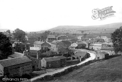
Bainbridge was once an important junction, for here the roads to and from Lancaster, Swaledale and Westmorland met.
The find was enough to convince the experts that the Roman crossing point had been located, though there is still some debate as to the original course of the Roman road.
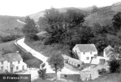
Today the mill has been turned into an inn, and the fields below the steep road have been laid out as a car park for visitors to Polperro village that lies down to the right.
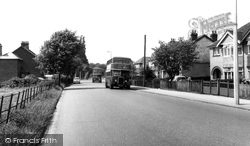
We are on the Fair Oak Road, but here looking back towards Eastleigh. The No 43 bus (the front one) was a service between Bishop's Waltham and the airport via Bishopstoke and Eastleigh.
Here the photographer looks north along the High Street, towards its junction with Bridge Street to the right, and Desborough Road curving left.
Many others followed in the 1960s and 70s, and the school occupies most of the south side of the road, with its playing fields extending close to the River Nene.
This is the extremely busy A15 main road heading north to Folkingham, Lincoln and eventually the Humber Bridge and south (the way we are facing) to Market Deeping and Peterborough.
This is the A15 road coming in from Bourne, which makes the traffic island a very busy place - it is now much smaller than it is in the picture.
As we leave the station, the first street we see is Dorridge Road.
Another highlight for children used to be the travelling fair which visited the Lickeys on bank holidays, occupying a site on the corner of Lickey Road and Leach Green Lane.
The original village remained agricultural, but a subsidiary settlement grew up on the Bristol road which had already become a sizeable suburb when Northfield was incorporated into Birmingham in
The Osborne Hotel is across the road opposite the station's approach. The field in the foreground still produces hay: at least the farming was a constant.
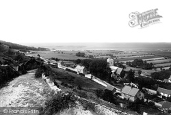
The photographer is standing on Monks Hill, looking down the winding road that leads to the centre of the original village.
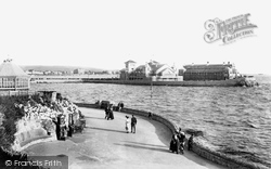
The gardens and rockeries create secluded little seating areas, while the winding path leads up to Birnbeck Road. Over the trees, the roof of Glentworth Hall is visible.
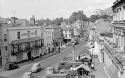
The scooter is king of the road. The rider is glancing towards the Blue Boar Inn, which dates from 1691. The International Stores are opposite under the elaborate striped awning.
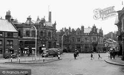
The Circus, in the town centre, is where five roads meet. It has the usual mixture of banks and public houses on its corners.
This was the gateway that led to the road to London. In the 10th century, when permission was granted for a house to be built on the bar, the yearly rent charged was sixpence.
These once quiet roads are now filled with heavy traffic.
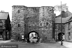
Guarding the road from the south, the Hotspur Gate was built in 1450; a licence to fortify the Border town of Alnwick had been granted in 1434.
The road rises up from the south, past the parish church, to enter Ibstock, gateway to industrial north-west Leicestershire.
Looking West This view looks down Commercial Road towards the old market site.
The road was developed in the Victorian period, and most of the houses and shops, like those on the right, are of that date.
Beyond this group is the road to Cat House Hard on the Orwell.
Beyond this group is the road to Cat House Hard on the Orwell.
Places (26)
Photos (14329)
Memories (11058)
Books (5)
Maps (476)


