Places
4 places found.
Those places high-lighted have photos. All locations may have maps, books and memories.
Photos
Sorry, no photos were found that related to your search.
Maps
11 maps found.
Books
Sorry, no books were found that related to your search.
Memories
227 memories found. Showing results 41 to 50.
There's Always Been A Chip Shop
At leas,t for as long as I can remember - there's always been a chip shop on the Parade at Crayford. Just like there's always been on the corner of Station Road - a little way further through the town - if you can ...Read more
A memory of Crayford in 1965 by
Paddler
I have lived in Saffron Walden all my life of 50 years. I have many great memories of Saffron Walden. My greatest memories are of the time we had at the locally named Paddler. The Paddler was at the top end of Rowntree Way. The area ...Read more
A memory of Saffron Walden in 1965 by
Playing In Salford
I was born in Salford in 1954, except for a brief spell of 4 years in Newton Heath in the late fifties, I have lived there ever since. When I was 11 years old my friend and I were playing digging on the old nursery croft on ...Read more
A memory of Salford in 1964 by
Laleham
Well a first visit to camp by the river and walk to the Lock and so on was really in 1962 with Guides, then a schoolfriend. Later my first 'serious' boyfriend and fiance came from there. I wonder if any of you recall not only the Abbey but ...Read more
A memory of Laleham in 1964 by
Life At St.Patricks
Hello - I was at St Patricks School from 1964-1969 - I remember all the nuns you name and more. I live in Harlow now and have contact with some of the nuns who were younger. I have all happy, valuable memories from my ...Read more
A memory of Hayling Island in 1964 by
First 24 Years
I was born and lived all my life till 24 in Oulton. It was then a small village and everywhere I went someone knew me or a family member. Back then we could play in the street and roam all over the village. One supermarket Grandways ...Read more
A memory of Oulton in 1964 by
Jtbells
This is the year I started on the building sites in 1963, I got a job on J. T. Bell's site in Whickam, the site hadn't been running long then as it was in the first stage. All the lads were mainly from Newburn, Lemington, and Throckley. If ...Read more
A memory of Newburn in 1963 by
Mixed Memories Of This Famous Hospital
About the time I was born in 1939, I had two aunts who were nurses in Claybury Hospital. Several years later, in the early 50s, I used to help the milkman from Drapers Farm and one of our biggest ...Read more
A memory of Woodford Bridge in 1963 by
1960s
I lived in Connaught Avenue, and went to Grove Road school (up to 1963). I had 3 local friends. One lived on Hounslow Heath in a prefab (now Frampton Road). We weren't allowed to go to the fairs there. I did see grass snakes though! Near ...Read more
A memory of Hounslow in 1963 by
A Cock No More
At Royston Senior school, I was a young lad of 14 and although the lads did not know it, I was quite strong and could do a man's job such as lifting heavy sacks of grain and humping bails of hay. Although I was a quiet lad ...Read more
A memory of Royston in 1963 by
Captions
141 captions found. Showing results 97 to 120.

School House stands at the corner of Market Place and Market Street. The Hospital of Christ, built in 1398, stood on this site, which was once known as Baresplace. School House was erected in 1853.

The sands slope gently, offering safe bathing for children, and extend for a mile and more.

Knowledge of the swift tides and currents in this area is vital, and that is why there are more fishermen using this beach than tourists, who have heeded the warning.

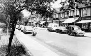
It is ten years after G66010, and more cars are evident. This view is flanked on the left by the shop front of Greenwoods chemist's and druggist's shop.

These were popular places for family outings on sunny days in the 1950s and 60s. Here young children splash in the paddling pool, while others are more adventurous in the main pool.

Street lighting has been improved, and there are seats from which to enjoy the scene.

West of the Market Square the road divides: the left hand road goes to Long Sutton, the right fork heads for Langport.

The church and a cluster of old houses are at the top of the hill, and more old buildings are on the river bank, east and west of the Bognor Road river bridge.

Between the wars, Worthing lost its wonderful town hall and theatre.

This picture is of the same road as photograph W64009, but dates from ten years later and is taken from the other direction.

There are two tarns on the part of the moor by Ilkley shown in 45157A, pages 68-69, both within easy walking distance of the town.

Just beyond the west tip of Nag's Head Island is the Malthouse (creeper-clad) and Fairlawn Wharf to the right, now housing and formerly warehouses and barns.

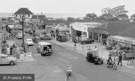
Ten years has made a tremendous difference in the appearance of both street and market day. The stalls are more tidy and professional in the goods on display.

Moving south-east and still within Wonersh parish, we reach Shamley Green, in 1965 still a remote Surrey hamlet loosely built around its triangular green.

Farther along are more barrels and boxes. Outside the lower building next door, now a private residence, is a display of spades.

We are now further along Leigh Road and looking back towards the station. Trees planted c1900 are now mature, and more modern lighting has been installed.

Beyond this there are now modern houses. The overhead electricity wires and poles remain and the slate roofed house behind, quirkily named Toad Hall. There are more modern houses on the right.

On the far side of the Severn, a boathouse and rowing boats indicate a swing to tourist trade.

Lakeside is the settlement furthest away from the Lakeland mountains, but it is historically important as the entry point for large numbers of Victorian day visitors who came up from Lancashire by way

Not a hatless head to be seen as the open-top tram, en route to Frindsbury across the river, passes the lantern and railings of Eastgate House, threatening conflict with horse-drawn traffic.

Ingoldmells has had millions of pounds spent on its redevelopment, and more is promised for the future. This makes it difficult to recognise a place like this.

The river has long been used for boats trading upstream and, more importantly, downstream, where the Stour links up with the River Severn and thus with the ports of Gloucester and Bristol.

The new parish was carved out of St James' parish as more and more houses and industry were attracted to the Burnley Road area.

On the left is the Three Mariners pub, an 18th- century building, but standing beyond it now are overscaled two-storey offices.
Places (4)
Photos (0)
Memories (227)
Books (0)
Maps (11)

