Merry Christmas & Happy New Year!
Christmas Deliveries: If you placed an order on or before midday on Friday 19th December for Christmas delivery it was despatched before the Royal Mail or Parcel Force deadline and therefore should be received in time for Christmas. Orders placed after midday on Friday 19th December will be delivered in the New Year.
Please Note: Our offices and factory are now closed until Monday 5th January when we will be pleased to deal with any queries that have arisen during the holiday period.
During the holiday our Gift Cards may still be ordered for any last minute orders and will be sent automatically by email direct to your recipient - see here: Gift Cards
Places
36 places found.
Those places high-lighted have photos. All locations may have maps, books and memories.
- North Walsham, Norfolk
- North Berwick, Lothian
- North Chingford, Greater London
- Harrogate, Yorkshire
- Whitby, Yorkshire
- Filey, Yorkshire
- Knaresborough, Yorkshire
- Scarborough, Yorkshire
- Clevedon, Avon
- Weston-super-Mare, Avon
- Richmond, Yorkshire
- Selby, Yorkshire
- Ripon, Yorkshire
- Scunthorpe, Humberside
- Pickering, Yorkshire
- Settle, Yorkshire
- Skipton, Yorkshire
- Saltburn-By-The-Sea, Cleveland
- Norton-on-Derwent, Yorkshire
- Rhyl, Clwyd
- Chester, Cheshire
- Llandudno, Clwyd
- Grimsby, Humberside
- Durham, Durham
- Nailsea, Avon
- Southport, Merseyside
- Brigg, Humberside
- Colwyn Bay, Clwyd
- Redcar, Cleveland
- Bath, Avon
- Grange-Over-Sands, Cumbria
- Cleethorpes, Humberside
- Sedbergh, Cumbria
- Barrow-In-Furness, Cumbria
- Barmouth, Gwynedd
- Dolgellau, Gwynedd
Photos
2,953 photos found. Showing results 1,181 to 1,200.
Maps
9,439 maps found.
Books
39 books found. Showing results 1,417 to 1,440.
Memories
1,550 memories found. Showing results 591 to 600.
The Alpine For Tea
I remember driving out to The Alpine for tea from North West London. It was an outing purely for Tea and Scones and it seemed like a long journey from NW10 to Bushey. Was in the 60's not as early as 1955!
A memory of Bushey Heath by
Searching For 1950s Neighbours
Hello there, My stepfather has asked me to search for three people that he knew in the 1950s and early '60s in Steventon. My stepfather is Robert Orchard from Pembrokeshire, Wales. He worked for the electricity ...Read more
A memory of Steventon by
Rosie The Doll
I remember Rosie the doll. During childhood we, my sisters and I, shared quite a few dolls – but Rosie was mine alone. She had a small round head; no hair as such, just molded plastic hair, which was the same plastic as her head and ...Read more
A memory of Guildford by
Growing Up In Belvedere
I spent most of my younger years up to about 5 years old living in Nuxley Road with my grandparents and my aunts. The house was next to Hammonds the Bakers at the bottom end near to Stream Way. I am not sure what the shop is ...Read more
A memory of Belvedere by
School Days
my name is George Bryant I went to North haringay boys school from 1958 - 1963.in the beginning I was the only black boy in school.at first it was pretty rough called all kind of names people lifting up my blazer to ask me where my tail ...Read more
A memory of Hornsey by
Collinson's Cafe And Brown, Muff & Co., The Early 1960s
As a schoolboy in the 1960s I would generally go to the city centre to lunch with my parents so as to avoid school meals. Large stores offered various dining options. Collinsons’ had an ...Read more
A memory of Bradford by
Gagie
This was my grandmothers house and i spent many school holidays here with my uncle and aunt and their 3 sons who lived with my grandmother. Long summer days were spent "going down the den" the wooded area next to the walled garden. We played ...Read more
A memory of Kellas by
Cricket
My family and I lived in Carlin Gate, Timperley from my birth in 1948 until we moved to Romford in Essex in the late summer of 1963. I have superb memories of playing schoolboy cricket on the ground just over the wall on the right whilst at North Cestrian Grammar School.
A memory of Timperley by
School Days
In the 1950s I lived in Broadhurst Gardens and every day walked with friends through this twitten to get to North Bank School in Smoke Lane. The lane was dark and overgrown on one side and on the other side backed onto the Crusader ...Read more
A memory of Reigate by
Wembley In The 1950's
I remember the lovely fresh bread smell from Aldridges the bakery at the Triagle, the Grove Fish and Chip shop's marvellous rock salmon and chips cooked in beef dripping of course, Killips department store's dumb waiter, learning to ...Read more
A memory of Egham by
Captions
2,676 captions found. Showing results 1,417 to 1,440.
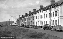
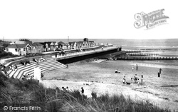
At the north end of the promenade the domestic character survives better than in the next two photographs.
of the wealthiest in the midlands, and the sheer bulk of its buildings must have made an imposing sight on the Coventry skyline.The complex included a church about 400 ft long; a cloister on the north
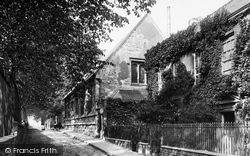
Facing the churchyard on the north side of Church Street is the oldest building in the King's School, built just before 1528 as a chantry school.
To the north beyond Ingoldmells, and rather more genteel, is Chapel St Leonards, where my mother used to holiday in the 1930s.
This, constructed in 1564-66, pre-dated the canals in the north of England, where many people think the canal age started.
Here, we are on the tow path along the west bank, looking north towards Christchurch Meadow; it is the end of May, and the annual Eights Week, when the college boats race each other, is in full swing.
The lake is over three miles long and 100 feet deep; it stretches north-east towards the edges of the town, its borders wooded and its shores gravelled.
The reclining oak figure of Jesse in the background has been moved to the north transept to give it more prominence.
The castle was on a hill north of the church, comprising a motte and bailey with earth and timber fortifications.
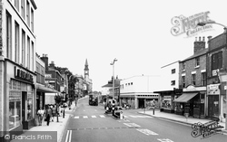
This is Chorley's main street, the A6, Lancashire's main north to south road; it used to get very busy in the summer.
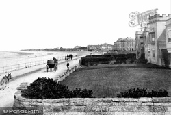
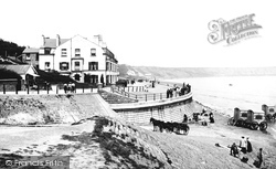
The small horse-drawn carts carried less active holiday-makers onto the sands, but could probably be hired as an alternative to a donkey ride.
This village is just one mile from Boston Spa and even less from the Great North Road.
This view looks north towards the Market Place and captures well the character of this market town, most of whose 19th- and late 18th-century buildings still line the streets.
This triangular piece of ground contains the old Bull Ring, and lies immediately north of the abbey gatehouse (out of picture, bottom left).
The half-timbered 17th-century King's Arms, on the left, lays claim, along with The King's Head in neighbouring North Street, to be the original Marquis of Granby in Charles Dickens' comic novel The Pickwick
The Roman bridge can be found down a footpath near the post office, and Fairy Bridge is north of the Red Pump Inn.
War Memorial Gardens were laid out to the north of Memorial Avenue between it and the Canch, as this stretch of the River Ryton is known.
While West Clandon with its railway station definitely has the air of a commuter village, East Clandon, facing the slope of the North Downs and surrounded by fields, still has a rural feel
This is Chorley's main street, the A6, Lancashire's main north to south road; it used to get very busy in the summer.
This small village, 3 miles north of Barnsley, is in the heart of the coal mining country. This view is hardly changed, except for a new retail development out of the picture on the left.
Circling Frome, we head north to the Mells Stream valley and Mells village, the home of the Horners, the nursery rhyme Little Jack Horner's family.
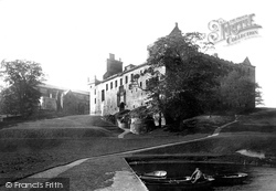
Linlithgow reached its final form during the reign of James V, though the north wing was reconstructed in the neo-classical style between 1618-1633.
Overlooking the Clyde to the north of the present town of Bothwell, the castle is still an impressive sight despite being a ruin.
This is the centre of the village; we are looking north to West Overton County Primary School with its toothed ridge line and bell tower just visible over it.
Places (9301)
Photos (2953)
Memories (1550)
Books (39)
Maps (9439)


