Places
36 places found.
Those places high-lighted have photos. All locations may have maps, books and memories.
- Pentre-cwrt, Dyfed
- Pentre Halkyn, Clwyd
- Pentre, Mid Glamorgan
- Ton Pentre, Mid Glamorgan
- Pentre, Powys (near Llangynog)
- Pentre, Powys (near Guilsfield)
- Pentre, Powys (near Bishop's Castle)
- Pentre, Dyfed (near Pontyates)
- Pentre, Powys (near Newtown)
- Pentre, Clwyd (near Mold)
- Pentre, Clwyd (near Ruabon)
- Pentre, Shropshire (near Chirk)
- Pentre, Clwyd (near Hawarden)
- Pentre, Clwyd (near Chirk)
- Pentre, Clwyd (near Ruthin)
- Pentre, Clwyd (near Mold)
- Pentre, Shropshire (near Oswestry)
- Pentre, Powys (near Welshpool)
- Pentre, Clwyd (near Mold)
- Pentre, Shropshire (near Forton)
- Pentre Broughton, Clwyd
- Pentre Gwynfryn, Gwynedd
- Pentre Maelor, Clwyd
- Pentre-clawdd, Shropshire
- Pentre Galar, Dyfed
- Pentre Llifior, Powys
- Pentre-cefn, Shropshire
- Pentre-Gwenlais, Dyfed
- Pentre-Poeth, Dyfed
- Burntwood Pentre, Clwyd
- Pentre Berw, Gwynedd
- Pentre Hodre, Shropshire
- Pentre Llanrhaeadr, Clwyd
- Pentre-celyn, Clwyd
- Pentre Cilgwyn, Clwyd
- Pentre Morgan, Dyfed
Photos
98 photos found. Showing results 2,221 to 98.
Maps
316 maps found.
Books
2 books found. Showing results 2,665 to 2.
Memories
1,253 memories found. Showing results 1,111 to 1,120.
I Was Born In Merriott
I was born in Merriott, Sept 1st 1960, in the bedroom of my parents' cottage opposite the nursery garden centre. My mum is June Elliott (Hooper family from Merriott) and my dad John Elliott (kingsbury Episcopi). I lived ...Read more
A memory of Merriott in 1960 by
Memories Of Mitcham Figgs Marsh Tooting Bec
When I was in my early teens, my mates and I used to go to Figgs Marsh and wait for the lads. We used to sit in an open brick-built toilet area which had seating and it was magical to see all the pictures ...Read more
A memory of Mitcham in 1950 by
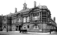
Battersea Town Hall
The impressive entrance on Lavender Hill actually led into the Council Offices, where I started work when I left school in 1966. At that time they had changed very little since their Victorian origins; there was a grand ...Read more
A memory of Battersea in 1966
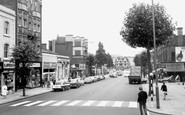
North Finchley
This picture was taken on the corner of the road I lived in, the road being Lodge Lane, which had the sorting office in it. This picture is taken looking towards the Tally Ho pub (centre), the shop on the right with the blind ...Read more
A memory of North Finchley in 1965 by
Recollections Of A Special Village
I attended Sunday School in the 1960s at St Peter's School, Caverswall and my teacher was Mr Harp. He was a great inspiration to me as a budding historian and he sometimes took us to visit the castle and taught ...Read more
A memory of Caverswall in 1960 by
Burford Lane Broomedge
My husband and his cousins were born in Burford Lane over 70 years ago and the pictures are just as the lane is now except that cars may be seen parked. In the 1950s there used to be a taxi business at the top of the road ...Read more
A memory of Broomedge in 1950
School Life Living In Bilsthorpe
My earliest memory was at the age of 5. I vividly remember sqeezing through the school railings at the bottom of my garden to go to school. My teacher was a lady called Mrs Malkin, she was very nice and kind to ...Read more
A memory of Bilsthorpe in 1960 by
Buildings.
The buildings featured from left to right - (I do not know the history of the white house), then there are the pillars which are the entrance to the churchyard and mortuary chapel. The church, built in 1865, was used until 1980 for funerals ...Read more
A memory of Woburn by
Visiting
The lady in the centre of the photograph walking towards the camera is Mrs Kate Silsby my grandmother who lived at 8 Tilehouse Street. When this was taken we think she would have been walking to St Ippollytts to visit her daughter Mrs Babs Brown.
A memory of Hitchin by
Days Out On Hyde Market
Being born and brought up in Flowery Field, Hyde was the centre of the universe for us as children. After shopping on Hyde market we would turn the corner and enter into the world of this picture. On the right of the picture, ...Read more
A memory of Hyde in 1960 by
Captions
3,593 captions found. Showing results 2,665 to 2,688.

Dartford is an ancient market-town which grew into a busy industrial centre on the River Darent, at the point where it was crossed by the Roman Watling Street, parts of which lie buried four feet beneath

Broadway still exists, but now much wider and with a multi-storey car park on the right, while Tesco's and the Nicholson Centre shopping mall take up most of the rest on the right.

The pediments to its left were 'modernised' in the 1960s with a straight parapet, while on the right there is now an entrance to the Nicholson Centre, a modern shopping precinct on the site

The photograph looks from outside the present entrance to Hornsey Town Hall and towards the town centre soon after the completion of most of the buildings, and a decade before the influx of extensive but

Before the ring of trees was damaged in the hurricane of 1987, the centre of the ring, planted in 1760 by Charles Goring of Wiston, had 'the luminous air of a temple'.

The brick building (centre) was Carter's cycle shop, and beyond it was Wells' the electrician.

The paddling pool in front of it is a precursor of the modern day Sun Centre, perhaps. The coats and the empty pool reveal few takers for its delights – it must be a cold day.

The Cooperative Emporium (right) and grocer's shop next door were demolished and replaced about four years ago by the Community Resource Centre.

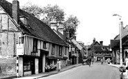
The Peacock (centre), named after the owner and not the bird, had a shop, which shut in 1977, built under the jetty in the 18th century.

The village got its red telephone box (centre) listed in 1987. The former post office, called Hunter's, is to its right.

The two gables with bargeboards (centre) belong to almshouses founded by Elizabeth Bull in 1634, rebuilt in 1876 and modernised in 1976. Beyond is the village lock-up and Cage House.

Ashby Road becomes the High Street at the crossroads (centre); to the left is Packington Hill, and to the right Broadhill Road.

In the distance, right of centre, is the long, pale form of the recently-completed Keay House.

Almost next door to this attractive hotel is the English National Golf Centre. The Woodhall Spa golf course has been voted the best inland course in England.

The High Street leads towards Stockton in the centre. The property on the left is little changed today.

In the centre are two fine Georgian town houses, and St Agatha's, the High School for Girls until 1939.

We are looking north, with the White Swan on the left and tall trees near the church in the centre. The grass in the foreground would soon bear a 1914-18 war memorial.
In the centre are two fine Georgian town houses, and St Agatha's, the High School for Girls until 1939.

Overlooking the River Asker and Happy Island, north-westwards to Watton Hill (centre) as a Great Western Railway pannier tank engine (right) steams out of Bridport Station (far left) with a goods train

South-eat of Chesham town centre the road runs alongside the River Chess in its flat-bottomed valley.

Here we see St Michael's Church topped by its original spire (centre right).

The Baptist chapel (centre left) was built in 1836, but since a larger building was erected on Cannon Street in 1874, it has undergone many changes of use.

Market Hill House, Grade II* listed (centre), has had a variety of uses over the years: a doctor's house, a dormitory for St Mary's School and bank premises.

The shot is southwards from Bay Cottage and the Royal Standard to the Cobb Warehouses (centre right).
Places (57)
Photos (98)
Memories (1253)
Books (2)
Maps (316)

