Places
26 places found.
Those places high-lighted have photos. All locations may have maps, books and memories.
- Cemmaes Road, Powys
- Six Road Ends, County Down
- Road Weedon, Northamptonshire
- Severn Road Bridge, Gloucestershire
- Roade, Northamptonshire
- Berkeley Road, Gloucestershire
- Harling Road, Norfolk
- Road Green, Devon
- Builth Road, Powys
- Cross Roads, Yorkshire
- Steele Road, Borders
- Cross Roads, Devon
- Four Roads, Dyfed
- Road Green, Norfolk
- Biggar Road, Strathclyde
- Clarbeston Road, Dyfed
- Five Roads, Dyfed
- Eccles Road, Norfolk
- Grampound Road, Cornwall
- Morchard Road, Devon
- Wood Road, Greater Manchester
- Four Roads, Isle of Man
- St Columb Road, Cornwall
- Clipiau, Gwynedd (near Cemmaes Road)
- New Road Side, Yorkshire (near Silsden)
- New Road Side, Yorkshire (near Cleckheaton)
Photos
14,329 photos found. Showing results 661 to 680.
Maps
476 maps found.
Books
5 books found. Showing results 793 to 5.
Memories
11,058 memories found. Showing results 331 to 340.
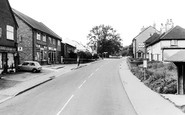
Top End Of High Street
The shop at the top left (now the Kebab Shop) was, I think, Wards the Greengrocers, the second shop down was Graingers a card and toy shop, later a pet shop (now Pendley Estate Agents). (Thanks to Rodney Grainger for the ...Read more
A memory of Bovingdon by
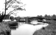
Bailey Bridge Pontoon Canal Cruisers.
I built the boat shown on the right hand side of the photograph. Bailey Bridge pontoon MKVI N0.19053 was manufactured by Gee Walker & Slater Ltd, Uttoxeter Road, Derby and sent to Engineers Stores, US ...Read more
A memory of Great Haywood in 0 by
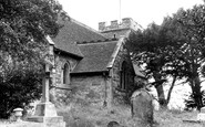
When The Reverend Nichols Was The Rector
Sadly, I believe St Michael's Church is little more now than a ruin of it's former self, nothing like it was in the 1940's when it seemed to stand proudly on the hill watching over and protecting the small ...Read more
A memory of Pitsea in 1940 by
St Joseph's Convent School
I note that a couple of people have mentioned St Joseph's Convent School. Having attended that school from 1960 to 1966, I can confirm that the location was opposite Hoadley's and the building did indeed curve alongside ...Read more
A memory of Burgess Hill
Russells And Dowdings
My mother, Edith Lucy 'Dot' Jeffery, was born in Penge in 1927, to a Lucy Russell, nee Dowding. She married in 1949 and moved into Queen Adelaide flats, and had me in 1950, before moving to Sidcup in 1955. Since that time, she lost ...Read more
A memory of Penge by
Childhood In Withyham
We moved to 2 Bower Cotts Balls Green about 1950. My dad was employed by the owner of Duckings, the farm situated opposite the entrance to station road. Nos. 1 and2 Bower Cotts were up on the bank almost opposite the school ...Read more
A memory of Withyham by
Peckham War Years
My name is Keith Rattray. I lived at 44 Radnor Road, Peckham from 1943 until 1956. My sisters are Joyce, Denise and Janet, all older than me. Joyce passed away in early 1960s but Denise lives in Princes Risborough and Janet lives ...Read more
A memory of Peckham by
The Beatty And Us
Like alot of young Kiwis, my wife and I started our OE (Overseas experience) in 1986, and in January 1987 found ourselves in Motspur Park as a result of applying and getting bar jobs at the Earl Beatty pub. Graeme and Marie ...Read more
A memory of Motspur Park in 1987 by
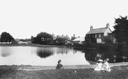
Ashtead Resident Finds Herself In 1925 Caterham Bus Photo
The above photo is the pond which is close to Dorothy Connor's current home in Glebe Road, Ashtead. This area has not changed so very much since the time the Frith photo was taken in ...Read more
A memory of Ashtead by
A Long Way From St Pauls Road
Hi, my name is Susan Thompson, formerly Hawkins and I'm 54, I was born in the above address and lived there for 18 years although my parents lived there for over 40 years. I went to Brook St. school finally ...Read more
A memory of Northumberland Heath in 1967 by
Your search returned a large number of results. Please try to refine your search further.
Captions
5,036 captions found. Showing results 793 to 816.
Walsworth Road again, this time in 1922 and at the junction with Highbury and Verulam Roads.
Bolton Road was the first paved road laid in Port Sunlight, and W H Lever named it after his home town as a reminder of his roots.
At the top is the junction of Heatcote Road and Park Road.
The village lies along the old turnpike road about halfway between Hatfield and Hitchin. On the right, a road branches off to Wheathampstead. Codicote had a number of interesting charities.
East of Gainsborough the Market Rasen road climbs the Lincoln Cliff, the limestone ridge which runs due north from Lincoln at about two hundred feet above sea level.
The camera looks north across the Golders Green Road/North End Road crossing.
The core of the old village lies at the north end of Central Avenue, where the road becomes Bridgford Road.
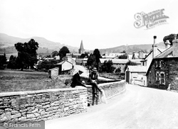
Behind them, New Road rises to the village centre and to the A40 road to Brecon and Abergavenny. At the top of the hill stands the steeple of the 14th-century parish church of St Edmund.
By the river, a road leads off Walton Lane under the bridge towards Walton Marina.
The arched windows on Tollgate Cottage (centre right) look out on what was a turnpike toll road. Beyond are Havering Cottage and Solways (top right).
Here in the main street, a policeman stands on traffic duty at the junction with Accrington Road outside the Whalley Arms.The church here was once the mother church for half of Lancashire (47 townships
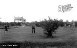
Between the golfers and the clubhouse was Burdon Lane, which until the 1950s joined the Brighton Road as it crossed the Downs by way of a dangerous blind junction.
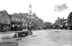
The tall buildings behind the lamp post, one with a sign for the Club and Literary Institute and built as a temperance hotel the other a bank dated 1898, flanked the entrance to Station Road.
The Hemel Hempstead Cricket Club plays at Heath Park, and Boxmoor Cricket Club plays on the 'Oval' in St John's Road. Hemel Hempstead (Camelot) Rugby Club use Chaulden Meadow.
Station Road led down to the railway station, now long gone.
Woodmansterne Station, situated in Coulsdon, did not arrive until 1932 and, although some distance from the old village, it was an impor- tant factor in the development of new roads off Rectory
The A127 arterial road (in the foreground) was opened in 1925 by Prince Henry, and succeeded Wash Road as the main east-west route through Laindon.
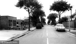
Stanway Road was created in the 1930s along with several other roads in the area, and is absolutely typical of the development which took place at that time.
The first school in Chandler's Ford was in Hursley Road near St Boniface Church; it moved to a more substantial building in Bournemouth Road, but eventually the Junior School was located to a site off
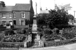
Here we can see the war memorial at the junction of High Street, Wollaston Road and Farndish Road, with steps leading up to the tall monument surmounted by a cross.
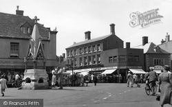
The Market Square is at the busy cross-roads in the centre of this delightful small town.
The road is still the A52, with a few bends in the village centre. Skegness is to the right.
The Bay View Hotel can be seen on the junction of St Helens Road and Oystermouth Road.
War Office Road joins Norden Road here. The manor of Bamford was owned by the de Bamford family from the 13th century until 1816, when it was sold to Joseph Fenton of Crimble.
Places (26)
Photos (14329)
Memories (11058)
Books (5)
Maps (476)


