Places
26 places found.
Those places high-lighted have photos. All locations may have maps, books and memories.
- Cemmaes Road, Powys
- Six Road Ends, County Down
- Road Weedon, Northamptonshire
- Severn Road Bridge, Gloucestershire
- Roade, Northamptonshire
- Berkeley Road, Gloucestershire
- Harling Road, Norfolk
- Road Green, Devon
- Builth Road, Powys
- Cross Roads, Yorkshire
- Steele Road, Borders
- Cross Roads, Devon
- Four Roads, Dyfed
- Road Green, Norfolk
- Biggar Road, Strathclyde
- Clarbeston Road, Dyfed
- Five Roads, Dyfed
- Eccles Road, Norfolk
- Grampound Road, Cornwall
- Morchard Road, Devon
- Wood Road, Greater Manchester
- Four Roads, Isle of Man
- St Columb Road, Cornwall
- Clipiau, Gwynedd (near Cemmaes Road)
- New Road Side, Yorkshire (near Silsden)
- New Road Side, Yorkshire (near Cleckheaton)
Photos
14,329 photos found. Showing results 761 to 780.
Maps
476 maps found.
Books
5 books found. Showing results 913 to 5.
Memories
11,058 memories found. Showing results 381 to 390.
Dads Shop
This was my Dad's shop where he started his butchering business in the 1930's till, he closed in 1973. Both my brother Tom and I worked there. Tom from 1955 till it closed and I began in 1962 and left in 1966, for Australia. In those ...Read more
A memory of Guisborough by
I Remember This Photo Being Taken!
I am the boy in the foreground on a bike and in the background on a bike is my friend Tony. We were worried about the man staring at us, he had a big box and I guess a tripod. When we got home we said about it ...Read more
A memory of Addlestone by
Good Old Times
I lived in Muspratt Road in the late 1940s and early 1950s and wonder if anybody remembers me. If you do, I would love to hear from you and would appreciate a message on jimchad29@talktalk.net. My name is George Anderson and I lived at 48 Muspratt Road, Seaforth.
A memory of Seaforth by
Sutton High School For Boys Closed In 1962
Does any one remember or, like me, go to this school that had the same purple-mauve school uniform colour as the twinned girls' school just along the road? The alumni blog (with photos of teachers like ...Read more
A memory of Sutton by
Sarc Florence Road And More
Woolston seems to have played quite a big part in the history of our family, so it's appropriate I guess that as an adult I have ended up living here with my Husband!! It started as far back as my great great great ...Read more
A memory of Woolston by
The Red Squirrels In Fisherman's Walk
As a young schoolboy in Southbourne from 1954 to 1956 I loved to walk to and fro in Fisherman's Walk. There were red squirrels which were fairly tame and would take food from my hand if there were not too ...Read more
A memory of Southbourne in 1954 by
The Croxley Elm Trees
The 1947 council house development that was built on the north side of Baldwins Lane, west of Manor Way became my home area after moving from Rochester Way in 1948. I loved the beautiful tall Elm trees that lined ...Read more
A memory of Croxley Green in 1947 by
War Time
During the WW2 war my dad was posted at R A F Finningley and we his family lived in the village at a small holding across the road from the school. I can still see in my mind Wilf the owner who lived there too with his wife. Also the ...Read more
A memory of Finningley in 1945 by
Stranger In A Foreign Land
Hello, I am just a a visitor to Coseley I came in the late 1980’s and stayed here ever since. I went to the Coseley Secondary School during that time and loved every moment. Yeah, as always there were some disputes along the ...Read more
A memory of Coseley by
Plymstock Memories Late 1950s
Having moved out of Plymouth, and awaiting a new build house off Dunstone Road, I lived for a while at my grandparent's house on Dean Hill whilst attending Goosewell Infants. At that time Dean Hill was a tranquil leafy ...Read more
A memory of Plymstock
Your search returned a large number of results. Please try to refine your search further.
Captions
5,036 captions found. Showing results 913 to 936.
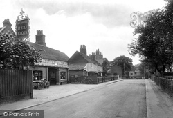
The façade of Ye Olde Red Lion pub in Park Road had undergone some minor changes shortly before this photograph was taken, with the removal of two decorative signboards above the main doorway and the replacement
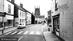
The road repairs next to the crossing are unusual, as nearly all the roads in these photographs seem to be in excellent condition.
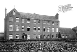
The Visitation Convent in Pymore Road, opposite the junction with Coneygar Road, is shown here from the potato patch behind it.
The road repairs next to the crossing are unusual, as nearly all the roads in these photographs seem to be in excellent condition.
The road has also been re-aligned, and the pub is now further away from the road.
The newer part of Langho, about a mile distant, has developed since the road to Clitheroe from Blackburn was made.
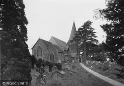
All Saints' Church looks out over the marshes by Church Farm, and stands at the west gates to the castle (not now the public entrance, which is from the Wartling Road).
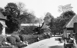
Behind the tearoom, the village shop, now closed, was once an inn with stables and yard running back from the road.
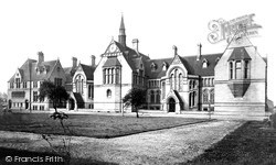
The college later moved into a new building on Oxford Road which had been designed by Alfred Waterhouse, winner of the competition to design Manchester Town Hall.
Road improvements have left it just off the main road today.
We are looking down towards the Market and the Town Hall, with the Lloyds Bank building beyond the Savoy Cafe (right) - Lloyds Bank moved to Whalley Road in 1962.
There are roads along each bank and houses face the river, giving it a slightly Dutch feel. Indeed, there are some fine Georgian houses, particularly on the east side near the good parish church.
Even in the mid-fifties, Edenbridge retained some of its atmosphere as a small agricultural town, strung out along the Roman road which reached out across the Weald from Lewes to London.
The Avenue leads round to Normanby Road, which recalls the landowners of the nearby Normanby Hall and Estate.
We are looking towards the corner of Island Road, with Brook and Williams's printers and bookbinder's shop and works on the right; this block of shops later became one of the first department stores in
Monton Green is also the name of the road in our photograph.
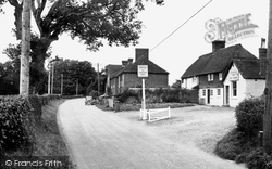
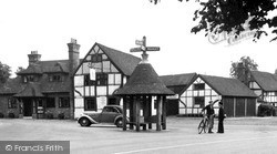
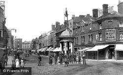
This quaint combined signpost and sheltered seat stands at the junction with The Street, Kings Road and Cranleigh Road. It is a 1920s delight, and reminiscent of a market cross in miniature.
Across the road - and stretching down to the bridge - were two inns fused together, the Lion and the Hart; and on the far corner of Springfield Road - where Next now is - was the Crown.
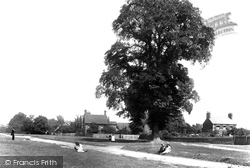
Earlier development shows in this view looking north-east up the Common with, to the right of the oak, nos 3 and 7 New Road, a road laid out a few years earlier.
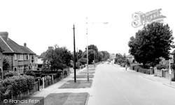
This view looking towards town captures well the flavour of interwar development along the Tring Road itself.
100 acres was considered enough for a park, and the rest was made available for what was to become Park Road with North and South Parades.
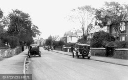
This view of Birkenhead Road was taken very early in the wartime decade - the parked vehicles lack the white painted edges to the front and rear wings, and none of the windows in the houses
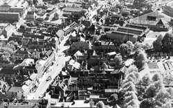
This aerial shot shows the High Street; it is a wonderful illustration of a common style of urban development, with narrow medieval burgage plots running back at right angles from the road.
This aerial shot shows the High Street; it is a wonderful illustration of a common style of urban development, with narrow medieval burgage plots running back at right angles from the road.
Places (26)
Photos (14329)
Memories (11058)
Books (5)
Maps (476)


