Merry Christmas & Happy New Year!
Christmas Deliveries: If you placed an order on or before midday on Friday 19th December for Christmas delivery it was despatched before the Royal Mail or Parcel Force deadline and therefore should be received in time for Christmas. Orders placed after midday on Friday 19th December will be delivered in the New Year.
Please Note: Our offices and factory are now closed until Monday 5th January when we will be pleased to deal with any queries that have arisen during the holiday period.
During the holiday our Gift Cards may still be ordered for any last minute orders and will be sent automatically by email direct to your recipient - see here: Gift Cards
Places
36 places found.
Those places high-lighted have photos. All locations may have maps, books and memories.
- Shanklin, Isle of Wight
- Ventnor, Isle of Wight
- Ryde, Isle of Wight
- Cowes, Isle of Wight
- Sandown, Isle of Wight
- Port of Ness, Western Isles
- London, Greater London
- Cambridge, Cambridgeshire
- Dublin, Republic of Ireland
- Killarney, Republic of Ireland
- Douglas, Isle of Man
- Plymouth, Devon
- Newport, Isle of Wight
- Southwold, Suffolk
- Bristol, Avon
- Lowestoft, Suffolk
- Cromer, Norfolk
- Edinburgh, Lothian
- Maldon, Essex
- Clacton-On-Sea, Essex
- Felixstowe, Suffolk
- Norwich, Norfolk
- Hitchin, Hertfordshire
- Stevenage, Hertfordshire
- Colchester, Essex
- Nottingham, Nottinghamshire
- Bedford, Bedfordshire
- Bury St Edmunds, Suffolk
- Aldeburgh, Suffolk
- St Albans, Hertfordshire
- Hunstanton, Norfolk
- Chelmsford, Essex
- Bishop's Stortford, Hertfordshire
- Peterborough, Cambridgeshire
- Brentwood, Essex
- Glengarriff, Republic of Ireland
Photos
11,145 photos found. Showing results 8,421 to 8,440.
Maps
181,031 maps found.
Books
442 books found. Showing results 10,105 to 10,128.
Memories
29,071 memories found. Showing results 4,211 to 4,220.
A Child In Langwith
I was born in Langwith in February 1930 at 8 Moorfield Lane. I went to Whaley Thornes infants school and started in the reception class in 1935, the teacher being Miss Smith, who had taught not only some of the pupil's parents ...Read more
A memory of Langwith in 1930 by
Cruick Avenue
I can remember Sandra Crosby, her and her husband were good friends of ours, my mum also knew the Crosby family. Happy memories of my life growing up in Broxburn Drive, and our early years living in the prefabs in Larksper Road. Have loved looking at all the old photos.
A memory of South Ockendon by
Kilburn Albert Road
Born in 101 Albert Road, moved to Charlton House and lived in flat No.38; the Whitby's, Streets, Watsons, Sullivans, Corrs, Reynolds, Ryans, Butchers, were all my neighbours. I went to St Marys School, Granville ...Read more
A memory of Kilburn in 1950 by
British Films
I was born in Louisville Road in 1944 . My father ,Jack, was General Manager of British Films Ltd in Balham High Road. We moved out of London shortly after I was born, but my father continued to run B Films well into the 1950's. Does ...Read more
A memory of Balham in 1944
Milkman
I remember Mr Souter and the Calverts who ran the garage, and Mr Pears in the corner shop. Started work as a hairdresser apprentice in Headley then moved to Bordon. Had hairdressing shop in Chalet Hill in Mr Simpkins next to Kings baby ...Read more
A memory of Lindford in 1960 by
Manod Boy.
Nice memories. Post office behind the bus, across I think was Crosville depot. There was a billiard hall on bridge somewhere. Central School till war broke out then work; Joined RN, spell in Malta, was AA Man in Bettws Y Coed ...Read more
A memory of Blaenau Ffestiniog in 1940 by
Howells Of Brithweunydd Road
I am researching the Howells branch of my family. My mother was Eileen Howells and she had a sister, Enfys Howells. Parents were Ivor and Iovie Howells. They ran a grocers shop on Brithweunydd Street. I wonder if anyone remembers my family?
A memory of Trealaw by
Peckham 1958 To Date
My mother and her family lived in Cronin Road until bombed out in 1940. Mum moved back there in 1953 when she married dad, an myself and my 3 sisters were all born there. We moved in 1963 when my baby sister was only 13 days ...Read more
A memory of Peckham by
Memories Of The Crows Nest, The Raven/Tartan Room, The Bin
I moved to Countsfarm Rd in 1959 and went to Hazel Leys School until 1962. I have great memories of working at Sealed Beams and as an Usherette at The Odeon, which meant I got to see movies ...Read more
A memory of Corby in 1963 by
The Ideal Village
I lived with my grandparents for a short while in the late forties and visited often over the next fifteen years or so. Their home was one of the wooden bungalows that was Ewden Village. My grandad worked on the reservoirs ...Read more
A memory of Ewden Village in 1948 by
Your search returned a large number of results. Please try to refine your search further.
Captions
29,395 captions found. Showing results 10,105 to 10,128.
The town is considered the gateway to the moors and forests of the Northumberland National Park, and the Pennine Way also passes through the town.
From here, there was a lock-free run all the way to the edge of Wolverhampton - apart from the one at Wheaton Aston which we saw earlier.
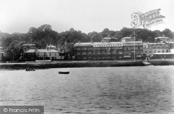
This view shows the river at low water, again with evidence of boating. The Imperial Hotel (centre left) has just completed a major expansion programme.
Following the death of the owner, the site was acquired by the town and first opened to the public in 1960.
Cobb Gate Jetty is in the foreground, dating in its present state from 1850; it is on the site of Lyme's first early medieval harbour, which was washed away on 11 November 1377 with the
About ten miles north-east of Penrith, near Staffield, pathways have been cut along the banks of the Croglin Beck where it tumbles down through the sandstone gorge it has carved on its way
There has been change here, with development on both sides of the road, though the white building in the centre and the terrace of houses remain.
A little further upstream we come to the village of Otterton, built around one long main street.
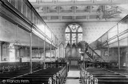
This view of the interior after its reconstruction in 1880 shows the delicate wrought iron work.
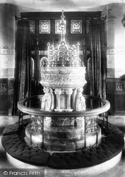
The font, reredos and chancel furnishings were mostly of marble, gaining for All Saints' the reputation of being 'the marble church'.
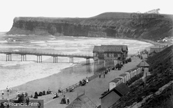
Note the row of bathing machines on the edge of the
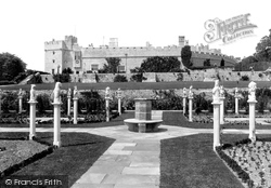
The south front of St Donat's overlooks the Bristol Channel, and a series of terraced gardens lead down to the shore.
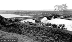
The 1405ft long concrete four-span Royal Tweed Bridge, designed by L G Mouchel & Partners, was built in 1925-28 to take traffic off the old stone bridge that still stands nearby.
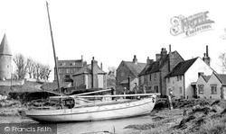
We are in the Ouse valley just north of Newhaven. St John's church is on high ground overlooking the tidal river. It has a Norman flint-built round tower, and a shingled octagonal spire.
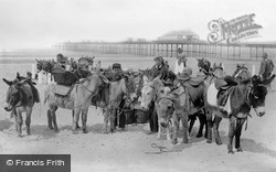
Donkeys are awaiting the arrival of the day's holidaymakers on the beach. A fisherwoman in a tall hat stands behind the donkey boys and their mounts.
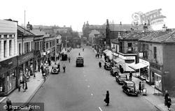
Formerly a dirty, rutted lane, this was changed into a shopping centre from 1872 with the demolition of the Hick Lane cottages.
The Cathedral viewed from the south has been a favourite subject for artists - including, of course, Constable.
Behind the spot where the photographer must have stood is Windrush Valley School, founded in 1951, and the low building on the extreme right of the picture, next to the three-gabled house
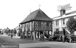
The Town Hall, standing in the middle of the High Street, was given by Lawrence Hyde, first Earl of Rochester, in 1700. Restored in 1889, it was presented to the town by Lady Meux in 1906.
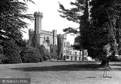
Viscount Valentia was a colourful character who loved fireworks and spent hundreds of pounds on his hobby.
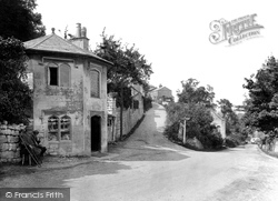
On the board above the toll house door are listed the charges for the passage of vehicles and animals through the gate that once stood here.
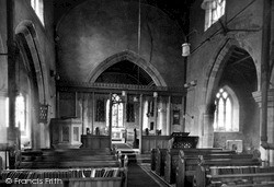
The chancel arch was rebuilt by Johnson, a Melton Mowbray architect, who achieved little of note. His work appears to have been virtually confined to the immediate area, which may be just as well!
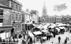
Until the 1930s the south side of the market, facing the camera, was bordered by a row of buildings which would be later demolished.
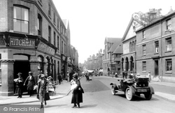
Hitchman's, the chemist on the left, was on the corner of Silver Street and Gold Street.
Places (6814)
Photos (11145)
Memories (29071)
Books (442)
Maps (181031)


