Places
36 places found.
Did you mean: street or streetly ?
Those places high-lighted have photos. All locations may have maps, books and memories.
- Heathfield, Sussex (near Cade Street)
- Street, Somerset
- Chester-Le-Street, Durham
- Adwick Le Street, Yorkshire
- Scotch Street, County Armagh
- Friday Street, Surrey
- Potter Street, Essex
- Boughton Street, Kent
- Newgate Street, Hertfordshire
- Streetly, West Midlands
- Shalmsford Street, Kent
- Green Street Green, Greater London
- Boreham Street, Sussex
- Park Street, Hertfordshire
- Cade Street, Sussex
- Appleton-le-Street, Yorkshire
- Hare Street, Hertfordshire (near Buntingford)
- Romney Street, Kent
- Trimley Lower Street, Suffolk
- Streetly End, Cambridgeshire
- Hare Street, Hertfordshire (near Stevenage)
- Brandish Street, Somerset
- Colney Street, Hertfordshire
- Langley Street, Norfolk
- Silver Street, Somerset (near Street)
- Street, Yorkshire (near Glaisdale)
- Street, Lancashire
- Street, Devon
- Street, Cumbria (near Orton)
- Street, Somerset (near Chard)
- Bird Street, Suffolk
- Black Street, Suffolk
- Ash Street, Suffolk
- Broad Street, Wiltshire
- Brome Street, Suffolk
- Penn Street, Buckinghamshire
Photos
24,920 photos found. Showing results 4,161 to 4,180.
Your search returned a large number of results. Please try to refine your search further.
Maps
1,622 maps found.
Books
3 books found. Showing results 4,993 to 3.
Memories
6,666 memories found. Showing results 2,081 to 2,090.
1952
I was born in the July of 1952,to my parents Frank and Bette Coxon. We lived above a butchers shop, on the corner of the Wednesfield Road and Heath street - the shop belonged to Mr Sammy Hall. My father worked as a butcher at Downs of ...Read more
A memory of Heath Town in 1952 by
The Brambles Abel Family
My grandmother used to live in a house called The Brambles in Church Street, as a young girl during the 1920`s when she was about 8 or 9. The family name was Abel- relating to Bobby Abel the famous cricketer. My great ...Read more
A memory of Crondall in 1920 by
Buckhaven In The Late Thirties And The 50's
In the late thirties, my mother worked as a dispatcher in Stuarts Bakery in Church Street just down from the junction with Randolph Street. This building has been closed down now for many years. In ...Read more
A memory of Buckhaven in 1950 by
Old Blackburn Lass
I was born in 1933 and brought up in Proctor Street, Grimshaw Park. I attended Christ Church School and then Audley Modern Secondary school from 1944 - 48. I left school and worked at Ewood Mill until going nursing in 1950 to ...Read more
A memory of Blackburn in 1930 by
Times Past
I was born in 1951 and lived for the first 2 years of my life at 241 the Blocks with my parents and Grandparents. This was a 2 up 2 down + attic house in a block of 3 situated on the bottom row of the blocks, now ...Read more
A memory of Barrow Hill in 1951 by
Gaslight 1954
In the early 50's many streets in Uxbridge were still lit by gas. So "lighting up time" had a whole different meaning. The iron lampposts were much lower than the lighting masts of today and were more widely placed along the ...Read more
A memory of Uxbridge in 1954 by
Fond Memories.
I lived in Coval Lane from my 1st birthday to my 24th birthday - 1948/1971. Then I got married and moved out. At that time the shop on the corner was a wool shop because my mum, an ardent knitter, bought most of her wool there. I ...Read more
A memory of Chelmsford by
40s/50s
Early memories of Buckhurst Hill. Re. Mark Brazier's message. Yes I remember the Three Colts and the French family. The son David was a close friend so I spent a lot of time there. I remember your mother and father Audrey and Ged ...Read more
A memory of Buckhurst Hill by
Great Memories Of Durham City
My Uncle Gordon was the police man who used to sit in the police box at the top of the street in the market square directing traffic. This was around 1950s. I used to live in Meadowfield and came to Durham many, many ...Read more
A memory of Durham by
The Mining Industry Abercynon Colliery
I worked under ground at Abercynon Colliery from 1951 until 1953. I worked on the coal face in the "S" district, a five foot coal seam which was about 100 yards in length and which had a slight gradient. I ...Read more
A memory of Abercynon in 1950 by
Captions
5,435 captions found. Showing results 4,993 to 5,016.
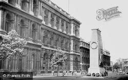
Once the site of a rambling royal palace largely burned down in the 1690s, the road gradually acquired government offices and the home of the prime minister in Downing Street - its entrance
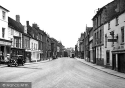
The flint-faced buildings on the right are some of the original village houses, but virtually all the rest of the High Street buildings have been replaced.
London Road, the old A1 before the town was by-passed, becomes Lombard Street before turning right into Castle Gate with its many former coaching inns; it then turns left beyond the castle
All survives in Bridge Street, which leads out of the south- east side of the Market Place in the distance.
From Bridge Street we head north towards Victoria Square over the Chesterfield Canal, whose bridge parapets are in the foreground.
The High Street is looking remarkably quiet and empty – there are only a few vans and cars, and no road markings.
A few years earlier, one local commentator had written: 'the other side [of Earle Street] has been considerably improved with the growth of the local Co-operative Society.
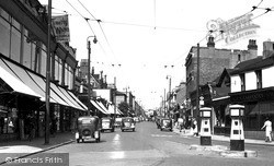
Many local authorities were to save ratepayers the expense of erecting lamp posts by attaching their street lamps to the trolley poles, as we see here.
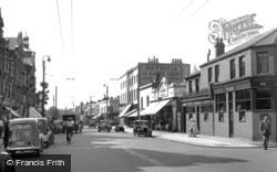
Many local authorities were to save ratepayers the expense of erecting lamp posts by attaching their street lamps to the trolley poles, as we see here.
The Assheton Arms, an old coaching inn, is at the bottom of Long Street, with the Williams Deacons and Salford Bank, designed by Edgar Wood, to its right.
This photograph shows the open market in New Market Street. Here we see the Market Hall (or House) from the rear, and the back of the Town Hall; its 20ft-high wall guards a courtyard.
At the south end of the High Street Frith's photographer looks northwards beside the turning on the right into Hawleys Lane.
Swindon adopted the Public Libraries Act in 1942, and its first public library opened in McIlroy's departmental store in Regent Street the following year.
This is a view along East Street to the former Market Place, from the Greyhound Hotel (left) which faces the wonderfully elaborate Georgian shop-front of Beach and Company.
This view is taken looking north- west along Benyon Road towards the junction of Pound Street and Carshalton Road. The high brick wall in the distance belongs to Carshalton House.
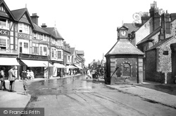
This view looks south down the High Street past a motor bike with its acetylene headlamp towards the old Market House with its cupola.
Few national brands were to be seen on the main street, apart from Lipton's grocery and the Westminster Bank visible in this photograph; the remainder are locally owned and managed businesses.
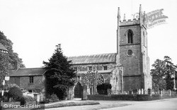
Close to the road, the solid but impressive ashlar tower dominates the immediate street scene with its substantial angled buttresses and crocketted finials; these are not 15th-century, but were added
Spring afternoons provide a fine sight as some of these elderly 'ladies and gentlemen' parade through the streets and lanes.
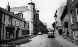
Uppingham School's Memorial Hall and classroom block dominate the street, replacing houses which were demolished in the 1920s.
The camera looks towards Hampstead High Street, formerly Red Lion Hill.
Visit today, and see that the pub has gone, and that offices and shops of little architectural merit have come to dominate the street scene.
High street shoppers in 1931 were finding that prices were continuing to fall back to their pre-Great War levels.
The A15 is in fact a Roman road – Ermine Street.
Places (385)
Photos (24920)
Memories (6666)
Books (3)
Maps (1622)


