Places
36 places found.
Those places high-lighted have photos. All locations may have maps, books and memories.
- Bangor, County Down
- Newcastle, County Down
- Greyabbey, County Down
- Donaghadee, County Down
- Downpatrick, County Down
- Portaferry, County Down
- Dromore, County Down
- Downings, Republic of Ireland
- Hillsborough, County Down
- Killyleagh, County Down
- Ardglass, County Down
- Rostrevor, County Down
- Dundrum, County Down
- Newtownards, County Down
- Warrenpoint, County Down
- Ballygowan, County Down
- Ballywalter, County Down
- Ballyward, County Down
- Bishops Court, County Down
- Boardmills, County Down
- Culcavy, County Down
- Katesbridge, County Down
- Killough, County Down
- Millisle, County Down
- Portavogie, County Down
- Saul, County Down
- Seaforde, County Down
- The Diamond, County Down
- Audleystown, County Down
- Kearney, County Down
- Annaclone, County Down
- Ballyhalbert, County Down
- Ballymartin, County Down
- Clare, County Down
- Conlig, County Down
- Dollingstown, County Down
Photos
1,089 photos found. Showing results 1,681 to 1,089.
Maps
459 maps found.
Books
47 books found. Showing results 2,017 to 2,040.
Memories
8,148 memories found. Showing results 841 to 850.
Happy Days
Oh the memories stored away!! Charlie's opposite Cove Green, going there for sweeties on a Sunday, Cove Green (not as good as Tower Hill swings though!), Mundays closing at 1pm on Sundays, Thorntons with its yellow facade, and wool etc, I ...Read more
A memory of Cove in 1965 by
Life As A Kid
I used to go to Usworth Park to play football or go bird nesting down the planton at Waterloo. I also used to go round collecting bottles to take back to shop and get the money for the pictures. We had 3 picture houses in ...Read more
A memory of Washington by
I Met And Then Married My Blind Date At Alton
I remember as a 16 year old that I was a patient in the Lord Mayor Treloars Hospital, ward 1. I was considered to be a long term patient who was having knee surgery. I had to stay in bed for six weeks, ...Read more
A memory of Alton in 1975 by
Boarding School, Harcombe House.
In 1956 I went to Harcombe House as a boarder. Mrs Jowett was in charge of us - 52 girls. Crocket did the gardens and lived in a cottage on the lane, as did cook. Matron and the housemistress, Miss Haytor, lived in. ...Read more
A memory of Uplyme in 1956 by
South Ockendon
We too lived on this street, half-way down on the left in fact. I remember the Spicers, I used to babysit Christopher.
A memory of South Ockendon by
Gladstone Park
Our family moved from Churchill Road, Willesden to the country right out to Dudden Hill, in Normanby Road. The entrance to the park was just down the end of the road near the old iron bridge. There was a rather short ...Read more
A memory of Hendon in 1961 by
Windsor Sundays
I remember always being taken by the parents to walk around Windsor Castle on a Sunday afternoon, just walking in then, not security checks or admission fees! And we were so bored of going to see the Dolls House which now you have ...Read more
A memory of Windsor by
The Happiest Days Of Your Life
Brambletye school, well set between the beautiful Ashdown Forest and thriving town of East Grinstead on the Sussex/Surrey border was a paradise on Earth for any schoolboy with an aesthetically romantic (!) ...Read more
A memory of Brambletye House in 1959 by
Great Memories Of This Area
Really it was 1961-66. I worked as a Geologist for the United Steel Companies based in Rotherham. I visited Haile Moor and Beckermet Mines every two or three weeks for 5 years and came to love the area and its people ...Read more
A memory of Thornhill in 1961 by
Growing Up In Newton
I was born in the old cottage on the left, 175 High Street, in 1948, as June Glencross, my parents squatted there after the war, my dad became the local builder. In 1956 we moved up the road to the old congregational ...Read more
A memory of Newton-le-Willows in 1948 by
Captions
2,258 captions found. Showing results 2,017 to 2,040.
During the Second World War, Mrs Armitage, who had taken to using her pony and trap to save petrol, would tie the pony up to the pump when she came down to the village to shop, never mind
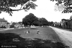
Green from the far side.The village (the name means 'the dwelling by the bow of the river') has two greens; because it was all part of the Pudsay estate, there was no pressure to expand or to pull down
The area around Glasson is teaming with wildlife, and is a bird watcher's paradise from Conder Green down to Cockerham Sands in the south. Swans and ducks live in the canal basin.
down, and nobody appeared to be very interest- ed in it.
It was burned down around 1900 and given a tiled octagonal roof with dormers and a weather vane.
The half-timbered house on the left was the Priest's House, and it stands beside a small church which was rebuilt in brick after being burned down in 1514.
Down at Church End there is another more well-known and photographed pond; it and the 13th-century parish church are to the left of the War Memorial.
This view looks south down the High Street past a motor bike with its acetylene headlamp towards the old Market House with its cupola.
The prosperous Georgian feel of the town originates with the presence of the castle and with its role as a market town and agricultural centre.
This is the road down to the shore (and Red Bank Farm). Red Bank is one of the spots from which you can cross the sands over to Kents Bank.
On occasions at dead of night, staff are convinced they have seen a lady with long, dark hair and wearing long black period clothes walk down this corridor to what was the arched front door of the
Pentewan was developed as a port in the 1820s for shipping ores and china clay, which were brought down from St Austell on a railway built in 1829.
This shows the town, the railway and the headland. The first station had been provided only 20 years before.
The King's Road was famous for trendy clothes and antique shops; in the 1960s Minis and Triumph Herald convertibles cruised up and down, the pavements thronged with peacock-gaudy young men and women.
It is rather surprising that most of the buildings in the shot have survived, although generally in a down-graded form. The bushes on the right have gone, to be replaced by shops.
The three pointed gables to its left belong to the 1824 warehouses in which guano, flax and cotton were stored (it was pulled down in 1965).
It was a co-educational school until the Girls' County School was built further down Buttrills Road.
The centre is overlooked by the 1100ft- high Witton Fell, and on the green is a huge boulder brought down by 20 horses in 1859.
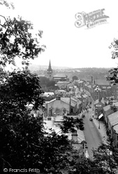
We are looking down from the keep of Clitheroe Castle to the town below.
The Macclesfield road rises in the distance to the bridge over the railway line, with the station and livestock market going down on the left.
As the town grew, Digbeth stretched from the High Street down to a small open stream running through the valley bottom.
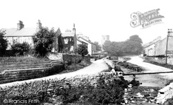
In this picture we can see the small stream that runs down from Waddington Fell and the Moorcock Inn as it runs right through the centre of the village to join the Ribble.
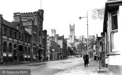
This is now an extremely busy road, and there is a host of traffic lights where five roads meet at the bottom of Lindum Hill, just about where the car is coming down the road.
Here we are reminded that before the building of the bus station in Merrywalks, buses waited at several locations in the town.
Places (198)
Photos (1089)
Memories (8148)
Books (47)
Maps (459)

