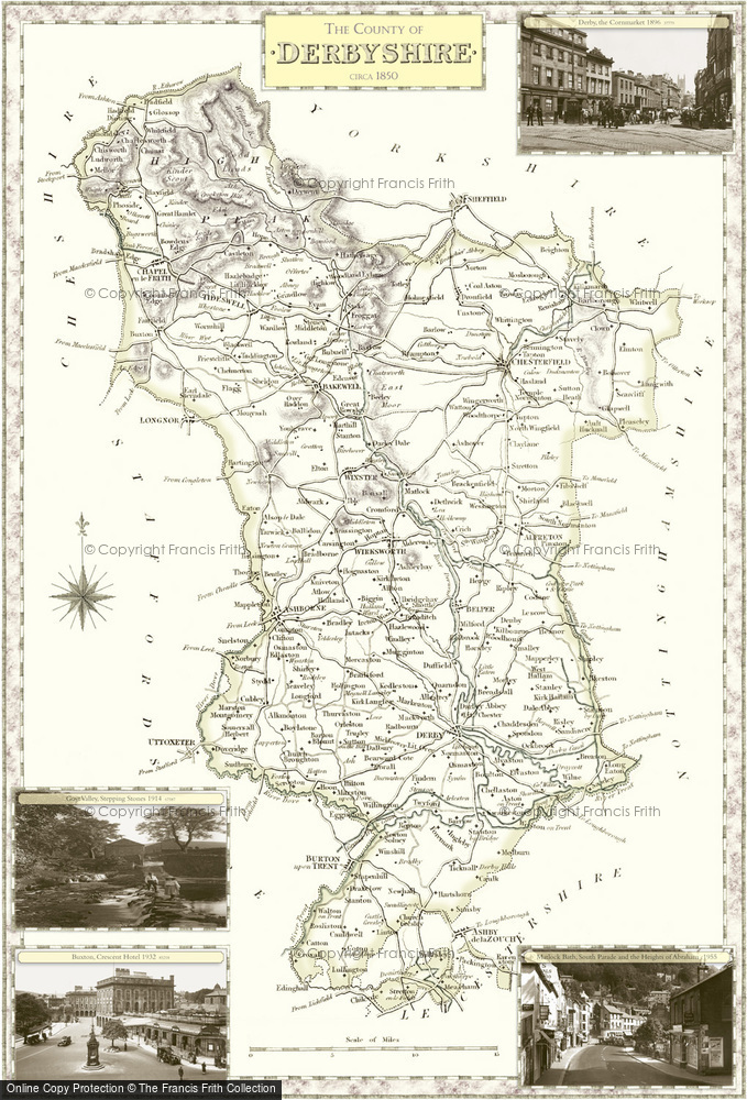
Historic County Map of Derbyshire

These superbly detailed maps provide an authoritive and fascinating insight into the history and gradual development of our cities, towns and villages. The maps are decorated in the margins by selected Frith photographs. Available to buy in a range of sizes and styles, including large prints on canvas and tea towels.
Buy a Print
Unframed, Mounted, Framed and Canvas prints in a range of sizes and styles.

Prices from
£57.90
to
£210
View Sizes & Prices
Add to Album
You must be signed in to save to an album
Sign inCreate a Gift With This Map
This County Map features these photos:
 Goyt Valley, Stepping Stones 1914
Ref. 67587
 Buxton, Crescent Hotel 1932
Ref. 85218
 Derby, the Cornmarket 1896
Ref. 37779
 Matlock Bath, South Parade and the Heights of Abraham c1955
Ref. M47025
About This Map
- Year drawn: 1840
- Series: Samuel Lewis County Maps
- Map reference: f08
- Features four Frith photos from the area covered in the margins. More details shown below.
- Learn about Samuel Lewis County Maps maps
Other Maps of Derbyshire
Samual Lewis Victorian County maps
Published 1840
Stunning, full-colour reproductions of hand-tinted original county maps which were drawn by R. Creighton and engraved by T. Starling and J. & C. Walker. They were created in the 19th century, during the great coaching era for Samuel Lewis' renowned guidebook.
