Places
20 places found.
Those places high-lighted have photos. All locations may have maps, books and memories.
- West Park, Cleveland
- West Park, Sussex
- West Park, Merseyside
- West Park, Humberside
- West Park, Tyne and Wear
- West Park, Yorkshire (near Horsforth)
- Goldthorn Park, West Midlands
- Friar Park, West Midlands
- Ashmore Park, West Midlands
- Park Village, West Midlands
- Rotton Park, West Midlands
- Ettingshall Park, West Midlands
- Selly Park, West Midlands
- Whitmore Park, West Midlands
- Summerfield Park, West Midlands
- Woodway Park, West Midlands
- Four Oaks Park, West Midlands
- Lime Tree Park, West Midlands
- Park Street, Sussex
- Queen's Park, Cheshire
Photos
42 photos found. Showing results 101 to 42.
Maps
36 maps found.
Books
Sorry, no books were found that related to your search.
Memories
456 memories found. Showing results 51 to 60.
Early Memories
My birth on 30 Nov 1946 at 34 Oldberry Road, Burnt Oak, is where it all started for me, but my mother & her parents moved into the house when it was built for the LCC. She's 89 now, but recalls that she, as a 9-yr-old in 1928, ...Read more
A memory of Burnt Oak in 1946 by
The Hub Of My Young Universe
London's main railway stations truly are wonderful and Charing Cross was the one that I frequented the most as I travelled every weekday from Woolwich Arsenal in SE London to Green Park Underground, near the great ...Read more
A memory of London in 1959 by
My Memories Of Salford
I was born in the upstairs back room of my maternal Gran's house at 20 John Street, Pendleton. I was told there was an air raid going on at the time. My first school was John Street where there was a play ground on the roof, ...Read more
A memory of Salford in 1951 by
History Of Clayton Family 1700s
Descendants of George Clayton Generation No. 1 1. GEORGE1 CLAYTON was born 1788 in Pickhill, West Roxby, Yorkshire England. He married ANN MUDD 08 December 1806 in Pickhill, West Roxby, Yorkshire England. She ...Read more
A memory of Pickhill in 1860 by
Cookridge Once Fields And Farms
I moved from Holbeck in 1948 into one of the first estates to be built in North West Leeds, Ireland Wood (Raynels). In 1950 I went to Cookridge School, then a wooden hut right slap bang opposite where Cookridge ...Read more
A memory of Cookridge in 1950 by
My Fading Memories
I was but a lad of 8 when my folks bundled us all off to a wide land downunder. Since 1968, Australia has been my home. I often speak of my fading memories of Queensbury, my walks through the village, living on 'The ...Read more
A memory of Queensbury in 1968 by
Hayes 1949 1971
I was born in Hayes at 3, Botwell Lane which was a big old house (now grade 2 listed) divided into three flats. As a young child it was a creepy old place and said to be haunted. I believe nuns lived there at one point and during the ...Read more
A memory of Hayes by
My Childhood In Wolverhampton 1946 1955
I played in the standing corn stooks behind our house, had my first pony/horse ride at Dixon's farm where my horse went berserk in a potato field, so I was put onto and stayed on a horse lead. I flew my ...Read more
A memory of Wolverhampton by
Kings Holiday Camp
It would have been mid August 1970 when I had my first holiday here, together with my parents, aunt, and our two dogs. I was 8 years old. It was 50 years ago this month. We rented a chalet for two weeks. There was a duck pond ...Read more
A memory of Canvey Island by
Pavenham 1945 1970
This is the village where I grew up, my parents moving into their very old, somewhat dilapidated cottage at the end of the war. This was 'The Folly' at the eastern end of the village opposite one of Tandy's farms. Why it had that ...Read more
A memory of Pavenham by
Captions
191 captions found. Showing results 121 to 144.
Along the Marlow Road at the west end of Kidwell's Park is the former Technical School, dated 1895.
Ray Park Avenue was one of the first roads laid out and has some houses of the 1870s.
At the top of the glen a pioneer amusement park was established from 1887, when the switchback railway from the Saltaire Exhibition was moved up the hill.
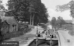
Here we see two horse-drawn narrow boats, the 'Linnet' and the 'Evelyn', belonging to George Garside, at the attractively sited lock in Cassiobury Park, Watford.
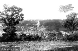
Looking west from the chalk hills east of the town, undeveloped to this day, Chesham nestles in the deep-cut valley of the River Chess.
Located in the suburb of Allerton, this junction provides access to West Allerton train station and to the B5180 and A562 arterial roads.
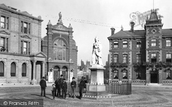
evocative late Victorian view with the youths posing beside Queen Victoria's Golden Jubilee Statue is very much an archive photograph: only the building to the left, a bank, now the Nat West
In the foreground we see the roof of Bury House and its stables at the western end of The Bury.
The hamlet of Mill End, about a mile west of the centre of Rickmansworth, grew up along the main road to Uxbridge to serve a watermill and factories.
The mansion and the church sit amid a park of over 200 acres, in an estate of more than 10,000 acres.
The 500 acres of deer park was incorporated in the city boundaries in 1932, but only the east side, a strip along the north side, and a strip along the west side were developed for
Moving north-west from Albert Park to the Faringdon Road, the town tour finishes at the School of St Helen and St Katherine, as it is now named.
This Grade II listed building was built about 1824 for Thomas Hall, a West Riding magistrate from Castleford.
This town, known to its inhabitants as 'Mach', is situated at the far north-west corner of Powys, so distant that it is also in the Snowdonia National Park and just ten miles from the sea.
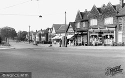
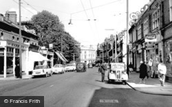
Whitehall is on the extreme left of this photograph, taken at this junction of Park Lane and The Broadway; the widening of the Malden Road has yet to take place.
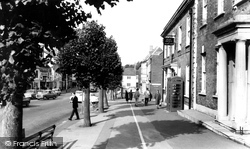
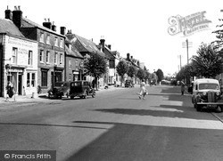
This picture looks westwards down the north side of West Street, with its lollipop limes, from the Post Office to Victoria Grove (right of centre).
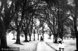
Taken from the west edge of St Peter's Green, this view looks north up the long avenue towards Bedford Park. This is an early view, with the lime trees little over ten years old.
The main shopping centre is in the High Street to the east, leading away from the parish church, and Broad Street to the west.
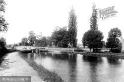
This view looks south-west along the canal past the last lock, No 16, Hills and Partridges Lock, to Park Street Bridge. (Hills and Partridges works have now long gone.)
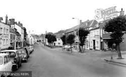
The lower end of West Street, looking westwards, has all manner of public houses from the Sun Hotel (left) to the Lily Hotel. Between them are the showrooms of Bridport Motors.
The manor of Barden lay to the south-west of Tonbridge. Barden Park House and its estate was in the possession of the Abrey family during the latter part of the 19th century.
Looking North-East This view was taken slightly further from the south-west than photograph W171036 (previous page).
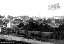
There is a substantial amount of Victorian development seen in this view of the town from the west, looking across Brooklands Park and the new cemetery on Queens Road with its chapel.
The manor of Barden lay to the south-west of Tonbridge. Barden Park House and its estate was in the possession of the Abrey family during the latter part of the 19th century.
Places (20)
Photos (42)
Memories (456)
Books (0)
Maps (36)

