Merry Christmas & Happy New Year!
Christmas Deliveries: If you placed an order on or before midday on Friday 19th December for Christmas delivery it was despatched before the Royal Mail or Parcel Force deadline and therefore should be received in time for Christmas. Orders placed after midday on Friday 19th December will be delivered in the New Year.
Please Note: Our offices and factory are now closed until Monday 5th January when we will be pleased to deal with any queries that have arisen during the holiday period.
During the holiday our Gift Cards may still be ordered for any last minute orders and will be sent automatically by email direct to your recipient - see here: Gift Cards
Places
36 places found.
Those places high-lighted have photos. All locations may have maps, books and memories.
- North Walsham, Norfolk
- North Berwick, Lothian
- North Chingford, Greater London
- Harrogate, Yorkshire
- Whitby, Yorkshire
- Filey, Yorkshire
- Knaresborough, Yorkshire
- Scarborough, Yorkshire
- Clevedon, Avon
- Weston-super-Mare, Avon
- Richmond, Yorkshire
- Selby, Yorkshire
- Ripon, Yorkshire
- Scunthorpe, Humberside
- Pickering, Yorkshire
- Settle, Yorkshire
- Skipton, Yorkshire
- Saltburn-By-The-Sea, Cleveland
- Norton-on-Derwent, Yorkshire
- Rhyl, Clwyd
- Chester, Cheshire
- Llandudno, Clwyd
- Grimsby, Humberside
- Durham, Durham
- Nailsea, Avon
- Southport, Merseyside
- Brigg, Humberside
- Colwyn Bay, Clwyd
- Redcar, Cleveland
- Bath, Avon
- Grange-Over-Sands, Cumbria
- Cleethorpes, Humberside
- Sedbergh, Cumbria
- Barrow-In-Furness, Cumbria
- Barmouth, Gwynedd
- Dolgellau, Gwynedd
Photos
2,953 photos found. Showing results 1,381 to 1,400.
Maps
9,439 maps found.
Books
39 books found. Showing results 1,657 to 1,680.
Memories
1,550 memories found. Showing results 691 to 700.
Gillingham Tech
I lived in Wigmore - the prefabs - and after passing the 11+ went to the Tech. I believe this was once Rochester Tech but had now started up in Gardener Street. We were the first year to attend in Gillingham and it was also the ...Read more
A memory of Gillingham in 1954 by
Houseboat Ml106 1926 36
Between 1926-36 my grandfather's family lived on an ex WW1 motor launch, known as the ML106, which was moored off Bursledon. My aunt recalls that they were the only ML moored mid river between the bridges, certainly in ...Read more
A memory of Old Milton by
Bramly Army Camp
I was one of three children of a soldier stationed at Bramley Army camp. I remember being taken to my first day at school in Bramley village school in 1930 and I refused to go through the school gate. Therefter I went on a school ...Read more
A memory of Rotherwick in 1930 by
A Child Of The Fens Remembers
I was child of Ramsey St Mary's in the period 1939 to 1960. My family lived in the last 'grey pebble-dashed' council house going north out of village (3/4 of a mile from Ponders Bridge). My father's name was ...Read more
A memory of Ramsey St Mary's in 1948 by
Chevington Drift
My father was born and brought up at Chevington Drift, James William Smith, born 1946. He met my mother who lived in Amble, Kathleen Roberta Mclaren born 1945, at a dance that was held in Amble. They married in 1967 at Amble. ...Read more
A memory of North Seaton in 1975 by
Steven Farelli
I have heard about the beautiful countryside around Greenock from an old friend - contact now lost. He moved from the Gorbals with his family when he was 12, in 1961ish. I think his father worked in the shipyards. Does anyone ...Read more
A memory of Greenock by
Working At Rhos Pool As A Lifeguard 1969 To 1972
Though the summers were often cold and the on-shore wind very cold, it was great fun working as a lifeguard in the late 60s and early 70s at the Rhos on Sea Swimming Pool. In the mornings after sweeping ...Read more
A memory of Rhos in 1969 by
Rugeley
I too grew up on the Peartree Estate and have memories of all that Christine remembers. I saw my very first pig at a small farm at the rear of Uplands Green, I think the farmers name was Mr. Duval. I too attended to St Joseph's school ...Read more
A memory of Rugeley in 1954 by
Biddulph,Early 1960s,Fondest Memories.
My father was transferred from a North East Mining Community,to a beautiful place called Biddulph.While he worked hard in the pits,we enjoyed many long days playing in some of the most wonderful places of ...Read more
A memory of Biddulph in 1962 by
Referring To My Frith 1887 Map Of Alconbury
On the 1887 map of Alconbury and its surroundings, there is a reference to the area between Alconbury and Alconbury Weston on Alconbury Brook as being 'Liable to Flooding'. This would have also applied to ...Read more
A memory of Alconbury in 1950 by
Captions
2,676 captions found. Showing results 1,657 to 1,680.
Tourism was given a boost in the 1840s when the North Staffordshire Railway opened its line through the Churnet Valley.
In this view we are looking north-west up London Road towards the Queens Head in the distance, beyond the junction with East Street.
We look north-westwards up The Street to the Coach and Horses Hotel (left centre), where the Victorian landlord was James Ingram. Charmouth House is further up the hill (centre).
It is now shorter than we see it here, as its extremities were swept away by the ferocity of the North Sea.
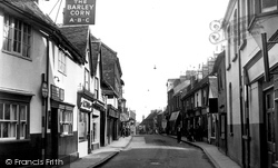
A view looking north along the High Street.
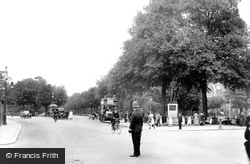
This is the main automotive route north from the city centre yet pedestrians appear happy to saunter UP the road rather than across it!
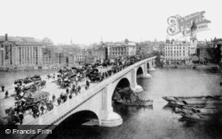
All to the left on the north bank, apart from the grand pedimented and columned Fishmongers Hall of 1831 near the bridge, has now gone.
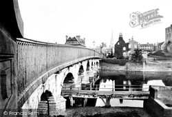
This seven-arched road bridge was built in 1775 to carry the Great North Road over the river. It replaced earlier crossings dating from 1190.
In this splendidly evocative view from the High Street/St Peter's Street/Dame Alice Street junction, the photographer looks north along the Broadway towards the leafy De Parys Avenue, past the policeman
In this photograph we head north-east out of Market Square along Cambridge Street, once known as Bakers Lane, a road that haas seen much change since the 1950s.
North Street 1899 This view was captured from just outside the old Half Moon Hotel, later to become the Urban District Council Offices.
The Greedon Estate is situated on the north west side of the Seagrave Road. This is a particularly uninspiring view, but again it is a view so typical of peripheral village estates.
Caister, just north of Great Yarmouth, has a strong tradition for both fishing and its lifeboat. In 1901, the lifeboat was launched into a storm, and nine out of the twelve crew lost their lives.
Eight miles further north along the coast is Sutton on Sea, another seaside resort somewhat overshadowed by Mablethorpe, the two linked by caravan sites.
In this view the photographer looks north from the lane that skirts Will's Neck.
Grinding up with slipping clutch and near-bursting radiators, it was, I recall, one of the trickiest parts of our summer holiday route in the 1950s to North Devon and Cornwall, with its
Here, at about that time, Frith's photographer looks north along the main Hindhead-Farnham road towards the Crossways: this is what the main crossroads in Churt is called, and so is the pub at the
At the far end is North Quay with the harbour tug company's office building.
'There is not any harbour like it in the world', the topographer Roger North exclaimed in 1582, as he described the new docks at Lyme.
Gawcott, a mile and a half south-west of Buckingham, lies at the head of a stream (flowing north into the River Ouse) whose course runs along the right-hand side of this road.
We are a little further north-west, and the clock tower disappears from view. The view is little changed since the 1950s, apart from more parked cars.
The Greedon Estate is situated on the north west side of the Seagrave Road. This is a particularly uninspiring view, but again it is a view so typical of peripheral village estates.
Trees have grown, and it is not possible to see this view now. The railway ran to Great Torrington when this view was taken; it later extended to Halwill Junction and the North Cornwall branch lines.
Kingsgate stands at the gap in the cliffs closest to the North Foreland. Its present name dates back to 1683 when Charles II landed here—it was formerly St Bartholomew's Gate.
Places (9301)
Photos (2953)
Memories (1550)
Books (39)
Maps (9439)


