Places
26 places found.
Those places high-lighted have photos. All locations may have maps, books and memories.
- Cemmaes Road, Powys
- Six Road Ends, County Down
- Road Weedon, Northamptonshire
- Severn Road Bridge, Gloucestershire
- Roade, Northamptonshire
- Berkeley Road, Gloucestershire
- Harling Road, Norfolk
- Road Green, Devon
- Builth Road, Powys
- Cross Roads, Yorkshire
- Steele Road, Borders
- Cross Roads, Devon
- Four Roads, Dyfed
- Road Green, Norfolk
- Biggar Road, Strathclyde
- Clarbeston Road, Dyfed
- Five Roads, Dyfed
- Eccles Road, Norfolk
- Grampound Road, Cornwall
- Morchard Road, Devon
- Wood Road, Greater Manchester
- Four Roads, Isle of Man
- St Columb Road, Cornwall
- Clipiau, Gwynedd (near Cemmaes Road)
- New Road Side, Yorkshire (near Silsden)
- New Road Side, Yorkshire (near Cleckheaton)
Photos
14,329 photos found. Showing results 3,461 to 3,480.
Maps
476 maps found.
Books
5 books found. Showing results 4,153 to 5.
Memories
11,058 memories found. Showing results 1,731 to 1,740.
Grandfather
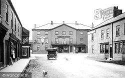
The man walking his dog across the road is my grandfather Arthur William Haggitt and his faithful companion Carlo, he was never without his dog. His sister Gladys Hicks ran The Butcher's Arms in Corn Street and I have fond memories of ...Read more
A memory of Witney by
Willowbrook, Rayleigh Road, Thundersley.
In the years leading up to World War 2, I recall visiting my Father's parents who lived in what I remember was a rather splendid house named Willowbrook, on the Rayleigh Road. I would have been about nine in ...Read more
A memory of Thundersley by
Tulse Hill Tesco Esso Petrol Station Formerly Cheriton Court Garage
Where the present Tulse Hill Tesco Shop and Esso Petrol station stands today, was the home of my grandfather Alfred John Thomas from the 1920's to the 1950's. Through the ...Read more
A memory of Tulse Hill by
1946 Stockwell Congregational Church Stockwell Green
On 8th September 1946 at Stockwell Congregational Church Stockwell Green, Kenneth Sydney Edwards a Commercial Clerk of Perranporth Cornwall married Widow Nellie Kathleen Drake of 26 ...Read more
A memory of Stockwell by
My Days In Drayton
How nice to read about Drayton. My parents moved here in 1953 and my father owned the chemists shop on the north side of Havant road opposite Lower Drayton lane. In the early 60s,I played in local groups (The ...Read more
A memory of Drayton by
My Days In Drayton
How nice to read about Drayton. My parents moved here in 1953 and my father owned the chemists shop on the north side of Havant road opposite Lower Drayton lane. In the early 60s,I played in local groups (The ...Read more
A memory of Drayton by
Kane Products Ltd, London Road
I have found an old cardboard box with a sticker of the above company on stating '2d Cocktail Drink with straw' there were 48 in a box (which is small) and I would love to know if anyone could enlighten me with what they were or anything about the company.
A memory of East Grinstead by
Xmas In Hanwell In The Sixties.
Xmas started Xmas eve. Everybody went to the pub at lunchtime and it was serious drinking. I worked in Turriff House on the Geat West Road and the pub was the Kings Arms by Brentford railway station. Around closing ...Read more
A memory of Hanwell by
Playtime In Waltham Road
We moved into no 76 in 1958. Mum still lives there. It was when there were allotments behind the houses that you could walk through (as long as you weren't caught), then cross a ditch before the Ashton.You could walk ...Read more
A memory of Woodford Bridge by
Painting & Decorating
This is a picture of 'The Lodge', the gate house for the Westcliffe estate. In 1966 it was home to Mr & Mrs Reg Black, he was a painter and decorator at the hall, I worked for him as a trainee. In the summer we did ...Read more
A memory of Hythe by
Your search returned a large number of results. Please try to refine your search further.
Captions
5,036 captions found. Showing results 4,153 to 4,176.
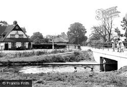
This view is north of the village, looking south across the 16th-century Duke of Northumberland's River with the southern perimeter road to Heathrow Airport immediately behind the photographer.
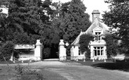
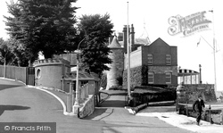
A fence now hides the short castellated turret of the lodge on the road leading away from the castle.
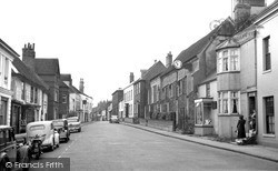
We can see the Crown Hotel towards the end of the road on the left.
Although the building has lost some of its forecourt to the road improvements, it still offers bed and breakfast accommodation and a busy popular restaurant called Temptations.
Standing between the Dartford Road and Seal Hollow, and with its Club Hall visible on the north side, it was built by the Constitutional Club company for social and political meetings, and
Further up Church Road, we are looking at the backs of 18th-century houses on Church End, the lane which leads to the medieval parish church of St Laud, out of shot to the left.
In any case, it was an ideal place to catch travellers to and from Birmingham, as well as anyone bold enough to travel the notorious Chester Road.
His mother had run the Rope and Anchor Inn in Skirbeck Quarter (rebuilt in 1803 as the Crown and Anchor) and now 10 London Road (see below).
The wider area now regarded as Teddington, stretching from the river through Bushy Park, Fulwell and Waldegrave Road, was countryside - a mix of heathland and forest.
Cottage (right) can be seen here in the northern end of the High Street (centre) which bends to the west beside Pound House (centre) to become Barr Lane as it carries the main road
This is a much-changed scene along the road leading to Maidenhead Station, for virtually nothing now survives of King Street's earlier buildings.
Isolated, as the road now crosses the water to its north, the bridge seems to take about itself an air of romance, probably associated with the image of luxury-laden animals in fact, their loads
When this view was taken, it was nearly 20 years after the opening of the pool in Bishop's Road.
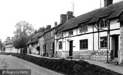
Oving Road runs east from the High Street; this view is taken beyond its junction with Market Hill looking west, showing the mix of building materials found in the village: timber-framing, brick, local
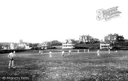
The photographer looks across the cricket field towards Steine Road (that name again) with the old town and the dominating church of St Leonard to the left.
The photographer looks across the cricket field towards Steine Road (that name again) with the old town and the dominating church of St Leonard to the left.
Boroughbridge probably saw its best days when it was a coaching town for traffic on the Great North Road, and had no less than twenty-two inns.
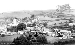
Looking north, the road runs close to the church whilst a back lane to Yarnacott - in the distance - climbs out of the valley.
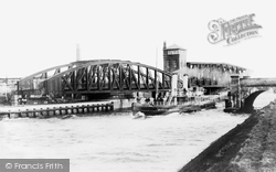
Both the 800-tonne Swing Aqueduct and the swing road bridge have been opened to allow the passage of a steamer on the MSC.
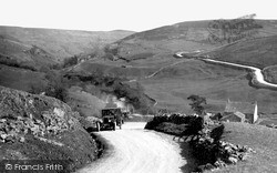
The circuitous narrow road which leads up from the Swaledale village of Keld is being negotiated by an early motorcar.
Dormouse Cottage (right) can be seen here in the northern end of the High Street (centre) which bends to the west beside Pound House (centre) to become Barr Lane as it carries the main road
In the years immediately prior to the Great War, a number of British car manufacturers got round the problem of the poor state of most of the country’s roads by offering ‘colonial’ versions of
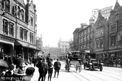
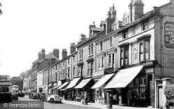
In 1949 the shops along Hagley Road were all taken. Booksellers and stationers T W Atkinson even operated a library from which books could be loaned at 2d a time.
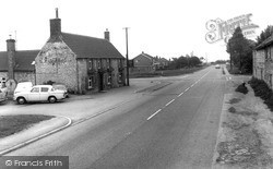
This stone-built pub on the main road between Grantham and Lincoln was probably built in the 18th century as a farmhouse.
Places (26)
Photos (14329)
Memories (11058)
Books (5)
Maps (476)


