Places
36 places found.
Those places high-lighted have photos. All locations may have maps, books and memories.
- Cardiff, South Glamorgan
- Barry, South Glamorgan
- Penarth, South Glamorgan
- Rhoose, South Glamorgan
- St Athan, South Glamorgan
- Cowbridge, South Glamorgan
- South Molton, Devon
- Llantwit Major, South Glamorgan
- Chipping Sodbury, Avon
- South Chingford, Greater London
- South Shields, Tyne and Wear
- Ayr, Strathclyde
- St Donat's, South Glamorgan
- Llanblethian, South Glamorgan
- Thornbury, Avon
- Llandough, South Glamorgan
- Fonmon, South Glamorgan
- St Nicholas, South Glamorgan
- Jarrow, Tyne and Wear
- Penmark, South Glamorgan
- Font-y-gary, South Glamorgan
- Maybole, Strathclyde
- Yate, Avon
- Oxford, Oxfordshire
- Torquay, Devon
- Newquay, Cornwall
- Salisbury, Wiltshire
- Bournemouth, Dorset
- St Ives, Cornwall
- Falmouth, Cornwall
- Guildford, Surrey
- Bath, Avon
- Looe, Cornwall
- Reigate, Surrey
- Minehead, Somerset
- Bude, Cornwall
Photos
5,607 photos found. Showing results 1,801 to 1,820.
Maps
2,499 maps found.
Books
23 books found. Showing results 2,161 to 23.
Memories
1,580 memories found. Showing results 901 to 910.
The Pumping Station On West Thurrock Marshes
My father Stan Wilson grew up in a cottage on the marshes at West Thurrock where his father was the resident engineer for the adjacent Pumping Station (Sewage?). The 1939 census shows the family ...Read more
A memory of West Thurrock by
The Pumping Station On West Thurrock Marshes
My father Stan Wilson grew up in a cottage on the marshes at West Thurrock where his father was the resident engineer for the adjacent Pumping Station (Sewage?). The 1939 census shows the family ...Read more
A memory of West Thurrock by
Family In Newington Or Walworth South London
My Great Grandmother had two brothers who lived in Newington or Walworth, South London. This would be the area between Camberwell and Kennington to the South and The Elephant and Castle and The Borough, Southwark to the North.
A memory of Newington by
Early Years
We moved to Watford in 1943. My war time memories are of night after night in the shelters, the "doodle bugs" and the boys playing Germans and soldiers on the bomb site next door. My special memories are of Cassiobury Park where we used to ...Read more
A memory of Watford by
Downside Estate
I remember Downside Estate, Morecombe Road (I think it was Road) very well as one of my best friends Pauline lived there and we used to go down to The Greyhound pub, High Street South, on Saturday nights. She used to have some fun parties too. I haven't thought about those in years.
A memory of Dunstable by
South Ockendon 1960s
I have very fond memories of my childhood in South Ockendon. My maiden name was Mary Cooper and we lived in a bungalow in West Road. The garden was big and had an orchard next to it. Jennifer and Rowland Costain were ...Read more
A memory of South Ockendon by
Growing Up In South Ockendon
So happy I have just found this site. The photographs brought back so many happy memories of my childhood. We lived in the prefabs in Larkspur Road, number 24. I was 2 years old in 1946 when we moved there, and we ...Read more
A memory of South Ockendon by
Wonderful Life To Follow
I was a Student at the South London Hospital for woman and Children in 1957 and for a few month working at woodhurst Lodge,at Pease Pottage. Just remenisen and using my Ipad came across the Photo .Stired up lots of memories .
A memory of Pease Pottage
Early Life
Otterington Hall is close to South Otterington, North Yorkshire and dates from the early 19th century. I was born in the gatehouse of the Hall, The Lodge, in 1947. The owners were the Furness family (involved in shipping), Sir ...Read more
A memory of Otterington Hall
Wood End
I lived in Wood End Lane (no. 9), from 1941 from the age of six months, until 1948 when I moved to the new council houses at Newnham Close, locally known as Tintown, because it had steel framed walls on the upper storey. No. 9 was a ...Read more
A memory of Northolt by
Captions
2,476 captions found. Showing results 2,161 to 2,184.
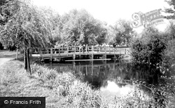
The Fraternity of the Holy Cross built the two bridges, the causeway across Nag's Head Island, and then the long causeway that runs south for over a thousand yards across the flood plain to Culham
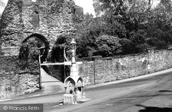
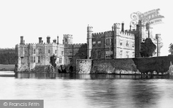
This, the south gate to the castle keep, is today the main entrance, but it is thought that in the castle's heyday the north gate was the main access.
Further east along The Embankment, Newnham Bridge crosses the north branch of the River Ouse at the south end of Tennyson Road. We are looking east from the north bank.
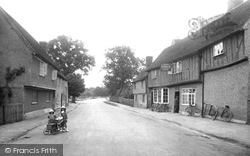
East of the church and the Moot Hall, a jettied timber-framed building of about 1500, standing in its green, is the main north-south village road, the High Street.
Here we look south down North Bridge Street towards that junction with High Street.
This view is taken looking south towards Oving from Bowling Alley's junction with the North Marston to Whitchurch Road.
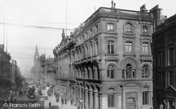
Dale Street was one of the ancient streets of the city and the main road to all points south.
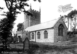
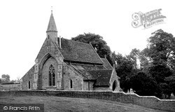
The nave became the north aisle during the rebuiding, while the granite-built south aisle (seen here) became the nave and chancel, so it is offset from the tower.
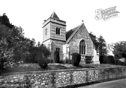
The south-east tower with its pyramid roof, the chancel and the Perpendicular-style east window were added in 1853. The building materials are a mix of local stone and flint.
It was opened to celebrate Queen Victoria's Golden Jubilee but when the new church was consecrated in South Parade the old building found use as the public library, until the new Sutton Coldfield
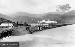
A train is heading south. The railway was built as part of the Cambrian railway, with two stations, Barmouth and Barmouth Junction.
Wartling is another parish like Herstmonceux, with its parish church and part of the village over a mile south of the main road and on the edge of the Pevensey Levels.
This very pretty village with its flint and brick houses and cottages runs south from the main road to its parish church of St Mary and St Peter, which is set high above the lane with the ruins of Wilmington
The town has a superb situation on the chalk ridge, with a castle south of the High Street; the ridge is cut through by the River Wey.
Romantically named for the sea breaking across its rocks, Dancing Ledge is a mile south of Langton Matravers village.
Looking South The Co-op store on the left was previously a double-fronted residential property (today the windows are gone, and the shop has been taken into a new Co-op store which replaced
The Main Line of the Stourbridge Canal swung south and then east around Brierley Hill to meet up with the Dudley Canal at Black Delph Locks.The Dudley Canal passed through Round Oak Steel Works and
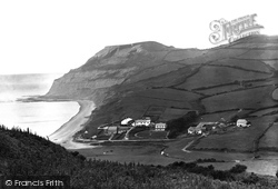
This is the classic view of Golden Cap (centre), literally gold when its sandy top catches the sun; at 618ft above sea level it is the highest cliff on the south coast.
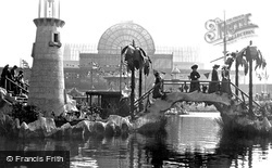
After the Great Exhibition of 1851, the Crystal Palace was moved to Sydenham in south-east London, where it was filled with lavish displays.
The south front was recast in 1822.
Situated six miles south-east of Mold, Caergwrle is a small castle comprising the ruins of three round towers and a polygonal turret; it was captured and destroyed in 1282.
The village, which in parochial terms was originally bracketed together with Kibworth Beauchamp and Kibworth Harcourt, which share the mother church of St Wilfred, lies some eight miles to the south
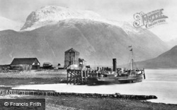
In the background, to the south-east, is Ben Nevis. The mountain once boasted a hostel and an observatory on its summit. The observatory lasted from 1883 to 1904, and the hostel closed in 1915.
A train is heading south. The railway was built as part of the Cambrian railway, with two stations, Barmouth and Barmouth Junction.
Places (15471)
Photos (5607)
Memories (1580)
Books (23)
Maps (2499)


