Places
4 places found.
Those places high-lighted have photos. All locations may have maps, books and memories.
Photos
87 photos found. Showing results 101 to 87.
Maps
21 maps found.
Books
Sorry, no books were found that related to your search.
Memories
1,091 memories found. Showing results 51 to 60.
Memories
My mother was born and brought up in west auckland in the 19 20 s she lived in a small miners cottage in a small street which I think was called New Street lived there with her parents 2 brothers and sister I remember going there when ...Read more
A memory of West Auckland
Growing Up In Seaton Sluice In The 1960s
I moved from Blyth to Seaton Sluice into a newly built house in Cresswell Avenue in 1957. Life as a child in the village was exciting; most days we would either play on the beach and harbour or the new ...Read more
A memory of Seaton Sluice by
Killie
My memories have a date range from 1958 to date. Although I was born in Irvine due to my mother needing urgent medical assistance I was brought up in a town that I grew to love and found easy to defend against anyone who barracked it. I ...Read more
A memory of Kilmarnock by
The Printing Works Premises.
The property on the left of the photograph marked 'Printing Office' is where I grew up and lived until my student days. My parents operated a bakers and confectionery business from the premises. In 1890, when a printing ...Read more
A memory of Ingleton by
Ferry Approach
My dad opened his first shop in Ferry Approach, a cafe, it was situated directly outside the woolwich foot tunnel with plenty of dock workers and factory workers passing by every day and a constant stream of traffic queuing for the ...Read more
A memory of Woolwich by
Family Of Ewj Moloney, Lancing Solicitor D 1978
I was part of the St James the Less Players, the Parish church drama group, which started my career on the boards. The Downs,The Manor, The Park, The Clump, The Chalkpit..The Woods The Beach..were ...Read more
A memory of Lancing by
Beanz Dreamz...
Our family moved to Friars Road in the summer of 66, from a damp house in Boothen Green, which looked over toward the Michelin Factory. I was 5 years old. My father Graham was a former art student at Burslem College of Art under the ...Read more
A memory of Abbey Hulton by
Church Path, Mitcham And The People That Lived There
I was born in Collierswood Maternity Home, a very short time before it was bombed during the Second World War. The year was 1944. My family being homeless were housed in requisitioned properties in ...Read more
A memory of Mitcham in 1944 by
Greenwich In The 1940s And 1950s
I was born, during the Battle of Britain, at 8, Roan Street. Our back yard bordered St Alfege's churchyard. The house is not there any more because it had to be pulled down after the war. We had several 'near-hits' ...Read more
A memory of Greenwich by
Camberley...Where Do I Start ?!
Our family lived at Lightwater (1 High View Road) ; I passed 11 plus and was sent to Frimley And Camberley County Grammar School, starting in Sept. 1959. One of the first things we had to do was to get the uniform. We ...Read more
A memory of Camberley by
Captions
533 captions found. Showing results 121 to 144.
The new building on the corner of the High Street, with its three large shops and two floors of flats above, can be seen in greater detail in this photograph.
Bisley stands high on a hillside to the north of the River Frome; it has a wonderful assortment of winding streets and rooftops at different levels, as though the village has grown out of the landscape
The grid-like pattern of the streets west of Laindon High Road preserves the layout of some of the early plotland estates.
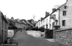
These views (below and pages 40-41) up and down Church Street would have been familiar to Dylan Thomas, who lived near New Quay in 1944, and to many visitors, who have to park their cars at the top of
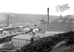
This view looks north from above the Memorial Park, with the huge Facit New Mill on the right. Built of Accrington brick, it replaced a mill demolished in 1904.
Comparing this with D83003, we see that the Plume of Feathers now has bow windows and has been repainted.
This is the main shopping street between the Market Place and New Bridge. On the right is the Black Bull Hotel, noted for its two-storey bow window which projects into the street.
The New Inn, sporting its new Watney's Red Barrel sign by the door and the sign board with the house style lettering, stands up the hill in Road Weedon on the old London to Holyhead turnpike.
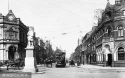
The statue of Hull's leading writer, Andrew Marvell, has been moved; George Street became the new centre of entertainment. Bars, bistros and night clubs flourish here.
Originally, the fire station was at the southern end of Mill Street, next to the Salvation Army Hall. By 1955 a new station had been built on the corner of Brooke Road and South Street.
Once known as Fyfield Street, or just The Street, this end of the village now takes its name from The Queen's Head pub.
Like many other shopping streets in Salisbury, Fisherton Street has changed very little over the last fifty years, in spite of most of the shops themselves moving or closing down and being replaced
A fascinating photograph showing Leigh Road at its junction with Market Street.This corner of Eastleigh has changed significantly: the new buildings interposed with the older ones on the left-hand
New Canal commemorates one of the many open waterways which ran through the medieval streets until the 19th century. The largest of the waterways was known as Town Ditch and was filled in 1875.
New Canal commemorates one of the many open waterways which ran through the medieval streets until the 19th century. The largest of the waterways was known as Town Ditch and was filled in 1875.
Continuing uphill past the end of The Paragon and at the junction with Guinea Lane, Roman Road heads for the junction with a steeply climbing Walcot Street and London Road.
The new W H Smith building, near left, had replaced the bank since 1926.
The grid-like pattern of the streets west of Laindon High Road preserves the layout of some of the early plotland estates.
This view down Silver Street, widened here at the junction with Gold Street in the 1930s, looks towards Dalkieth Place.
This town can be confusing for the visitor, as not only has it two rivers, but also two High Streets.
Where Victoria Street meets the High Street, we have a busy scene. The post office (second right) is well patronised.
The curved front of the Market Hall, visible behind Boots, was demolished in 1956 and replaced by a new building for Boots.
This view down Silver Street, widened here at the junction with Gold Street in the 1930s, looks towards Dalkieth Place.
This view looks towards the New Brig and Main Street.
Places (4)
Photos (87)
Memories (1091)
Books (0)
Maps (21)

