Places
26 places found.
Those places high-lighted have photos. All locations may have maps, books and memories.
- Cemmaes Road, Powys
- Six Road Ends, County Down
- Road Weedon, Northamptonshire
- Severn Road Bridge, Gloucestershire
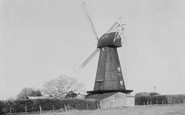
- Roade, Northamptonshire
- Berkeley Road, Gloucestershire
- Harling Road, Norfolk
- Road Green, Devon
- Builth Road, Powys
- Cross Roads, Yorkshire
- Steele Road, Borders
- Cross Roads, Devon
- Four Roads, Dyfed
- Road Green, Norfolk
- Biggar Road, Strathclyde
- Clarbeston Road, Dyfed
- Five Roads, Dyfed
- Eccles Road, Norfolk
- Grampound Road, Cornwall
- Morchard Road, Devon
- Wood Road, Greater Manchester
- Four Roads, Isle of Man
- St Columb Road, Cornwall
- Clipiau, Gwynedd (near Cemmaes Road)
- New Road Side, Yorkshire (near Silsden)
- New Road Side, Yorkshire (near Cleckheaton)
Photos
14,329 photos found. Showing results 121 to 140.


Maps
476 maps found.


Books
5 books found. Showing results 145 to 5.
Memories
11,058 memories found. Showing results 61 to 70.
Growing Up In Queensbury
I was born in Wellington Street on the 16th. of June 1955. My mother was Kate Holland, formerly Henderson. and my father was George E Holland. Sadly he passed away in 1939. So I dont remember very much about him. I had a ...Read more
A memory of Queensbury by
Ethelbert Road
I lived in 1a Ethelbert Road from 1968 to 1979. so many happy memories, the plowing match over the 'Butts' , the deep snow every year , and my old mate Duncan Yandle who lived next door.
A memory of Hawley by
The Fairway
I was born at 28 The Fairway in 1946. There was (is) a wide grassed area down the centre of the road making it a kind of dual carriageway. In the years following the 2nd World War there were, "Pig bins", on several sections of the grass ...Read more
A memory of Northolt by
Grosvenor Road And Urmston, Always A Place In My Heart.
I lived on Grosvenor Road, Urmston - the allotment end - from 1965 to late 1969 age 3 to nearly 8 years of age with my 2 brothers and parents (we then moved to Blackburn). My daughter has recently ...Read more
A memory of Urmston by
Happy Days
My name is Brian Newman and I was born in Barking in 1942. My old man was a grocer and his shop was Newman Stores in Ripple Road by the Harrow, or as we called it, the "arrer". There was a long row of shops either side of Ripple Road. I ...Read more
A memory of Barking by
Happy Days
I went to Wescott Road school in 1950 then St Crispins 1956. I can recall quite a few shops. Herrings furniture where you could buy on HP with no checks, as Mr Herring assessed whether or not you looked trustworthy. NSS newsagents. Next ...Read more
A memory of Wokingham by
Stanmore 1950 52
Hallo , my name is Cliff Bowley. My family moved to Stanmore in 1950 to a very large house called "Belmont Lodge " on the corner of Denis Lane and London Road junction. Does anybody remember it? It was knocked down for development, ...Read more
A memory of Stanmore by
Through The Kitchen Window
I was born in my Grandparents house - "Wimbourne" - in the valley below the Mill. Many pleasant hours have I spent sitting in the kitchen with my grandmother shelling peas that granddad had grown in the garden. The Mill ...Read more
A memory of Barham in 1959 by
Thornton Heath Mid 60s 1972
My family lived in Osborne Road so my brothers and I went to Beulah Infant and Junior Schools. I think Mrs Colby was head of Infznts and Mrs Grumberg head of Juniors. Mrs Bird was my favourite teacher. I loved having ...Read more
A memory of Thornton Heath by
Mitcham
I lived in Manor Road in the late fifties and then Lymington Close until the end of the sixties, it was a great place to live then. We played on Mitcham common going to the seven island ponds on our bicycles and the old gun site. Mr ...Read more
A memory of Norbury
Your search returned a large number of results. Please try to refine your search further.
Captions
5,036 captions found. Showing results 145 to 168.

Post Office Road was originally called New Road.

A photograph of the well-known landmark of Killarney, the road tunnel on the Killarney to Kenmare road. The tunnel is beneath Cromaglan mountain, near the shore of the Upper Lake.

This panorama takes in the Old Winton Road, which crosses on the right. A lone block of four houses were the only dwellings on that straight length of road in 1899.

The back of the Crown Inn can just be seen in the centre, where Station Road becomes Hinckley Road, curving south past the parish church, and on to Nailstone and Market Bosworth.

A train on the Smitham railway bridge adds interest to this photograph of the northern end of Brighton Road shopping area.
Leaving the town centre we move along Church Street to the Missenden Road, just past the junction with Pednor Road and Wey Lane.

This road formed the old parish boundary between Sutton and Cheam. At its southern extremity and the junction with Cheam Road was the site of East Cheam Manor and a dozen or so houses.

The church tower can be seen in the centre of the view, which looks west along what is now called All Saints Road (in 1903 it was Benhill Road).

The 1909 police station in Carshalton Road is in the distance. Behind it is the side elevation of the Congregational Church of 1888.

The grand pub and the simple working men's houses and shops in St Marks Road and First Avenue are all of a similar date.

A small village at the western edge of St Leonards Forest, on the main road and railway line between Horsham and Crawley. Local legends say that dragons and serpents inhabited the forest.

We begin with Mulgrave Road, which started as shops and flats, but soon became entirely residential. The road runs south and parallel to the railway as far west as Belmont Rise.

Grindleton is a classic case of village development: here ancient roads cross, and ribbon building took place along those roads.

On the right-hand corner with Dalton Road is Saxone Shoes, now Thomas Cook.

A classic view of a 'boreen' or small road. The luxuriant vegetation reveals the almost Mediterranean climate of the west coast, whilst the roads hereabouts are dotted with isolated smallholdings.

A busy shopping day, at a time before Moulsham Street was effectively bisected by Chelmsford's inner relief road.

Pelham Road runs all the way through the town; it is now built up on both sides of the road. The vehicles are up-to-date - a new Austin A30 van is delivering to the shop on the left.

If we leave Daventry eastwards on the London turnpike, we arrive at Road Weedon, the portion of Weedon village on the main road.

These baths are around the corner from where Throwley Road once turned to the north (it is now Throwley Way and acts as an inner relief road or High Street by-pass).

This is Main Road, and it is full of local limestone-built houses. Originally it was the Great North Road, and had numerous inns.

New Road is one of the main shopping streets of the town. The roads seem empty by today's standards. In the foreground is British Home Stores, and Hepworths is on the extreme left.

The bungalows along Church Road are fairly representative of the kind of housing to be seen in Laindon before the New Town came. Several of them are still there.

The main road from London originally climbed Angel Hill's ridge, but in the early 19th century a cutting was made.

This view looks along Station Road at its junction with Westminster Road (on the left) and Meadow Lane. The Westminster Bank building (left) still stands, but it is now occupied by a bookmaker's.
Places (26)
Photos (14329)
Memories (11058)
Books (5)
Maps (476)

