

Merry Christmas & Happy New Year!
Christmas Deliveries: If you placed an order on or before midday on Friday 19th December for Christmas delivery it was despatched before the Royal Mail or Parcel Force deadline and therefore should be received in time for Christmas. Orders placed after midday on Friday 19th December will be delivered in the New Year.
Please Note: Our offices and factory are now closed until Monday 5th January when we will be pleased to deal with any queries that have arisen during the holiday period.
During the holiday our Gift Cards may still be ordered for any last minute orders and will be sent automatically by email direct to your recipient - see here: Gift Cards
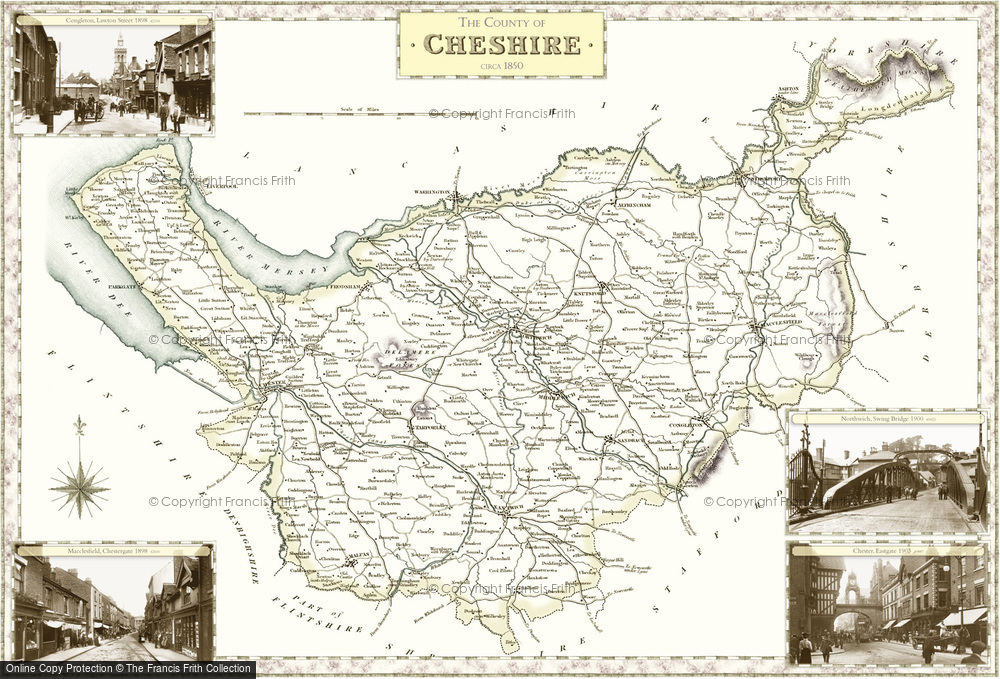
Historic County Map of Cheshire

These superbly detailed maps provide an authoritive and fascinating insight into the history and gradual development of our cities, towns and villages. The maps are decorated in the margins by selected Frith photographs. Available to buy in a range of sizes and styles, including large prints on canvas and tea towels.
Buy a Print
Unframed, Mounted, Framed and Canvas prints in a range of sizes and styles.

View Sizes & Prices
Add to Album
You must be signed in to save to an album
Sign inCreate a Gift With This Map
This County Map features these photos:
 Chester, Eastgate 1903
 Northwich, Swing Bridge 1900
 Macclesfield, Chestergate 1898
 Congleton, Lawton Street 1898
About This Map
- Year drawn: 1840
- Series: Samuel Lewis County Maps
- Map reference: f05
- Features four Frith photos from the area covered in the margins. More details shown below.
- Learn about Samuel Lewis County Maps maps
Samual Lewis Victorian County maps
Published 1840
Stunning, full-colour reproductions of hand-tinted original county maps which were drawn by R. Creighton and engraved by T. Starling and J. & C. Walker. They were created in the 19th century, during the great coaching era for Samuel Lewis' renowned guidebook.
