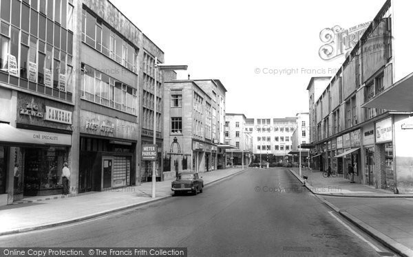
Bristol's Lost Streets
A Memory of Bristol.
A list of just some streets which have disappeared or changed their names since 1900.
Barr's Street (Lane until 1848) - Milk Street to St James's Barton - demolished and built over post-war for Broadmead Shopping Centre.
Barton Alley - widened in 1860s and became Bond Street.
Carey's Lane - Old Market Street to Ropewalk - demolished for underpass and roundabout.
Castle Mill Street - Merchant Street to Narrow Weir - blitzed, now Newgate.
Clark Street - now Midland Road.
College Street - Anchor Lane (now Road) to College Green - Deanery Road built and houses later demolished 1950s.
Counterslip - although the name remains,it was transferred from the original Countess Quay to a new road off Victoria Street in the 1960s.
Cross Street - off College Street - removed for building of Council House on College Green.
Dolphin Street - Union Street to Bridge Street - destroyed by blitz, now part of Castle Park.
Duck Lane - off Nelson Street - now part of Fairfax Street.
Ellbroad Street - Narrow Weir to Redcross Street - removed post-war for Broadmead Shopping Centre.
Frogmore Street - Park Street to Trenchard Street - most buildings demolished for new road pattern.
Griffin Lane - now Lower Park Row.
Lampblack Hill - although a continuation of Redland Road, it became known as Arley Hill after Arley Chapel.
Limekiln Lane - became part of St Georges' Road.
Mary le Port Street - High Street to Dolphin Street - blitzed and now part of Castle Park.
Milk Street - Horsefair to Newfoundland Street - now covered by Bond Street extension/M32 approach road.
Montague Street - St James's Barton to Dighton Street demolished for Bus Station.
Old King Street - buildings removed post-war and now part of Merchant Street.
Peter Street - Dolphin Street to Castle Street - blitzed, now part of Castle Park.
Philadelphia Street - Broad Weir to Milk Street - demolished and built over post-war for Broadmead Shopping Centre.
Pile Street - demolished and became part of Redcliffe Way.
Redcliffe Hill - houses demolished for road widening 1960s.
Ropewalk - later known as Wellington Road.
Rosemary Street - became the eastern part of Broadmead.
Sims Alley - Broadmead to Horsefair - destroyed due to post-war Broadmead Shopping Centre.
St James's Back - Broadmead to Horsefair - now Silver Street.
St James's Square - St James's Barton to Milk Street - part blitzed, part wantonly destroyed in 1968.
St Philip's Plain - now Broad Plain and Narrow Plain.
Steep Street - Host Street to Griffin Lane (see above) -road line altered and became Colston Street.
The Quay - now Colston Avenue.
Thunderbolt Street - off Prince Street - built over by the CWS building, later replaced by Broad Quay House.
Can anyone name any more?
Add your comment
You must be signed-in to your Frith account to post a comment.
Add to Album
You must be signed in to save to an album
Sign inSparked a Memory for you?
If this has sparked a memory, why not share it here?


Comments & Feedback
Be the first to comment on this Memory! Starting a conversation is a great way to share, and get involved! Why not give some feedback on this Memory, add your own recollections, or ask questions below.