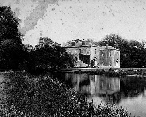
Glasgow, The Necropolis 1890
Photo ref:
G11001X


More about this scene
By the beginning of the 17th century the centre of Glasgow had shifted south, to the foot of the High Street where it joined the Saltmarket. Glasgow was never a walled town, but it had four gates at the points of the compass to control traffic. These gates were known as ports and were called the Stable Green Port (north), the Gallowgate Port (east), Brig Port (south) and Trongate Port (west). Rather confusingly, the streets were called gates (often spelled gait or yet). East and west of the Cross were the Trongate and the Gallowgate, still the principal thoroughfares leading to Argyle Street and the Edinburgh Road respectively. The Briggait or Bridgegate linked the north end of the bridge to the Saltmarket (originally called the Waulcergait (street of the wool- scourers), while the Drygate ran east from the cathedral and terminated on the west bank of the Molendinar.
Add to Album
You must be signed in to save to an album
Sign inShare This Photo
Buy a Print
Unframed, Mounted, Framed and Canvas prints in a range of sizes and styles.
View Sizes & Prices
Create a Gift


A Selection of Memories from Glasgow
For many years now, we've been inviting visitors to our website to add their own memories to share their experiences of life as it was, prompted by the photographs in our archive. Here are some from Glasgow
Sparked a Memory for you?
If this has sparked a memory, why not share it here?


 Before
 After
After