

Photos
Sorry, no photos were found that related to your search.
Maps
10 maps found.


Books
1 books found. Showing results 1 to 1.
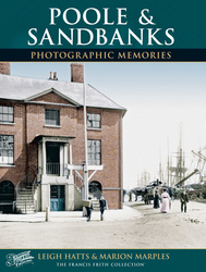
Memories
40 memories found. Showing results 1 to 10.
Family Holidays
My dad always ensured that we had a "fortnight's" family holiday each year. A fortnight was 2 weeks - ie fourteen nights. These holidays started in 1949, when I was seven and continued to up to 1958 when I was 16. In 1949 and ...Read more
A memory of Bournemouth in 1949 by
Born In Fenny Stratford
I was born at number 8 Woodbine Terrace; in attendance was nurse Brinklow the local midwife and Dr Gleeve. My parents were Jim and Vera Cusack. Just after the begining of the war my mother, ...Read more
A memory of Fenny Stratford in 1948 by
Doseley
When my dad Derick John Jones was born in 1944 he lived in a row of houses called Dill Doll Row or Dill Da Row as some people called them, they were situated at Sandy Bank, Doseley, just behind the Cheshire Cheese pub at Doseley. My dad lived ...Read more
A memory of Doseley in 1944 by
Remembering Byfleet
I was born in Byfleet in 1950. We lived in Binfield Road. Later I moved to the hotel that was built where the village green is now. My mother Beatrice Stenning was the housekeeper, cook, maid and everything in between. My dad ...Read more
A memory of Byfleet by
The 50s At School
I remember starting school at the 'old' school and then after 3 years moving to the new school - it seemed huge and daunting and many of us got lost in the first few weeks. Pyrford was great to grow up in then - we had fields to roam ...Read more
A memory of Pyrford in 1959 by
Living On Cornfield Road
I had lots of friends to play with up on the green and also the woods where we used to ride our push bikes or swing on the big rope swing over the sandy bank. I even fell off and broke my arm. I also broke my jaw falling out ...Read more
A memory of Reigate in 1975
Jurys Gap East Sussex
I lived at Camber Sands from 1950-1958 and then Rye. Jury's Gap is a little past Camber and the name comes from 'Jews' Gate' - probably because the area seems to have been used by Jewish merchants of Rye and Winchelsea, ...Read more
A memory of Jury's Gap in 1950 by
Growing Up In Buildwas
I was known as Katie Baker, I lived at No.4 Park View. Looking back life was simple, enjoying the changes of the seasons knowing you would be snowed in in winter, and flooded out in the spring. Watching the boar come up the ...Read more
A memory of Buildwas by
My First Memories Of Saltfleet
My first visit to Saltfleet was as a 12 year old in 1956. A relative , Kitty Scherdel was managing the Sunnydale site for local farmer George Tuxworth and had recently moved a converted bus there from South Yorkshire and ...Read more
A memory of Saltfleet by
The Gables Westbourne
Reading my Mother's notes in my 'Baby Book ' ,something seemingly not done nowadays, I was reminded that I was born in a Private nursing home, The Gables, Pine Tree Glen ,Westbourne in 1947. Now flats and ironically retirement ...Read more
A memory of Bournemouth by
Captions
27 captions found. Showing results 1 to 24.

It was here, on rough sandy banks, that the St Ives pilchard fishing boats of the 19th century were drawn up clear of the beach. St Ives Station can be seen directly behind the boy in the foreground.

The warning sign on the left is significant, because there are treacherous sandbanks here, and bathing is only really safe at times of high water.

The view is of Sandbanks Ferry from Shell Bay looking towards Poole's sandy peninsula. The chain ferry began in 1926, saving 15 miles on the journey to Swanage.

The shallow draught of the trow was essential along a river like this with its sand banks and low summer water levels.

A great sweep of sand, appropriately called Sandbanks, guards the Bournemouth side of Poole Harbour, reaching towards the opposite peninsula of wild Studland Heath.

Sandbanks is the long spit of land dividing Poole Harbour from the sea at the southwestern end of Bournemouth.

This is the village of Sandbank on the western side of Holy Loch. On the far side are the houses of Kilmun and the heights of Stronchullin Hill, Beinn Ruadh and Creachan Mor.

Sheltered from the worst of the gales by Hengistbury Head, Christchurch's harbour empties into the sea between Mudeford's quays and sandbanks.

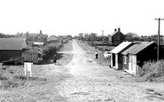
Some of the buildings on the tip of Sandbanks are coastguard cottages.

This beach in tidal Poole Harbour was handy for campers here in the northern part of Poole, who were some distance from the extensive beaches at Sandbanks and Canford Cliffs.

A cliff railway toils up and down the cliffside to help the bather gain access to the many miles of beach between Sandbanks and Hengistbury Head.

The seal banks in the Wash were a favourite destination, where hundreds of seals could be seen basking on the exposed sandbanks at low tide.

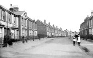
Shore Road (left) and Banks Road (centre) lead from Poole and Lilliput to Sandbanks (far right).
Sandbanks gives an impression of how wild and lonely the nearby site of Bournemouth must have been before Lewis Tregonwell built his house there in 1810.

The village stands on the east side of the Towy where the river breaks out to sea through a widespread expanse of sandbanks at low tide.

Lowestoft is the most easterly point of Britain, with many dangerous sandbanks offshore. Trinity House built two lighthouses, one on the clifftop, one on the shingle below.

The village of Sandbank is on the left, Kilmun is off camera to the right.

The lifeboat house was deemed necessary by the local authorities in view of the dangerous channels and sandbanks already noted.

Where the tidal waters do reach, however, the sandbanks can be quite treacherous. Nearby are the famous Ness Botanic Gardens, maintained by the University of Liverpool

Sheltered from the worst of the Channel gales by Hengistbury Head, Christchurch Harbour empties into the sea between the quays and Mudeford sandbank.

This row of diminutive, white cottages provided accommodation for the Coastguards maintaining a watch along this busy stretch of the Kent coastline with its treacherous offshore sandbanks.
This row of diminutive, white cottages provided accommodation for the Coastguards maintaining a watch along this busy stretch of the Kent coastline with its treacherous offshore sandbanks.

Here, great ships inch their way up to the docks through the sandbanks by Lytham St Anne's. Preston was a major cotton town, and the Lancaster Canal runs from Ashton Basin.

Set on the south coast of the Lleyn peninsula, at the mouth of the Penrhos river, it was once a thriving commercial port; but the sea threw a sandbank across the mouth of the Afon Erch, causing the maritime

