

Places
26 places found.
Those places high-lighted have photos. All locations may have maps, books and memories.
- Cemmaes Road, Powys
- Six Road Ends, County Down
- Road Weedon, Northamptonshire
- Severn Road Bridge, Gloucestershire
- Roade, Northamptonshire
- Berkeley Road, Gloucestershire
- Harling Road, Norfolk
- Road Green, Devon
- Builth Road, Powys
- Cross Roads, Yorkshire
- Steele Road, Borders
- Cross Roads, Devon
- Four Roads, Dyfed
- Road Green, Norfolk
- Biggar Road, Strathclyde
- Clarbeston Road, Dyfed
- Five Roads, Dyfed
- Eccles Road, Norfolk
- Grampound Road, Cornwall
- Morchard Road, Devon
- Wood Road, Greater Manchester
- Four Roads, Isle of Man
- St Columb Road, Cornwall
- Clipiau, Gwynedd (near Cemmaes Road)
- New Road Side, Yorkshire (near Silsden)
- New Road Side, Yorkshire (near Cleckheaton)
Photos
764 photos found. Showing results 1 to 20.


Maps
Sorry, no maps were found that related to your search.
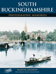
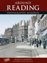
Books
4 books found. Showing results 1 to 4.


Memories
Sorry, no memories were found that related to your search.
Captions
39 captions found. Showing results 1 to 24.

This picture was probably taken just down the road from Penventon Farm.

In the medieval manorial rolls there are references to ancient roads and lanes that carry the same names today.

Extra road traffic has also made the road outside the busy village stores and post office (just to the left of the car) a frequent bottleneck.

Off a northward loop from the main road is the Three Cranes, again in the estate style with some leaded windows and some timber framing.

The elegant Georgian house on the right of the road has been converted to offices.To the right of it is the entrance to Botley Mills, an 18th-century mill complex, which is mentioned in the Domesday

This view of the main road (known here simply as 'The Ringway') shows St George's Park just to the left of the dual carriageway.

Across the road - and stretching down to the bridge - were two inns fused together, the Lion and the Hart; and on the far corner of Springfield Road - where Next now is - was the Crown.

The main axis of the principal roads consists of the Roman east-west artery, now the High Street, and one of the Roman north-south roads, now North Hill and Head Street.

Looking across Bowling Green to the south side of Oxford Road, these houses are mainly early and later 19th century.

The narrow road on the right leads to the hamlet of Owlpen, and is called Fiery Lane.

Across the road the half-round windows, on the ground floor of the single-storey building on the right, show the site of the original Roman Bath, in constant use from that time.

In 1901, Hermitage Road was a pleasant, open avenue. The building on the left in view 46642, left, is the Hermitage, home of Frederick Seebohm; very little of it still remains.

Early in the afternoon of Easter Monday, the road was thronged with groups making their way to the Punchbowl Fair’.

This view is taken from beside the 17th-century pre-fire stone survivor, Hazelrigg House, looking east along the tram tracks, with the road widening towards Horse Market.

The brand-new tower of the Town Hall can be seen above the far shops in North End, which today is a pedestrianised road.

The unsurfaced roads and thickly wooded banks climb down the steep slopes at the end of the Vale of Pewsey.

This 204ft (63m) high obelisk on the south side of the main road was designed by Robert Smirke and believed to be the highest in the world at the time.

From the bottom of Valley Road the camera captures a crowded South Beach scene, and a bay full of sail-driven fishing boats.

Station Road looks a tidy place: the hedges are well trimmed and the roadway is clean. Each of the houses shows a differing style, with dormers, gables and bow windows.

It is hole in the road time again as the lads from Stourbridge gas works prepare to do their stuff.

The residences seen (right) through the shrubbery are their enclave – the grand villas of Bridgman Road and neighbouring Marine Parade.

They are set slightly below road level, and are reached by steps down. The thatch remains in excellent condition, and so do the porches. The picket fence has been extended to replace the hedging.

Approaching the village from the west along the Botley Road, we see on the right All Saints' Church, built in 1836 in Early English style. The village war memorial is on the left of the picture.

A century on, the view of Church Hill in Marlborough Street is still easily recognisable, despite the two great complexes built on each side of the road, the Lloyds TSB Training Centre on the left and
Places (26)
Photos (764)
Memories (0)
Books (4)
Maps (0)

