Places
26 places found.
Those places high-lighted have photos. All locations may have maps, books and memories.
- Cemmaes Road, Powys
- Six Road Ends, County Down
- Road Weedon, Northamptonshire
- Severn Road Bridge, Gloucestershire
- Roade, Northamptonshire
- Berkeley Road, Gloucestershire
- Harling Road, Norfolk
- Road Green, Devon
- Builth Road, Powys
- Cross Roads, Yorkshire
- Steele Road, Borders
- Cross Roads, Devon
- Four Roads, Dyfed
- Road Green, Norfolk
- Biggar Road, Strathclyde
- Clarbeston Road, Dyfed
- Five Roads, Dyfed
- Eccles Road, Norfolk
- Grampound Road, Cornwall
- Morchard Road, Devon
- Wood Road, Greater Manchester
- Four Roads, Isle of Man
- St Columb Road, Cornwall
- Clipiau, Gwynedd (near Cemmaes Road)
- New Road Side, Yorkshire (near Silsden)
- New Road Side, Yorkshire (near Cleckheaton)
Photos
14,329 photos found. Showing results 321 to 340.
Maps
476 maps found.
Books
5 books found. Showing results 385 to 5.
Memories
11,058 memories found. Showing results 161 to 170.
School Days
As far back that I can remember, it was the summer of 1934 when I first started school at St Mary's Roman Catholic School in Calcutta Road. I sat next to a friend that I had made (John Toole) Who later in life emigrated to Canada and was ...Read more
A memory of Tilbury in 1930 by
Life In Full Circle
The little house next to Mary Newman`s Cottage is where I live now...but I first walked past it with my mother at about the time this photo was taken. We got off the steam train at the station just up the hill, to walk to the ...Read more
A memory of Saltash in 1955 by
Barrel Organ
The island in the middle of Market Place had a unique feature. Between the two zebra crossings on the island each Saturday was a man with a barrel organ. The music could be heard all over the town centre. You had to walk past it when you ...Read more
A memory of Dewsbury in 1969 by
Trolley Buses
I remember there used to be trolley buses through the high street, this would have been in the 1940s or 50s, and there was a lending library on the high street that you paid to take a book out. Also a grocers called Williams Brothers , ...Read more
A memory of High Barnet by
Back In 1963
I was moved to Wickford with my family in December 1963, a hard winter, removal van had trouble getting up the unmade road. Coming from London, it was a bit of a sleepy village for me and especially for my teenage siblings. Had to wait ...Read more
A memory of Wickford in 1963 by
Woodlea Drive
I used to come down and up this road from the bus stop every day to and from school. One of the boys who grew up in this street (a house on the right as I remember) started playing for a very influential rock band called the herd. It ...Read more
A memory of Bromley in 1967 by
The Old School
I remember the old school on Wigan Road, it was called Ormskirk Cross Hall High School. It has now been demolished and replaced with a newer building.
A memory of Ormskirk in 1979 by
Tottenham Royal
Barry Watkinson I remember the Royal. I was born in Tewkesbury Rd. When I was 10/11 we moved to Tottenham Hale. We visited the Royal regularly - there was a young teens on a Saturday afternoon. We had some old friends from Tewko ...Read more
A memory of Tottenham
Memories Of Baby Burial At Dilston Maternity Hospital
by Mr Alex Hillary (April 6th 2007) - as reported to Susan Hedworth, Community Care Assistant No, we don’t get the snow like we used to! Like it was in 1941, I mean. I was a taxi driver at ...Read more
A memory of Corbridge by
Croglin 1958
When my husband and I married in March 1958, he bought the cottage nearest the camera on the left; no electricity, no bathroom......it cost the princely sum of £300! The building at the end of the street is the pub, and behind the trees ...Read more
A memory of Croglin by
Your search returned a large number of results. Please try to refine your search further.
Captions
5,036 captions found. Showing results 385 to 408.
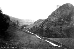
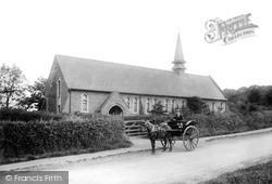
A horse and cart wends its way up a gated minor road through the Coniston Fells.
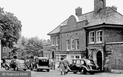
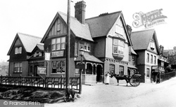
Situated on the main Oxford Road, it became a coaching inn, and today it is a hotel. It still has its original oak beams and large stone fireplaces.
Bath Road is an extension of the village, which grew with the wool trade in the 17th and 18th centuries. Until a by-pass came in 1990, it carried both the A36 and A361.
This extensive building on the corner of Godstone Road and Station Road was demolished in 1966 and the site is now a car park for local shoppers and commuters.
The open countryside and woodland beyond the church is now where Carter Drive leads into road after road of neat suburban houses.
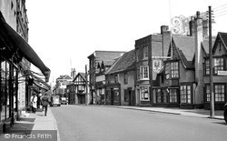
A wide variety of building styles can be seen in the row on the right of the road. Apart from a change in function of many of the shops, this road has altered little over the years.
Tufa Cottage, on the Via Gellia road from Cromford to Bonsall, was constructed entirely from blocks of tufa, the stone deposited by lime-rich water in this limestone country.
Gun Hill takes its name from the Gun Inn, further up London Road at Bowers Gifford. The pub seen here—the Bull—is displaying a 'Sundays: No Coaches' sign.
Before the link road between the M5 and Barnstaple was built, Landkey was on the main road out of North Devon. Its long, straggly nature is clear from this photograph.
Although it had decamped to Broomfield Road by the time this picture was taken, the Grammar School had formerly stood here - the entrance to the old buildings being just to the left of
The road sign indicates the directions to Shrewsbury and Oswestry. Since this photograph was taken, the route of the road at this point has been altered, so that it now goes through the trees.
This is London Road, showing the Duke of York Hotel, now minus its covered porch, at the junction with the Frimley Road.
Looking towards the town centre from Manchester Road. The magnificent Town Hall comes into view beyond Broadfield Park slopes, created from 1870 onwards.
The old library was on the other side of the road and had once been the Charity School.
This view of Portskewett is still recognisable today, although there are now pavements rather than grass verges, and the patch of grass with the road sign to Crick in the middle is
Shops extended along Main Road to serve the residents of the garden suburb and the residential developments which grew up between Main Road and the railway.
The number 84 bus seems to have a clear run; it need not be too concerned about the sole road marking, `No Parking`, at the Haywards Road junction.
This view has not changed much in the intervening years, but note the absense of road markings.
This photograph was taken to capture the early days of the Antrim Road as a superior residential area of Belfast.
Close to the junction of Nine Mile Ride, New Wokingham Road and Honey Hill, we can see Chappell's Store, clearly the local retailer for Salmon's Teas but also providing the facility of
At this point, the Market Place adjoins Blackpool Old Road.
The road at the foot of the hill still curves past the pub, but the houses adjacent to Sandy Close, to the left, have been rebuilt. The road is wider and most of the trees have gone.
The Church of England School dates back to Victorian times, and occupied a site at the top of St Neots Road until 1987, when it was transferred to its present location in Ivel Road.
This is an old name which means 'the road leading to the stirk (cattle) land' and refers to the use of the road to drive cattle into market from the north.
Places (26)
Photos (14329)
Memories (11058)
Books (5)
Maps (476)


