Merry Christmas & Happy New Year!
Christmas Deliveries: If you placed an order on or before midday on Friday 19th December for Christmas delivery it was despatched before the Royal Mail or Parcel Force deadline and therefore should be received in time for Christmas. Orders placed after midday on Friday 19th December will be delivered in the New Year.
Please Note: Our offices and factory are now closed until Monday 5th January when we will be pleased to deal with any queries that have arisen during the holiday period.
During the holiday our Gift Cards may still be ordered for any last minute orders and will be sent automatically by email direct to your recipient - see here: Gift Cards
Places
36 places found.
Those places high-lighted have photos. All locations may have maps, books and memories.
- North Walsham, Norfolk
- North Berwick, Lothian
- North Chingford, Greater London
- Harrogate, Yorkshire
- Whitby, Yorkshire
- Filey, Yorkshire
- Knaresborough, Yorkshire
- Scarborough, Yorkshire
- Clevedon, Avon
- Weston-super-Mare, Avon
- Richmond, Yorkshire
- Selby, Yorkshire
- Ripon, Yorkshire
- Scunthorpe, Humberside
- Pickering, Yorkshire
- Settle, Yorkshire
- Skipton, Yorkshire
- Saltburn-By-The-Sea, Cleveland
- Norton-on-Derwent, Yorkshire
- Rhyl, Clwyd
- Chester, Cheshire
- Llandudno, Clwyd
- Grimsby, Humberside
- Durham, Durham
- Nailsea, Avon
- Southport, Merseyside
- Brigg, Humberside
- Colwyn Bay, Clwyd
- Redcar, Cleveland
- Bath, Avon
- Grange-Over-Sands, Cumbria
- Cleethorpes, Humberside
- Sedbergh, Cumbria
- Barrow-In-Furness, Cumbria
- Barmouth, Gwynedd
- Dolgellau, Gwynedd
Photos
2,953 photos found. Showing results 721 to 740.
Maps
9,439 maps found.
Books
39 books found. Showing results 865 to 888.
Memories
1,550 memories found. Showing results 361 to 370.
From 1940 But Historically Long Before
Along with my mother Ruby, I was evacuated to Alconbury on my birthday, 23 September 1940. Unknown to me, my paternal grandparents had already moved there and were in residence in Chapel Street. My Mum and I ...Read more
A memory of Alconbury in 1940 by
Reigate, Doods Road 1939 50
My Granny and Grandad Weller, in their cramped semi, took me, my mum and dad, my brother and sister plus 2 billeted soldiers under their loving wing in 1940 and I can honestly say that was the most happy household you ...Read more
A memory of Reigate in 1940 by
Heather And Gorse Clog Morris Entertain At The Teign House Inn Christow
It was the weekend of the Royal Wedding and on Sunday, the day before the May Bank Holiday, everyone was in a party mood. We took a party of dancers and musicians to the ...Read more
A memory of Christow in 2011 by
Teenage Days
My parents bought the little cottage, 1 Harbour View (end of Boringdon Rd) in Coronation year. The area at that time was, quite frankly, a slum and many of the surrounding houses were being condemned and pulled down. Our cottage was ...Read more
A memory of Turnchapel in 1953 by
Evacuees
This memory is a bit vague as it relates to my aunt who was evacuated from Tottenham, North London to The Lizard in 1940. Sadly she died a few years ago and I have been trying for a while now to find out exactly where she stayed and which ...Read more
A memory of Ruan Minor in 1940 by
Happy Days
I lived in Fron until I was 16. Lived at what was "Bourne Terrace". Went to Fron School then Llangollen Grammar School. Fond memories of working in my Uncles shop (Ethelstons) and delivering bread and groceries around the village ...Read more
A memory of Froncysyllte in 1960 by
Childhood In Glanwydden North Wales
Is there anybody out there who lived at or visited the village of Glanwydden, or was a pupil of the local county council school during the period 1937 to 1945?, I attended the local school between 1937 and 1945 ...Read more
A memory of Glanwydden in 1940 by
My Home
I lived in the Wheatsheaf for 20 years. My parents Len and Desi Murphy were Landlord and Landlady from 1950-1977 The pub had only a beer licence when Dad took over. What a great photo. I remember the Catholic church bell ringing and the ...Read more
A memory of Midhurst in 1950 by
My Birthplace
I was born at 228 Springhill Cottages, Haverah Park, Beckwithshaw in 1939. I don't remember anything about Beckwithshaw as we moved to North Shields and lived at 3 Vickarage Street for a while,then came back to live at 23 Brunswick ...Read more
A memory of Beckwithshaw in 1930 by
North Road And The Treacle Hole.
I was at the local junior school, the headmaster of which was Mr Ronald Pearson,when this photo was taken.He lived just beyond and to the right of the area of the photo,in Hallas Road.My uncle Jim Wroe was at one ...Read more
A memory of Kirkburton in 1950 by
Captions
2,676 captions found. Showing results 865 to 888.
Here we see the main road leading north from Preston and the Methodist Church.
Shelley is a parish north of Ongar, consisting of a Victorian church, a hall, and a handful of houses and farms. The Hall was built in the 15th century.
Behind the Anchor Inn (left) are Seatown Farm and the black-painted coastguard cottages (centre), with veranda- fronted Seatown Cottage to the north (right).
This flint and brick village on the downs north of Brighton is now severed in two by the main A27. The village pond is an old dewpond; it is surrounded by sarsen stones found on the downs.
Its position on the north-west corner of Finborough Road was handy for both Earl's Court Station and West Brompton Station. One of the posters outside is an appeal for lead foil silver paper.
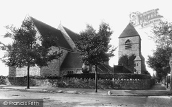
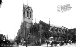
The foundation stone was laid in 1883 by Sir Erasmus Wilson, a famous surgeon, who popularised Westgate for its health-giving air.The church, by C N Beazley, is unusual in that its north tower is
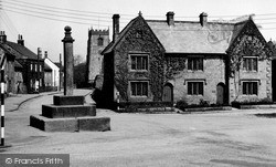
The Butter Cross in the centre of Kirkby Malzeard, north west of Ripon, was the traditional venue for the village's famous Sword Dance, now rarely performed.
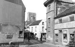
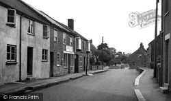
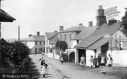
We are looking down North Street from the Duke of York pub, and this scene looks much the same today. The 'Family Shop' - the post office and stores on the left - is now a watch repairer's.
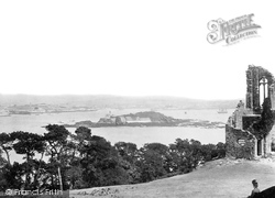
Island and Mount Edgecumbe, known as The Bridges, is only navigable via one narrow channel, which is why ships always appear to take 'the long way round', following Drake Passage to the east and north
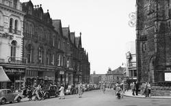
'The Prisoner of Zenda' was showing at the Regal Cinema in the elegant North Yorkshire spa town of Harrogate when this picture was taken.
The narrow cobbled streets of Staithes still wind down to the North Sea just as they did in the 1950s.
The hillside town of Yeadon lies to the north of Bradford, and is today perhaps most famous as the site of the Leeds-Bradford Airport.
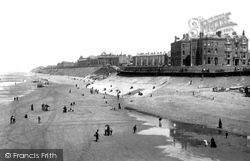
It is still possible to make out a part of the building shown here by standing on the North Pier and looking at the near left-hand side and corner of the Metropole.
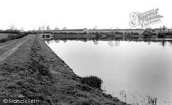
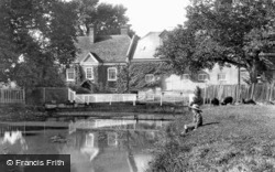
This view looks north along the grassy dam towards the bridge over the sluices. There is now a two ft high brick wall along the track.
Although only a few miles from Plymouth to the south and Tavistock to the north, Bere Alston feels quite remote, situated on the peninsula between the Tamar and Tavy.
Originally built as an Anglican church in Milton Road in 1834, and then purchased for the Catholic community in 1851, St John the Evangelist had its unusual and prominent tower, with a French-style saddleback
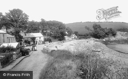
Here on the north shore, a mile from Mawnan Smith, is the ferry place for foot passengers wishing to cross the estuary to Helford village on the Lizard side. A small van is making a delivery.
The clerestory was added in the 17th century and the north aisle remodelled in the 1870s.
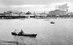
The South Marine Lake opened in 1887, the North Lake in 1892.
A child gazes wistfully into the tranquil waters of the River Anton, a tributary of the Test, which rises to the north of Andover and runs through the heart of the town.
On the north side the walls are about two feet out of true because of subsidence and the collapse of the south walls in 1569.
The castle stands to the north-east of Clevedon. It is not in fact a castle, but an early example of a folly, and it was probably built as a ruin to start with.
The houses of Clapham Common North Side, part of the busy A3 London to Portsmouth Road, are visible through the trees.
Polesworth has developed on both sides of the River Anker, with the original Saxon settlement on the north bank.
Places (9301)
Photos (2953)
Memories (1550)
Books (39)
Maps (9439)


