Places
2 places found.
Those places high-lighted have photos. All locations may have maps, books and memories.
Photos
11 photos found. Showing results 121 to 11.
Maps
10 maps found.
Books
Sorry, no books were found that related to your search.
Memories
102 memories found. Showing results 61 to 70.
Junior School
I attended the C of E Junior School in High Street earl Shilton opposite the old Working Mens Club there were about 7 classrooms the Headmistress was a woman cannot remember her name two teachers I remember were Mrs Sidey and Mrs ...Read more
A memory of Earl Shilton by
Inverernie
Inverernie lies within the boundaries of Farr and Strathnairn. I remember when people used to call Inverernie by its correct name and not the misspelt 'Inverarnie'. The shop also used to have the correct spelling on display. However, ...Read more
A memory of Inverarnie
Hummed To Sleep By A Factory
We used to live on what was called The Avenues on the Rylands estate. This was situated behind the Princess shopping parade, so called after the name of the local flea pit where all the kids went to Saturday morning ...Read more
A memory of Dagenham in 1961 by
Hornchurch, Wingletye Lane Circa 1950
For the first part of my life from 1947 I lived in Glanville Drive which ran parallel to Wingletye Lane about 100 yards to the West of where the photograph was taken. The railings to the right of the photograph ...Read more
A memory of Hornchurch by
Harworth 'old' Village
The large Horse Chestnut tree to the right was very popular when conkers were in season with boys searching the ground and throwing whatever came to hand at the tree to try and dislodge the nuts that were temptingly out of ...Read more
A memory of Harworth in 1964 by
Happy Hours Of Reading But Also Destruction.
So many hours of reading here in this library. The children's section was in the main door and to the right served by the 2 windows shown on the ground floor. I recall taking out every Arthur Ransome title ...Read more
A memory of Wallington by
Happy Days At Elmcroft Crescent
Hi, I came across this site by accident but I am delighted to recap on happy days spent living in North Harrow. We lived in Elmcroft Crescent off Headstone Lane and attended the comprehensive school at the ...Read more
A memory of North Harrow in 1957 by
Growing Up In Selsdon
I was 9 when we returned from Australia in the summer of 1967, we lived at 37 Farley Road after three different houses in Littleheath Road all belonging to friends of my parents, who conveniently were away on holiday by consecutive ...Read more
A memory of Selsdon by
Growing Up In Cold Ash Part Ii
Hello again. I started at Cold Ash School, St Marks C of E in 1953. The school consisted of the original brick building housing two class rooms and a large hall, plus a new wooden extension of two more class rooms and ...Read more
A memory of Cold Ash by
Growing Up In 50s Middleton
I loved growing up in Middleton in the 50s. Except for the smell from the Pixie Pickle factory - always hated vinegar!. Late afternoon April 30 1954. Passing through the town were endless 'charrers' full of blue and ...Read more
A memory of Middleton by
Captions
233 captions found. Showing results 145 to 168.
Here the river Trent is the boundary between Lincolnshire and Nottinghamshire.
The Waveney forms a natural boundary between Norfolk and Suffolk.
Dunstable Street housed most of the 'household' shops in 1955 - the situation has considerably altered since then as the town has expanded its boundaries.
At Parkmill we can see the earth bank or pale, with its wall and inside ditch, which marks the boundary of the deer park known as Park le Breos.
Denmead started to grow when Portsea Island began to expand its boundaries and creep up over Portsdown Hill.
Today, no other city in England has such a large area of public common, and within its boundaries more than 350 species of flowering plants and over 100 species of birds have been identified.
Cobbled Church Street leads to the church of St Michael and All Angels - the parish boundaries once extended to Chorley.
Dinas Powis would thus attract incomers in need of accommodation, and an extensive building plan would rapidly expand the boundaries of the town.
Further away from the waterfront are Victorian houses behind the low boundary walls.
This view is taken further down West Street, with the churchyard on the left and the boundary walls of the Victorian Baptist Church on the right.
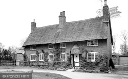
This is an almost ideal two- storey chocolate box cottage, with its thatched roof and door hood, small pane timber casement windows, and a profusion of flowers and creepers adorning the boundary
Here the river Trent is the boundary between Lincolnshire and Nottinghamshire.
Over the parish boundary in Carshalton in what was named Carshalton Beeches, lavender fields were developed in the years after after 1905.
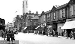
Bridge Street on the left and Gordon Street on the right-hand side were the boundaries of 'old' Luton, and the architectural changes between the 19th and 20th centuries are clearly visible.
The 500 acres of deer park was incorporated in the city boundaries in 1932, but only the east side, a strip along the north side, and a strip along the west side were developed for
To the right, the stone wall is the south boundary of the Grammar School (now Abingdon School) grounds, with Albert Park in the middle distance.
Although not designated an Ancient Monument, it is with its extensive boundary banks the best example of its type in Middlesex.
In Church Road there are some older houses and the parish church; the south churchyard boundary runs along Church Lane to the left.
Of interest are the heavy slate boundary walls between the buildings.
The boundary runs along the A45 and veers left by the Lawn Works to meet the A5, Watling Street.
At the other end of Frimley High Street, we cross the River Blackwater, which is the boundary between Surrey and Hampshire.
The district is also divided into four meres, an old term for boundary, comprising Quickmere, Shawmere, Lordsmere, and Friarsmere; they come together at Delph.
The houses on the right, including The Little House facing the camera (and now painted a bright pink), have the River Thames as their south boundary.
We are now in the Lias clay country along the Leicestershire boundary.
Places (2)
Photos (11)
Memories (102)
Books (0)
Maps (10)


