Places
26 places found.
Those places high-lighted have photos. All locations may have maps, books and memories.
- Town End, Derbyshire
- Town End, Buckinghamshire
- Town's End, Somerset
- Towns End, Dorset
- Town End, Merseyside
- Town End, Cambridgeshire
- Town's End, Buckinghamshire
- West End Town, Northumberland
- Bolton Town End, Lancashire
- Kearby Town End, Yorkshire
- Town End, Cumbria (near Grange-Over-Sands)
- Town End, Cumbria (near Bowness-On-Windermere)
- Town End, Yorkshire (near Huddersfield)
- Town End, Yorkshire (near Wilberfoss)
- Town End, Cumbria (near Appleby-in-Westmorland)
- Town's End, Dorset (near Melbury Osmond)
- Town's End, Dorset (near Swanage)
- Town End, Cumbria (near Ambleside)
- Town End, Cumbria (near Lakeside)
- Town End, Cumbria (near Kirkby Lonsdale)
- Town End, Cumbria (near Ambleside)
- Town's End, Dorset (near Bere Regis)
- West-end Town, South Glamorgan
- Townend, Derbyshire
- Townend, Strathclyde (near Dumbarton)
- Townend, Staffordshire (near Stone)
Photos
26 photos found. Showing results 3,421 to 26.
Maps
195 maps found.
Books
160 books found. Showing results 4,105 to 4,128.
Memories
3,719 memories found. Showing results 1,711 to 1,720.
A Snatch Of A Gateshead Childhood
My memory relates to the years 1946-ish to 1960 but I couldn't get all that in at the top! I was born in 1943 at 148 Somerset Street, an 'upstairs house' which we would now call a maisonette, the home of my ...Read more
A memory of Gateshead in 1946 by
My First Memories Of Harpurhey
Let me amend my memories of Harpurhey, after looking at some old photos of Manchester I can now remember and recollect other things, like for example holding on to the rails outside St Edmund's Junior School on the ...Read more
A memory of Harpurhey in 1951
Peterlee The Place To Be.
My mother had a few problems back in 1979 in a small village called Glossop in Greater Manchester, so she placed an ad in our local paper asking for an exchange of houses. We never knew that we would get a response from what ...Read more
A memory of Peterlee in 1979
Construction Of Civic Centre
I worked as a carpenter on the construction of the Civic Centre for Allen Fairhead &Sons whose H.Q. was in Enfield Town just down the road from Lyons Corner House opposite the gas company. I got married during this ...Read more
A memory of Enfield by
Long Days On The Beach With Family And Friends
My parents owned a caravan on what is now Seaview Caravan Park and as a child I remember going down onto the beach with my brother. My parents and an uncle called Sparky and his wife all went down ...Read more
A memory of East Runton in 1960 by
Sanderstead
I moved to Sanderstead when I was 5 from Crystal Palace and lived there until I moved to Scotland for work reasons when I was 24. I also have fond memories of Sanderstead being a great place to grow up - going to Ridgeway Junior ...Read more
A memory of Sanderstead
My Mother Was From Gilfach
I was four years old when I moved to Gilfach Goch with my sister Pauline and my dad Samual James Carson and my mam Sybil (Mills), she was from Gilfach and so was most of her family. We lived with my Gransher, Mark ...Read more
A memory of Gilfach Goch by
Moving To The West Midlands
We moved from The Medway Towns in South-east of England in the early nineties to the West Midlands to go narrow boating on the canals. I worked for premier narrow boat builders Les Allen and Sons at Velencia Wharf in ...Read more
A memory of Cradley Heath in 1992
Post House Coffee Shop
Hi Who remembers the Post House coffee shop in Post House Wynd? The first time I went there I thought "this is it - I've made it!!". It was a great meeting place and everyone had such a good laugh. Brings back very happy ...Read more
A memory of Darlington in 1967 by
A Memorable 'stay' At Joyce Grove Nettlebed
As a young student nurse at St Mary's Hospital, Paddington W2 - I recall fond memories of Joyce Grove where I undertook my initial six week training period, prior to joining the staff at St Mary's ...Read more
A memory of Nettlebed in 1950 by
Captions
5,111 captions found. Showing results 4,105 to 4,128.
Garboldisham is steeped in ancient history: there is a defensive earth work here known as the Devil's Dyke, and a mound traditionally supposed to be the grave of Boudicca, Queen of the Iceni.
The heavy broach spire of Billingshurst Church rises above the town. The church was enlarged and restored in 1866, though some evidence of its Early English character survives intact.
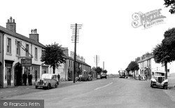
A virtually deserted tree-lined High Street in Longtown, a small town on the Esk a few miles short of the Scottish Border. Locals gather outside the Globe Tavern, perhaps waiting for opening time.
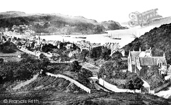
The Island of Kerrera faces Oban, and is linked to the town by a ferry service. On the island is the ruined Gylen Castle, where King Alexander II died of fever in 1249.
The Island of Kerrera faces Oban and is linked to the town by a ferry service. On the island is the ruined Gylen Castle, where king Alexander II died of fever in 1249.
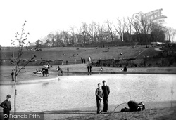
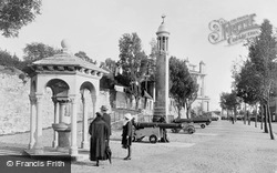
The wall beyond the boating pool is part of the north defensive wall of the Roman town.
This attracted the wealthy, and so began the town's development. This was probably the earliest seaside resort in the country.
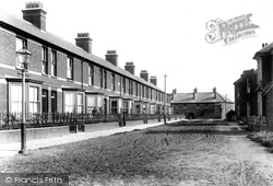
Pretoria Terrace, a well-rutted mud and sand road, looks towards the town steps. The name of the terrace must commemorate the recently fought Boer War.
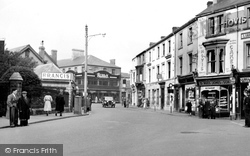
There was once a railway crossing at the bottom of Commercial Street, the main business centre of the town.
Travelling aboard the 'Mayflower', the emigrants had to put into Dartmouth and Plymouth following problems with the ship.The memorial was erected opposite the pier on Town Quay in 1913, 11
Fortuneswell 1894 The Isle's main town of Fortuneswell grew up, as the name implies, around a supply of fresh water, as did many of the Portland settlements.
This tiny cathedral city stands above the confluence of the River Clwyd and its tributary the Elwy. The cathedral is the smallest in Britain.
Broadwater is the old parish on which Worthing was built; its church is the mother church of the town. It was an old market under the Camois family, and is now a district of Worthing.
The half-timbered Kings Head inn in the background recalls the coaching age: Northleach was on the main London, Oxford, Gloucester and South Wales road (the main A40 road now by-passes the
Before the by-pass this was the main road through the town; it is now pedestrianised.
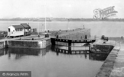
In 1810 the Severn & Wye Railway Company developed Lydney Harbour, constructing the canal, dock basin and lock gates we see in the photograph.
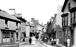
This street is a short one, running up into the town after crossing the Usk. The motor car is not yet a common sight, hence the horse-drawn carts going about their business.
The half-timbered Kings Head inn in the background recalls the coaching age: Northleach was on the main London, Oxford, Gloucester and South Wales road (the main A40 road now by-passes the
The Cross and the Carew Arms 1929 Further south, Crowcombe is the largest village on the western flanks of the Quantocks, and once was a small market town.
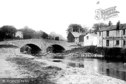
Here we see the bridge over the River Greta in the busy little market town of Keswick in the northern Lakes.
It was built in 1850 by Joseph Kaye, who was well-known in the town as a merchant, a brewer and the owner of four mills at Folly Hall.
Here we have a fine overview of the town centre against a backdrop of the Fairfield Horseshoe group of mountains.
Before the advent of the car moved shoppers to out-of- town stores, main streets such as this displayed a rich multiplicity of goods, with regional shops trading beside the more well-known
A place familiar to all train travellers through Devon, Dawlish nestles across the sides of a broad combe, with the railway line protecting the town from the sea.
Places (26)
Photos (26)
Memories (3719)
Books (160)
Maps (195)


