

Places
36 places found.
Did you mean: street or streetly ?
Those places high-lighted have photos. All locations may have maps, books and memories.
- Heathfield, Sussex (near Cade Street)
- Street, Somerset
- Chester-Le-Street, Durham
- Adwick Le Street, Yorkshire
- Scotch Street, County Armagh
- Friday Street, Surrey
- Potter Street, Essex
- Boughton Street, Kent
- Newgate Street, Hertfordshire
- Streetly, West Midlands
- Shalmsford Street, Kent
- Green Street Green, Greater London
- Boreham Street, Sussex
- Park Street, Hertfordshire
- Cade Street, Sussex
- Appleton-le-Street, Yorkshire
- Hare Street, Hertfordshire (near Buntingford)
- Romney Street, Kent
- Trimley Lower Street, Suffolk
- Streetly End, Cambridgeshire
- Hare Street, Hertfordshire (near Stevenage)
- Brandish Street, Somerset
- Colney Street, Hertfordshire
- Langley Street, Norfolk
- Silver Street, Somerset (near Street)
- Street, Yorkshire (near Glaisdale)
- Street, Lancashire
- Street, Devon
- Street, Cumbria (near Orton)
- Street, Somerset (near Chard)
- Bird Street, Suffolk
- Black Street, Suffolk
- Ash Street, Suffolk
- Broad Street, Wiltshire
- Brome Street, Suffolk
- Penn Street, Buckinghamshire
Photos
21,809 photos found. Showing results 1,141 to 1,160.


Maps
1,622 maps found.


Books
1 books found. Showing results 1,369 to 1.
Memories
6,667 memories found. Showing results 571 to 580.
Transportation
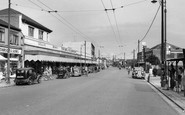
Trolleybus route. During the war my dad and I were physically blasted across this street by a landmine falling on a house in Yorkland Avenue. We were about to cross the street to a shelter.
A memory of Welling in 1940 by
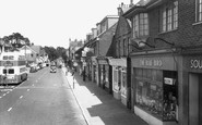
Shopping With My Mum In Heathfield...
I remember in the 1960s going to Heathfield with Mum on the bus (we lived at Corner Farm, Swife Lane). We would go shopping and often would go into the Bluebird. Seeing that name in this picture brought all ...Read more
A memory of Heathfield in 1965 by
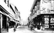
Shoe Shop
The shoe shop at number 44 was Thomas Alderton and Son, shown on the 1871 census as the family living there, presumably above the shop, it was still there in 1985 with the original street frontage, is it there now?
A memory of Ipswich in 1870 by
Birth
This is not actually a memory, I was born at 26 BARUGH LANE, BARUGH, DARTON in 1942. I only have one vague memory, that is of a flat face bus. We moved to Wales about 1946, I have written to the above address but the letter was returned 'no such ...Read more
A memory of Darton in 1942 by
The War Years In Leytonstone
I have lived the past 43 years in Arizona, USA. Seeing the photo of St John's Church brings back many memories of my childhood in the Leytonstone area. During the blitz on London, going down the unfinished underground ...Read more
A memory of Leytonstone in 1940 by
Aftermath Of The Great War
Born in Felsham Road, off the High Street, in 1927, I of course have many memories of the area in this photograph. One in particular, has stuck with me for the last 75 years or so. It is of terribly wounded and maimed men, ...Read more
A memory of Putney in 1930 by
Technical School Park Square
I attended this school from the 8th January 1951 until the end of March 1953. Every morning all classes would attend assembly in this building and would then disperse to their classrooms which were often at other points ...Read more
A memory of Luton in 1951 by
Cotgrave Memories
Our grandad George Boultby was a miner at Cotgrave. Because we didn't have a car, we had to go on the old type Barton buses. We would walk from the bus stop to our grandparents' house. They used to live in two different locations, ...Read more
A memory of Cotgrave in 1970 by
Growing Up Years
I was born in Old Argent Street 1945 (VJ Day), only one in Grays as my old mum used to tell everyone, she was so proud of that, living in a 2 up, 2 down, mum, dad, 3 brothers, 2 sisters, overcrowded, nah, we got by. We spent summers ...Read more
A memory of Grays by
The Bell
My name is Ann Jones. I live in the USA I was formerly Ann Groom, my dad Sydney Groom and mother Mildred kept The Snoring Bell. I remember the Whiteheads down the street on the farm, and going to Little Snoring School - my teachers ...Read more
A memory of Little Snoring in 1960 by
Captions
5,381 captions found. Showing results 1,369 to 1,392.

On the right is Union Street; the corner shop was W H Smith, but is now Oxfam. All of this part of the street was dug up during the extensive road works of early 2004.

Up to the southern border of Royston, the A10 follows the route of the Roman Ermine Street, but close to the market Ermine Street becomes the Old North Road (which was the A14 and is now the A1198) taking

When this view was taken, Manchester Road was a much more important shopping street than it is today.

The main street of Alllington village (bottom left) leads into this panorama of Bridport town, looking south-east from Allington Hill, with the outer parish's St Swithun's Church being the prominent building

Preston Street links the station with the market town centre. A policeman stands on point duty; once again, one is struck by the lack of heavy traffic.

In the 1970s double-decker buses passed in the upper High Street. People on busy pavements feared for their safety, a sure case for pedetrianisation.

Every conceivable example of architecture is visible here in the gently rising street, from The Norton Arms in the foreground to the clock tower in the distance.

This fine study of Goudhurst looks up the High Street. The Vine Hotel stands on the left, whilst halfway up the hill is a horse-drawn wagon.

The street is now tarmacadam.

The total street scene exudes 1900, with typical shops and corner pub.

Adjoining the Hollow, the main A47 becomes Wood Street. Today the scene is a lot more commercial. The four Belisha beacons have been replaced by their pelican equivalent.
The High Street has attractive tile-hung and weatherboarded cottages tumbling down the hill.

The Jaegar Shop on the extreme left of the picture conjures up memories of tweeds and country pursuits; nowadays the branch is much more fashion orientated, but nevertheless to be found on the High Street
A good smaller furniture factory survives (it is now a listed building): the Cane and Rush Works of about 1880 in Desborough Street.

The original carriage driveway of the house preceded the 'new' Westgate Road, shown in the foreground here, which was laid out to connect the Victorian streets of Reid Terrace, Gill Street and

One of Maidenhead’s best-known landmarks is the Clock Tower, near the station, at the south end of King Street. It commemorates Queen Victoria’s Diamond Jubilee in 1897.

One of Maidenhead's best-known landmarks is the Clock Tower, near the station, at the south end of King Street. It commemorates Queen Victoria's Diamond Jubilee in 1897.

Lloyds Bank, on the right, is on the corner of Market Street. The policeman, possibly on traffic duty, is talking to a man whose cap and breeches suggest a chauffeur or AA patrolman.

But as the population increased massively, over five times in four decades, the streets surrounding this area became infamous for fights and drunken brawls.

The name Eccles comes from 'ecclesia', and means 'the place of the church', so it is no surprise that its central street is called Church Street.

In 'Pride and Prejudice' Jane Austen calls Hatfield 'a busy little street that leads to my Lord Salisbury's house'.

The High Street is without doubt extremely attractive, and the school buildings contribute greatly to that well-manicured ambience, such as Bradbys to the left and The Park seen here to the right, a fine

Local bus services used Terminus Street, and so did the Green Line and National Express. The furniture and furnishing shops were all concentrated in this area.

Empty barges waiting to be towed back down the river are tied up at the embankment alongside the Portsmouth Road where it becomes the High Street.
Places (385)
Photos (21809)
Memories (6667)
Books (1)
Maps (1622)

