Places
26 places found.
Those places high-lighted have photos. All locations may have maps, books and memories.
- Cemmaes Road, Powys
- Six Road Ends, County Down
- Road Weedon, Northamptonshire
- Severn Road Bridge, Gloucestershire
- Roade, Northamptonshire
- Berkeley Road, Gloucestershire
- Harling Road, Norfolk
- Road Green, Devon
- Builth Road, Powys
- Cross Roads, Yorkshire
- Steele Road, Borders
- Cross Roads, Devon
- Four Roads, Dyfed
- Road Green, Norfolk
- Biggar Road, Strathclyde
- Clarbeston Road, Dyfed
- Five Roads, Dyfed
- Eccles Road, Norfolk
- Grampound Road, Cornwall
- Morchard Road, Devon
- Wood Road, Greater Manchester
- Four Roads, Isle of Man
- St Columb Road, Cornwall
- Clipiau, Gwynedd (near Cemmaes Road)
- New Road Side, Yorkshire (near Silsden)
- New Road Side, Yorkshire (near Cleckheaton)
Photos
14,329 photos found. Showing results 2,421 to 2,440.
Maps
476 maps found.
Books
5 books found. Showing results 2,905 to 5.
Memories
11,058 memories found. Showing results 1,211 to 1,220.
Looking For Old Memories
Both my parents lived in Woodford for most of their childhood. Mum lived in Uplands Road, and Dad lived in Chalford Walk. They got married in Broadmead Baptist Church in 1964. I'm trying to find any records, memories anything at all that might relate to either of them. Can anyone help?
A memory of Woodford Bridge by
Mountnessing School
I was at school in the 1940s. I remember a teacher there, I believe he was a Mr Davis. I remember the annual sports, these were held on a field just a short walk from the school. The days of the great snow fall in 1947, living ...Read more
A memory of Mountnessing in 1940 by
Church On Kings Road
Does anybody have a picture of the church on Kings Road that was knocked down to build the International Hotel?
A memory of Harrogate by
Early Memories
My birth on 30 Nov 1946 at 34 Oldberry Road, Burnt Oak, is where it all started for me, but my mother & her parents moved into the house when it was built for the LCC. She's 89 now, but recalls that she, as a 9-yr-old in 1928, ...Read more
A memory of Burnt Oak in 1946 by
17 Years At West Tilbury
My husband and I moved to a bungalow on the Muckingford Road, West Tilbury in 1972. It was bought from Mrs. Jones (wid). We kept various animals, ducks, geese, chickens, horses and pigeons. We lived there for 17 years when we sold so that we could start our own business. Alma Bacon
A memory of West Tilbury in 1972 by
The Fox And Goose Public House
Hello from Australia. I was hoping that someone looking through these "memories" might remember The Fox and Goose Public House on Penn Road. I think that this is the picture of it. My mom was the cleaner there ...Read more
A memory of Penn by
A Ham Family
My mother and father lived in Evelyn Road - the cul-de-sac opposite the large white house in the distance - mother still there - lived in two of the houses for all her eighty years - married the boy next door (well.. at the top of the cul- ...Read more
A memory of Ham in 1955 by
Long Hot Summer!
Spent many a hot summer lounging around with friends in Park Road, Gatley Hill (especially fishing for sticklebacks in the stream) and the school fields, not to mention the village. Great local shops owned by friendly local people. My ...Read more
A memory of Gatley in 1975 by
Memories Of The Red Lion
I was born in 1966 and lived in the Red Lion. My dad and mum were married in 1961. My dad lived in the village all his life, moving to the Red Lion on his marriage. My dad was formerly of Temperance Hall, down the road from ...Read more
A memory of Wareside in 1966 by
Ann & Vic Norman's Shop
My mother Joyce Stannard worked at the shop in this picture in the foreground with the canopy next to the wine merchants. When she started it was a little wool shop owned by Miss Wright - she sold it to the Norman's who expanded ...Read more
A memory of Cobham in 1960 by
Your search returned a large number of results. Please try to refine your search further.
Captions
5,036 captions found. Showing results 2,905 to 2,928.
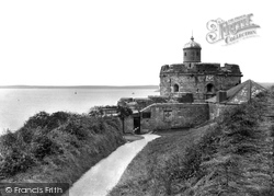
Like its twin castle of Pendennis on the opposite side of the river mouth, St Mawes was built on the orders of Henry VIII to guard the entrance to Carrick Roads.
The whole frontage has now been railed off from the road.
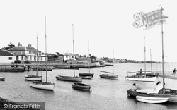
The road leads all the way round the shore here, and today there is a car park behind the third building.
The sun highlights the front of the post office on this quiet, peaceful road. A bicycle leans against the wall. Strawberry growing was still a popular occupation around here.
Weeke Primary School is down this road - today it has about 280 pupils.
On the left is now either cleared or a car park, and the road is much wider. Here the river Trent is the boundary between Lincolnshire and Nottinghamshire.
The view has changed little, although the shop beside the road junction, in the centre of the picture in front of the Town Hall, has been replaced.
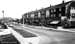
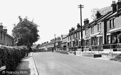
The road leading to Chipstead Valley is dominated by Edwardian terraced houses on the right.
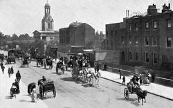
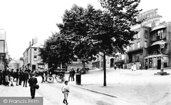
The buildings on the High Street which we can see behind the horse (left), were demolished to widen the road for 20th- century traffic.
Imagine the road rage if there were such obstructions today.
The village was soon to become quite industrialised with the Vulcanised Fibre Works at nearby Broadford and also the engineering firm Nelco, in Station Road.
The scene is little changed today, although the young tree in the foreground has grown to maturity and milk churns no longer wait beside the road for collection by the dairy.
London Road acts as a dividing line between Camberley the town and the military area - the town, with its line of shops, is to the right of this picture and the grounds of the Royal Military Academy are
Here we see a quiet summer scene in the valley bottom, where the Wadebridge road crosses the River Camel at the foot of a long descent from Bodmin.
The humbler quarter of town is on the east side of the bridge over the Fowey, where the old road climbs out towards Liskeard.
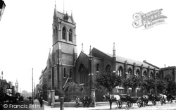
Originally built as an Anglican church in Milton Road in 1834, and then purchased for the Catholic community in 1851, St John the Evangelist had its unusual and prominent tower, with a French-style saddleback
Streetly is a residential community built alongside the Roman road known as Ryknild Street, traces of which can still be seen in Sutton Park.
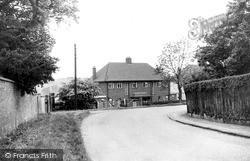
A semi-detached house of little architectural merit dominates the view here, but beyond is a glimpse of the Gumley Hills as the road swings right towards Saddington.
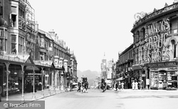
Not to be outdone, the chemist just across the road proclaims that his establishment is the largest in the world. Harrogate had become a fashionable town noted for its fine shops and rich teas.
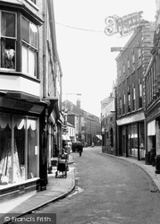
A horse must have recently passed by, as it has left a deposit on the side of the road.
There have been many more changes to the buildings on the right, and now the tram lines have been removed; road markings, showing a one-way system, have taken their place.
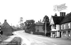
The main road tourist route has great views of the Downs.
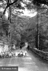
A small flock of Welsh mountain sheep are being driven along the road through Aberglaslyn pass. The breed is hardy, and well adapted to thrive on poor grazing. The narrow gorge is heavily wooded.
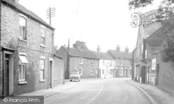
The houses stand on a hairpin bend of the road that leads to Hornsea. There seem to be more advertisements for cigarettes than anything else here.
Places (26)
Photos (14329)
Memories (11058)
Books (5)
Maps (476)


