Places
26 places found.
Those places high-lighted have photos. All locations may have maps, books and memories.
- Cemmaes Road, Powys
- Six Road Ends, County Down
- Road Weedon, Northamptonshire
- Severn Road Bridge, Gloucestershire
- Roade, Northamptonshire
- Berkeley Road, Gloucestershire
- Harling Road, Norfolk
- Road Green, Devon
- Builth Road, Powys
- Cross Roads, Yorkshire
- Steele Road, Borders
- Cross Roads, Devon
- Four Roads, Dyfed
- Road Green, Norfolk
- Biggar Road, Strathclyde
- Clarbeston Road, Dyfed
- Five Roads, Dyfed
- Eccles Road, Norfolk
- Grampound Road, Cornwall
- Morchard Road, Devon
- Wood Road, Greater Manchester
- Four Roads, Isle of Man
- St Columb Road, Cornwall
- Clipiau, Gwynedd (near Cemmaes Road)
- New Road Side, Yorkshire (near Silsden)
- New Road Side, Yorkshire (near Cleckheaton)
Photos
14,329 photos found. Showing results 1,981 to 2,000.


Maps
476 maps found.
Books
5 books found. Showing results 2,377 to 5.
Memories
11,058 memories found. Showing results 991 to 1,000.
Colerne In The Second World War Continued
Those of us at Colerne school who passed our 'scholarship' exam at the age of about eleven usually went on to Chippenham Secondary School, which probably goes under a different name now: it's at ...Read more
A memory of Colerne in 1940 by
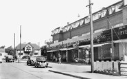
Broad Parade Shops
My parents bought a house in Willow Walk, which is on the right of the photographer, in August 1954. At that time there were no shops, no pavements, just muddy concrete roads. We were the first to occupy a house in the road, ...Read more
A memory of Hockley in 1955 by
The Cosy Cafe
My family owned the Cosy Cafe on Lyme Road in the 1950s. I did not start working their until 1957 as I was still at school until then, but I still remember a lot of the customers who use to come in for their cups of tea. John ...Read more
A memory of Axminster by
My First Boyfrield Was From Splott
My first boyfriend was John Hawkins, he lived in Splott. My name was Christine Morris then and I lived in no 8 Rossily Road, Rumney with my aunty Eunice Lloyd and my cousin Dennice. I loved living down there. I ...Read more
A memory of Splott in 1961
Childhood Memories
Wonderful memories of Greatstone. My fifth birthday. A picnic on the vast sandy beach, playing hide & seek in the sand dunes, swimming in the sea-the water I recall was rather murky & the beach very muddy when ...Read more
A memory of Greatstone-on-Sea in 1957 by
Beatie Bebb
I remember Beatie Bebb had a horrid little Scottie dog that used to chase me around the road trying to bite me. I was terrified of it !!
A memory of Builth Road in 1947 by
St John's Gate Broad Street
St John's Gate in Broad Street in Bristol is the only surviving medieval city gateway, at one one time there were seven gates into the old city. Fortified gateways pierced the town wall at intervals. St John's Gateway, ...Read more
A memory of Bristol by
The Mount In The Early 1970s
I went to see 'The Jungle Book' in the Odeon and remember the restaurant opposite - dead posh. I worked in the tiny TESCO supermarket which was opposite Rossis. In the 1970s Rossis was a mecca for teenagers as ...Read more
A memory of South Harefield by
Village People
I remember the people with shops in village. There was Charlie Chants grocers, Hardings stores, real old characters were Jack & Charle Hawkes with their grocery and corn shop. Good old Edger Stagg and his sweet shop. ...Read more
A memory of Stoke Sub Hamdon by
Clarendon Road School
I would love to see a photograph of Clarendon Road School, on its original site, before it was replaced by homes. Does anyone have any Internal or external?
A memory of Ashford by
Your search returned a large number of results. Please try to refine your search further.
Captions
5,036 captions found. Showing results 2,377 to 2,400.

This photograph successfully shows the long incline of Perrymount Road. The bus coming up the hill would have already passed the recreation ground.

Taken across the road from the Wellington Inn, this view is looking south along the village.

Like the later County High, it was on Easemore Road. Much extended, it now serves as a college.

This quiet residential road is very close to the centre of the town, yet even that fact has not saved the cinema on the left from demolition.

Today, heavy traffic thunders close by on the road in the foreground (the A3094), but drivers do not see the church because of the screen of trees which has grown up along the wall in front of it.

Here the view of the kiosk is all but obliterated by a telephone exchange box, a police telephone box and the large road sign which gives directions to Stoke, Stafford, Rugeley and the

Iwerne (pronounced Youen) Minster stands on the road to Blandford, and boasts this fine peace -rather than war - memorial.

The road leads to the sea and the ferry service to Fleetwood across the River Wyre.

The cobbled areas to the sides of the road remain an attractive feature today, although they are usually covered in motor cars.

This road runs south to Stokesley, some five miles away. The Mobil petrol station is just off to the left - they were evidently offering Green Shield Stamps in return for purchases at that time.

This is the lower end of the High Street, with the Long Shop complex off to the right and Victoria Road to the left.

The High Street, with many cars, and a tarmacadam road, is much changed from earlier pictures. Simonds Bank is now Barclays, and Armstrongs has become Eighteens.

Harbour Road has changed considerably since this photograph was taken. The car park has disappeared with the building of flats and shops.

The road beside St Paul's Church has been widened, and in the process the pub has gone, and so have all the terraced houses that can be seen beyond.

The Cross is the name given to this road junction in the centre of the town, and does not refer to the drinking fountain pictured here.

The building, now a private residence, is on the road to Cartmel, and is nearly opposite the former Constabulary Station.

Traffic restrictions and the roundabout by the Whyteleafe Tavern are still many years away, but the post office remains at 217 Godstone Road on the right.

A small village with a common on the Portsmouth to Guildford main road near the Hampshire border. There is chalk quarrying being carried out on the hillside on the left.

The elegant street lamps were a feature of this road. To w a r d s t h e P i e r

The road opposite leads to Willow Vale. The bunting probably means that it is carnival time, which is held annually in September; the first carnival was held in 1927.

Services operated were Ferry Road to Torpoint (fares 1d and 2d); the Barbican to Turnchapel and Oreston; Admiral's Hard to Cremyll (Mount Edgcumbe); and Mutton Cove to Cremyll.

Upwey stands on the high road between Weymouth and Dorchester and features in Thomas Hardy's novel 'The Trumpet Major'.

Just across the road is the Gigmill pub, a reminder of Stourbridge's days as a wool town in the 17th century. A gig was a machine which raised the nap on cloth.

Sutton Coldfield initially grew in linear fashion along the Birmingham-Lichfield road. It retained its predominantly rural character until industry began to develop in the 17th and 18th centuries.
Places (26)
Photos (14329)
Memories (11058)
Books (5)
Maps (476)

