Merry Christmas & Happy New Year!
Christmas Deliveries: If you placed an order on or before midday on Friday 19th December for Christmas delivery it was despatched before the Royal Mail or Parcel Force deadline and therefore should be received in time for Christmas. Orders placed after midday on Friday 19th December will be delivered in the New Year.
Please Note: Our offices and factory are now closed until Monday 5th January when we will be pleased to deal with any queries that have arisen during the holiday period.
During the holiday our Gift Cards may still be ordered for any last minute orders and will be sent automatically by email direct to your recipient - see here: Gift Cards
Places
32 places found.
Those places high-lighted have photos. All locations may have maps, books and memories.
- Cliffs of Moher, Republic of Ireland
- Cliffe, Kent
- St Margaret's at Cliffe, Kent
- Cliff, Warwickshire
- Cliffe, Lancashire
- Cliff, Highlands
- Cliff, Derbyshire
- Cliffe, Yorkshire (near Darlington)
- Cliffe, Yorkshire (near Selby)
- Cliffs End, Kent
- Gold Cliff, Gwent
- Guy's Cliffe, Warwickshire
- King's Cliffe, Northamptonshire
- Canford Cliffs, Dorset
- South Cliffe, Yorkshire
- Middle Cliff, Staffordshire
- West Cliffe, Kent
- Cliff End, Yorkshire
- Beechen Cliff, Avon
- North Cliffe, Yorkshire
- Telscombe Cliffs, Sussex
- Matlock Cliff, Derbyshire
- Great Cliff, Yorkshire
- Cliffe Woods, Kent
- Friars Cliff, Dorset
- Hemswell Cliff, Lincolnshire (near Hemswell)
- Little Alms Cliff, Yorkshire
- Normanton-on-Cliffe, Lincolnshire
- West Cliff, Dorset (near Bournemouth)
- Cliff End, Sussex (near Hastings)
- West Cliff, Yorkshire (near Whitby)
- West Street, Kent (near Cliffe)
Photos
2,428 photos found. Showing results 501 to 520.
Maps
162 maps found.
Books
1 books found. Showing results 601 to 1.
Memories
441 memories found. Showing results 251 to 260.
The Thrill Of The Shop At The Top Of The Cliff.
We used to stay in the family bungalow in the 1960s (all the cousins remember it as a magical place) and play all over the sands and cliffs - still have the fossil collection. Big treat going to the ...Read more
A memory of Reighton
Prussia Cove 1908
Before Louis Behrens built Porthenalls during WWI, on promontory in front of Coastguard Cottages (to right of Cliff Cottage shown), musta been where the Carters the smugglers had large thatched house (shown in 1885 Valentines ...Read more
A memory of Prussia Cove by
Best Years Of My Young Life.
I'm a Polzeath girl (grown woman now ). During the war I lived in Bryher, moved to Yoyo cottage then again to Tywardale. My nursery school was Tregear and primary school was Holiday House on the terrace. The playground was ...Read more
A memory of Polzeath
A Long Time Ago!
Hi everybody, only just found this site and so interesting to read the comments. I was at Tiffield in the old Victorian "fridge" they called the main building from early 1957 to approx middle 1959. Mr Turner was head (nice chap) ...Read more
A memory of Tiffield by
Memory Of Runswick Bay
I was with a group of 8 friends who walked the Cleveland Way some years ago in June. Unfortunately, it was the wettest June for years! The plan that day was to walk from Runswick Bay to Whitby, some 8 miles. We had booked to ...Read more
A memory of Runswick Bay by
Working In Perivale In The Sixties
I had two gap years between school and college. I worked at Brown and Polson I. PERIVALE in 1967. I remember Barry Spicer, Roger Wallbank, Cliff Treadwell and Cheryl Whittamore The office was next door to Perivale Wood nature reserve which I as a member of the Selborne Society could visit.
A memory of Ealing by
Broadstairs Convalescence Home June 30th 1954 Solar Eclipse
I remember being at a convalescent home in Broadstairs at this time. I was 9 years old. However I cannot remember the name of it. I do remember helping to shell hundreds of pea pods ...Read more
A memory of Broadstairs by
Hounslow .. Tin Town .. Cranford And Budding Stars!
Hi, My Nan and Granfer, along with my aunties lived on Cedar Rd on what many called 'tin town' near Hounslow West and Cranford. Cecil and Peggy Costa, the then Carol Costa (Mum) Auntie Julie, Auntie ...Read more
A memory of Hounslow by
War Time Evacuees
in 1944 we were taken to St Agnes, me, my two sisters and my mum. I was only 5 years old. They put us in the hotel Driftwood Spars, St Agnes. I went to school there, I can't remember the name of it. My mum worked in the pub in ...Read more
A memory of St Agnes by
Purfleet In The 50s And 60s
I was born in Purfleet in 1947 and lived in Riverview Flats opposite Thames Board Mills until leaving for University in 1966. The flats were owned by Esso where my Dad, Herbie Jarvis, was a manager. He worked there for 46 ...Read more
A memory of Purfleet by
Captions
646 captions found. Showing results 601 to 624.
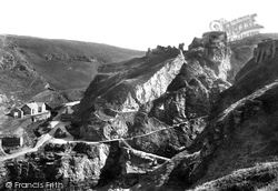
The dramatic cliffs and ruined castle at Tintagel have been photographed from many angles over the years.
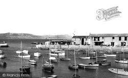
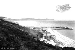
The view across the water is to the cliffs of Cain's Folly (left) and the skyline of Stonebarrow Hill, Chardown Hill and Golden Cap.
Then building began in earnest as visitors flocked to enjoy its safe, sandy beach and bracing cliff-top walks.
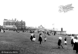
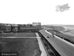
Eventually the West Cliff Hotel appeared, and the Princess Royal Hotel (right) was built here half a century later in the 1920s.
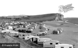
Post-war, caravans advanced on to the pea-gravel beach, and this photograph was used by the National Trust land agent John Cripwell when he presented the case for the purchase of Burton Cliff (top right
The view is south-eastwards to the Bay House Cafe and East Cliff (centre).
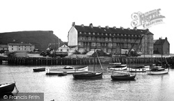
The building to the right, Cliff House, gained another storey soon after this photograph was taken; in the 1920s, it offered 'furnished apartments - an ideal spot for summer or winter residence
During a violent storm in 1829, the cliff fell into the sea taking most of Kettleness with it.
Thomas Warwick's Revolving Viewing Tower, set high on the cliffs near the castle, was a short-lived Victorian attraction from 1897 to 1907 - it was demolished after being described an eyesore
The clay cliffs at Southend have always been prone to slipping. Frequently, over the years, notices have been erected closing the threatened areas.
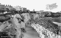
The line of new hotels along the cliff-top, including the white stuccoed Albion Hotel, and the crowded beach, are a clear indication of the resort's appeal to holidaymakers.
Until 1864, Clacton had simply been a row of cliffs. It was Peter Bruff, a railway engineer, who bought the land and started to develop a resort here.
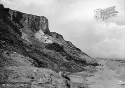
The cliffs rise to about 70ft, and are the seaward end of the chalk ridge which stretches right across Norfolk.
The road southwards leads to Birling Gap, a coastline hamlet with spectacular scenery and chalk cliffs. The scene is similar today, but with more trees and buildings in the foreground.
The old church tower, along with the old graves, was left on the cliff top.
As with other fishing villages along the Yorkshire coast, Staithes clings to the sides of steep cliffs and ravines.
From Ware Cliffs we can see the medieval Cobb harbour (centre right) and the coastal skyline of Stonebarrow Hill, Golden Cap and Thorncombe Beacon.
This view over The Square was taken from Bell Cliff.
East Cliff (centre left) rises to the south-east; the distinctive building is Pier Terrace, which is locally known as Noah's Ark (centre right).
The view looks from the junction with Higher Sea Lane, below Old Lyme Road and Old Lyme Hill, from where earlier generations of roads headed towards Lyme Regis - but they slipped over the cliff in landslides
The name is Danish, meaning 'new fortress', and the strategic importance of the river crossing defended by river cliffs is emphasised by the castle.
As with other fishing villages along the Yorkshire coast, Staithes clings to the sides of steep cliffs and ravines.
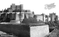
Some of the walls are eight metres thick, and the chalk cliff below is honeycombed with passages excavated by invading French troops in the 13th century.
This is the classic view of Golden Cap (centre), literally gold when its sandy top catches the sun; at 618ft above sea level it is the highest cliff on the south coast.
Places (32)
Photos (2428)
Memories (441)
Books (1)
Maps (162)


