Places
26 places found.
Those places high-lighted have photos. All locations may have maps, books and memories.
- Cemmaes Road, Powys
- Six Road Ends, County Down
- Road Weedon, Northamptonshire
- Severn Road Bridge, Gloucestershire
- Roade, Northamptonshire
- Berkeley Road, Gloucestershire
- Harling Road, Norfolk
- Road Green, Devon
- Builth Road, Powys
- Cross Roads, Yorkshire
- Steele Road, Borders
- Cross Roads, Devon
- Four Roads, Dyfed
- Road Green, Norfolk
- Biggar Road, Strathclyde
- Clarbeston Road, Dyfed
- Five Roads, Dyfed
- Eccles Road, Norfolk
- Grampound Road, Cornwall
- Morchard Road, Devon
- Wood Road, Greater Manchester
- Four Roads, Isle of Man
- St Columb Road, Cornwall
- Clipiau, Gwynedd (near Cemmaes Road)
- New Road Side, Yorkshire (near Silsden)
- New Road Side, Yorkshire (near Cleckheaton)
Photos
14,329 photos found. Showing results 2,721 to 2,740.
Maps
476 maps found.
Books
5 books found. Showing results 3,265 to 5.
Memories
11,058 memories found. Showing results 1,361 to 1,370.
Cissiess Memories
Cissie's memories: I came to Barry in 1900. Holton Road was muddy and planks of wood were put down to enter the shops. We had a shop in 26 Holton Road, and later at the bottom of the block on spare ground Johnson's opened a portable ...Read more
A memory of Barry in 1900
The Railway Bridge
In this picture I can remember that on the left was W H Smith's, a bicycle shop and an Options on the corner of Colham Road. To the right between the two pubs many years earlier was Pat's Garage. In the picture we have the new ...Read more
A memory of West Drayton in 1954 by
Kathryn Trevelyan Nee Bennett.
I remember the houses opposite St.Theodore's as my cousin Veronica (Non) lived in one and the "Turners" (Pat, Shirley, Roy and others) lived next door. These houses had front doors in Higher Church St, while the back ...Read more
A memory of Pontycymer in 1964 by
Cowplain In The Early 1960's
I lived as a toddler in Kings Road, Cowplain, between 1958 and 1963, in the days when it was a cul-de-sac. These photographs really bring back memories. If I'm not mistaken, the small building on the right of the ...Read more
A memory of Cowplain in 1963 by
Baptist Church
The building with a clock tower on the right was the old Baptist church. It was knocked down in the early 1960s in order to widen the road (which was of course the main Portsmouth to London road in those days) and was replaced by ...Read more
A memory of Waterlooville by
Ripple Road
I was born in 1948 and lived behind Wallis's undertakers in Ripple Road, where my dad was the manager. I went to St Margaret's Church of England School in Back Lane, and was married at St Margaret's Church in 1970. I also did my nursing ...Read more
A memory of Barking by
Bute Hospital, Dunstable Road, Luton
Later to become part of the old St Mary's hospital, Dunstable Road. Luton. I was born there in 1948.
A memory of Luton in 1948 by
Highcliffe Then In Hants
In 1960 or possibly 1961 I went to Highcliffe with my pal for a holiday. We rode there on our motorcycles from High Wycombe in Bucks. We had a chalet on the beach with my parents but lied it was ours alone. It seemed more cool ...Read more
A memory of Colne in 1960 by
Mobo Horses
We moved to Prestatyn in 1948. I loved the Mobo horses that the little ones could ride at the Bastion Road beach. My little school was Pendre, up the hill Fforddlas I think. Also going to St Chad's School annual fair and sale. Always ...Read more
A memory of Prestatyn in 1950 by
Your search returned a large number of results. Please try to refine your search further.
Captions
5,036 captions found. Showing results 3,265 to 3,288.
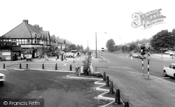
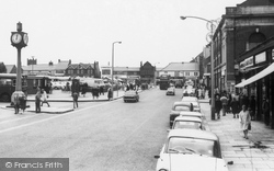
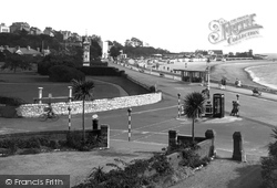
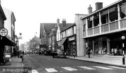
There is the more familiar red telephone box on the traffic island, a modern post box, and Belisha beacons to aid pedestrians wishing to cross the road.
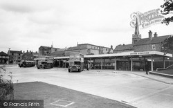
This is the view from Northampton Road, with the George Hotel roof visible behind the bus station.
Batley was one of the pioneers of steam trams; they ran from 1874, and the depot in Bradford Road later became Wilson's Mill.
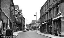
Many of the buildings look much the same, though the road here is much busier today. The High Street sign is still there, though the shops below it have changed hands over the years.
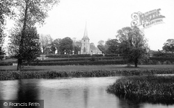
The apparent terracing between the river and the church is actually hedges on either side of the Marks Tey to Sudbury railway line and of the road from Bures to Sudbury running south to north across
West of the crossroads, Church Street runs north from Frilford Road, behind the camera, to the church, glimpsed to the left of the big tree at the far end.
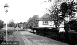
The large house on the left with the shuttered windows stands on a busy road junction, and the sign pointing left indicates the route to Scaynes Hill, Chailey and Lewes.
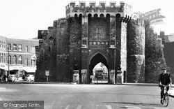
Bargate was originally built to guard the main road into Southampton.
Compare this view with No O45043, and note the cottage on the right with the broad light-coloured band above the front door running across the house front. This building appears in both pictures.
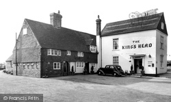
The King's Head in The Street in Capel, a village now by-passed by the A24 London to Worthing road, is now a private house, and its once sterile car park is now an attractive front garden
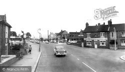
Marsh's stores and Ferring Motors' garage are on the opposite side of the road.
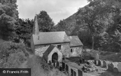
Nearing the coast, in a steep wooded combe 400 feet above the sea, Culbone's church is well-known to walkers along the Somerset and North Devon Coast Path , but is inaccessible by public road
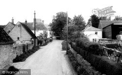
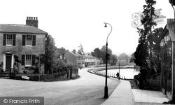
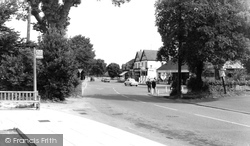
This is a quiet residential road in a village of fine buildings. The most impressive is probably Brasted Place, built by Robert?
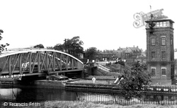
Barton Bridge closed in favour of road traffic.
Straddling an unclassified road between Hayfield and Marple, the village of Mellor is noted for its church, which is dedicated to St Thomas.
Maiden Newton stands on the high road between Dorchester and Crewkerne, an old route connecting Dorset with Devon. Its old mill became a carpet factory in the 20th century.
This view was taken from the top of Brunel's railway viaduct and looks down New Road to the bridge and the beginning of the High Street.
This view looks down Castle Gate and the road to Leicester and Nottingham. In later years the house on the extreme left of the picture would become the Castle Garage.
At the Stamford Road end of the street, the newly-built showroom of Tutty's sold kitchen units and appliances. Newman's next door was an old-fashioned ironmongers, which has resisted change.
Our view clearly shows the terraced housing, built on the north side of the Lune outside the old city walls, where Lune Terrace and Derby Road are today.
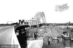
Built in 1956-61 to accomodate the enormous increase in road traffic, the roadway hangs from a single steel arch, the top of which is 306 feet above the high-watermark level.
The open aspect of the street pictured here and familiar to us today originates from the demolition of older buildings in 1862 to allow road widening.
As for The Castle, it was finished in that bleak sixties style that looked shabby before the paint was even dry, while across the road The Angel looks as solid as ever.
Booth's shop, beyond the signpost, marks the beginning of Stockerston Road.
Places (26)
Photos (14329)
Memories (11058)
Books (5)
Maps (476)


