Places
17 places found.
Those places high-lighted have photos. All locations may have maps, books and memories.
- Bridge End, Oxfordshire
- Bridge End, Lincolnshire
- Bridge End, Essex
- Bridge End, Bedfordshire
- Bridge End, Clwyd
- Bridge End, Warwickshire
- Bridge End, Surrey
- Bridge End, Durham (near Frosterley)
- Bridge End, Northumberland (near Hexham)
- Bridge End, Hereford & Worcester (near Tirley)
- Bridge End, Hereford & Worcester (near Bosbury)
- Bridge End, Shetland Islands
- Bridge End, Cumbria (near Carlisle)
- Bridge End, Northumberland (near Hexham)
- Bridge End, Devon (near Kingsbridge)
- Bridge End, Devon (near Sidmouth)
- West End, Yorkshire (near Pateley Bridge)
Photos
40 photos found. Showing results 1,061 to 40.
Maps
520 maps found.
Books
2 books found. Showing results 1,273 to 2.
Memories
1,928 memories found. Showing results 531 to 540.
Bridge Cottage
Hi, Does anyone have any photos or memories of the Bridge House/Cottage in Bedwas that was an Indian restaurant for some time. We now own it and want to try and bring it back to the very early years. Many thanks if you do.
A memory of Bedwas by
Clog Dancing At The Two Rivers Folk Festival
I went to this folk festival for the first time this year and got some memories that I will never forget! Exciting music and dance memories at the entertainment venues around Chepstow plus a never to be ...Read more
A memory of Chepstow in 2008 by
Helmshore 1950 1964
We lived at No 23 Broadway, Ronald my dad, Ruth my mum, Colin, me, Glenda and Kenneth. Next door was a working farm as the houses had only just been built. On Thursdays they used to run cows from the railway station to the ...Read more
A memory of Helmshore in 1950 by
Happy Days!!
I moved to Broadstone with my parents at the tender age of 2, and we lived in Sidney Road, off York Road. It was 1950, and ,of course there was no Waterloo Estate at that time, so York Road ended when it came to the railway line and the ...Read more
A memory of Broadstone in 1950 by
Another Ghostly Experience On Grace's Walk
The year is approximate as I was in my teens, so it was somewhere between 1972 and 1974. I had a horse called Shamrock, that I kept in Sandon and I used to ride him through Danbury and Little Baddow all ...Read more
A memory of Little Baddow in 1973 by
A Pool Of Evocative Tears
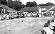
I was 8 years old when this picture was taken. It is hard to express how evocative this innocuous little picture is to me. Is that a box of tissues on the right?. Well this picture really set me off blubbing. At this end ...Read more
A memory of Barnehurst in 1955 by
Happy Days
I was born in No. 23 Hastings Street in 1950 (is anyone still living there?). Moved away 1968. Was a regular client of the cinema (flea pit) at Klondyke. I remember the coal trains running above the road between High Pit and Klondyke. ...Read more
A memory of Cramlington in 1950 by
Memories Of A Youth
I remember when there were two fishmongers in Earlestown, Lyons's fishmongers in Bridge St. and one whose name I can't remember in Legh St., now we have none. We also had two picture places, the Rink where the Police Station ...Read more
A memory of Earlestown in 1960 by
Toll Money
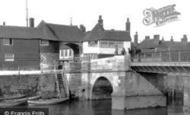
Sandwich Town relied on its toll money taken on the bridge, which was used purely for the town's benefit alone and it became wealthy over the years because of it. During the 1960s I think it was, Sandwich came under the jurisdiction of ...Read more
A memory of Sandwich
1976 In Llanbradach
I visited my gran and my aunts in Llanbradach twice in the early 1970s. It was my first ever visit to Great Britain and I fell in love with the church. To someone accustomed to supermarkets, shopping from grocer to butcher to ...Read more
A memory of Llanbradach by
Captions
1,770 captions found. Showing results 1,273 to 1,296.
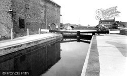
This view of the basin from its entrance lock adjacent to the Trent, shows a nearby warehouse and the Crown Inn, now the Waterfront Inn, across the water.
It was also important in draining the nearby Isle of Axholme and the two steam pumping stations once controlled the river level.
In the early 19th century, the colliery at Brereton nearby was connected by rail to a wharf, which enabled coal to be transported along the Trent and Mersey canal.
Initially the village developed along a road constructed on a causeway across the marshes between the castle and a possible wharf near Bramber Bridge.
A comfortable Tudor farmhouse beside a 15th-century pele, Turton Tower is associated with Humphrey Chetham, remembered for the free library, school and hospital that he founded in Manchester.
Built around 1840 to carry the London and North Western railway line north through Lancashire, this splendid six-arch bridge strides across the River Wyre just below Scorton Lakes.
Winter skaters used to risk their lives on the thin ice, and fishing from the bridge has long been a popular activity here.
It is separated from the enclosed village green by the Winn Brook, which is spanned by five little bridges before it reaches the Exe.
Go back into town and cross the Pulteney Bridge with its small shops into Argyle Street.
During the 13th century tolls were paid by those passing under the bridge as well as by those passing over it.
Indeed, the only Thames-side development has been between Caversham and Reading bridges. This has conserved the openness of the river banks which play a central role in the town's leisure.
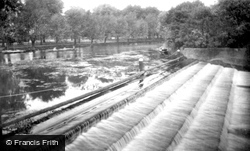
Frith's photographer has moved beyond Boatslide Weir Bridge to the bank to look at the weir itself. The chains on posts are still here to protect rowers from the hazards of the weir.
The curious Mathematical Bridge across the Cam, built on geometric principles, and originally held together - so the story goes - without any fixing devices.
Two paddle steamers are berthed on the opposite quay, and in the centre of the picture a lady is being rowed down to the river. We can just see the swing bridge in the background.
Two paddle steamers are berthed on the opposite quay, and in the centre of the picture a lady is being rowed down to the river. We can just see the swing bridge in the background.
The bridge, built in 1848, carried the Great Northern Railway main line from Grimsby to London King's Cross (via Peterborough), but since the Beeching cuts it now only carries the Skegness to Nottingham
Beyond are workshops and outhouses, now all gone and replaced by 1970s blocks of three-storey flats.
The king took a keen interest in the College, and often crossed the bridge to talk to scholars.
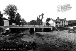
Entering the hamlet, the main A483 crosses the River Camarch en route to Builth Wells.
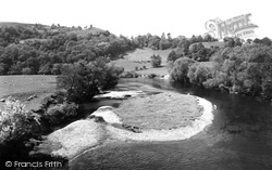
The Wye River is viewed here looking downstream from the Kerne Bridge. Within a short distance, the river becomes the border between Herefordshire and Gloucestershire.
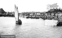
The crew in an approaching sail fishing boat, having raised her sails, stand by to clear the jetty, leaving both harbour and fellow craft moored alongside the Stade.
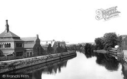
Warehouses and industry flourish along the banks of the river. In 1968, when work was underway on a new Devon Bridge, timber piles and some stonework were discovered on the river bed.
Beautifully situated by the tree-lined River Wyre and the ancient bridge (Bonnie Prince Charlie's army passed over it) is one of the three most ancient churches in the Fylde—they are Preston, Kirkham,
The Kennet and Avon Canal, authorised by Act of Parliament in 1794 and opened in 1810, linked Bristol with London, cutting a canal from the Avon in Bath to the Kennet, which was then canalised to the Thames
Places (17)
Photos (40)
Memories (1928)
Books (2)
Maps (520)


