Places
17 places found.
Those places high-lighted have photos. All locations may have maps, books and memories.
- Bridge End, Oxfordshire
- Bridge End, Lincolnshire
- Bridge End, Essex
- Bridge End, Bedfordshire
- Bridge End, Clwyd
- Bridge End, Warwickshire
- Bridge End, Surrey
- Bridge End, Durham (near Frosterley)
- Bridge End, Northumberland (near Hexham)
- Bridge End, Hereford & Worcester (near Tirley)
- Bridge End, Hereford & Worcester (near Bosbury)
- Bridge End, Shetland Islands
- Bridge End, Cumbria (near Carlisle)
- Bridge End, Northumberland (near Hexham)
- Bridge End, Devon (near Kingsbridge)
- Bridge End, Devon (near Sidmouth)
- West End, Yorkshire (near Pateley Bridge)
Photos
38 photos found. Showing results 1,041 to 38.
Maps
520 maps found.
Books
Sorry, no books were found that related to your search.
Memories
1,928 memories found. Showing results 521 to 530.
Holidays
It's just great to look at the old pictures of Blakeney's High Street, it seems almost like yesterday when I used to walk from my gran's house in the row of cottages where the railway bridge used to be. We used to go on ...Read more
A memory of Blakeney in 1955 by
My Memories Of Wickford
My parents and I lived in North London near Hendon aerodrome. Because it was well known as an RAF base the German Luftwaffe raided the area regularly. My parents decided to move to somewhere safer and because my mother's ...Read more
A memory of Wickford in 1940 by
M62 Motorway Bridge
I remember being taken to Peel Green one Sunday, and witnessed the opening of the new bridge over the canal. On that day, the bridge was closed to all motor traffic, and thousands of people walked across it, quite a unique ...Read more
A memory of Eccles by
Shopping Memories.
This photograph shows two ladies chatting together in the foreground. On the right in the floral dress is my mother Mrs Beatrice Farnsworth. My family have been farmers in the locality for three generations. My mother's car is ...Read more
A memory of Worksop by
Railway Info.
The building on the left is a carriage shed, used for holding spare passenger vehicles under cover. It is from the North Devon Railway in the 1850s and still appears to have broad gauge track (7ft gauge - not removed until 1877) laid ...Read more
A memory of Barnstaple in 1870
The Kennet
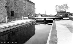
The river is the Kennet and this view shows the junction of the Kennet river (from low level bridge on the right) and the Kennet and Avon Canal (towards the locks straight ahead). The tributary to the left is towards the West Mills flour mill (water powered). The view is upstream (West).
A memory of Newbury by
Growing Up In The 1960's
We lived in Headon's Cottage, Fairy Cross - it had been an old German doctor's cottage in the 1700s, a Doctor Wacerill who is buried in St. Andrew's churchyard, and his faded plaque was still above the front door - walls made ...Read more
A memory of Alwington by
Critchlows Corner
The building in view was a Post Office and General Stores, the area was known as "Critchlows Corner" after the name of the family that owned the shop. The post office was the only one in the area. At the age of 10 I would cycle to the ...Read more
A memory of Blurton in 1963 by
The Rec!
Ah yes, The Rec! Scene of many a battle and many a cup final, in later years there was romance! You could get through the hedge and down onto the railway line to put halfpennies on the line that got flattened by trains as they ran over ...Read more
A memory of Little Sutton by
A Small Boys Paradise
Moving from Lewisham in London to Three Bridges in 1953 was wonderful. I was only 9 and we were, I believe, the first family in the Birches. We had the river mole with rainbow trout, horses, rabbits, all manner of wildlife and ...Read more
A memory of Crawley by
Captions
1,755 captions found. Showing results 1,249 to 1,272.
A little further downstream, just through the railway bridge, the view down river from the Staines bank has changed; now there is extensive housing development on both banks, much fortunately still hidden
In 1924, this compact little town had (and still has) its own town council.
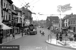
The Maidstone tramway system opened in 1904, but by 1930 had been replaced by buses and trolleybuses. Maidstone Bridge, which spans the River Medway, lies at the bottom of the hill.
The whole area shown in these two photographs vanished when the new bridge over the river and the new Churchill Road were built to ease congestion in the town centre in 1971.
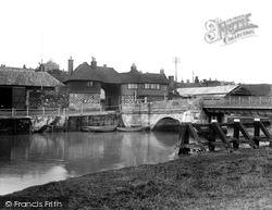
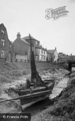
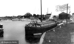
A fishing boat lies in the tidal section of the canal that linked it to the River Nene, which can be seen under Sluice Bridge.
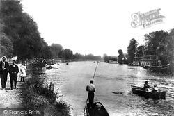
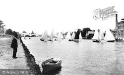
The river upstream from Kingston Bridge was largely free from commercial traffic, and consequently safer for yachtsmen.
The whole area shown in these two photographs vanished when the new bridge over the river and the new Churchill Road were built to ease congestion in the town centre in 1971.
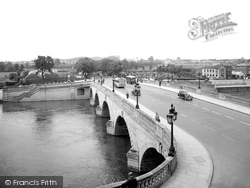
Note the Malvern Hills in the distance, and the tower of St John's Church, adding interest to this view of Worcester Bridge, which had been substantially widened just a few years before the picture was
With the removal of both the main shopping and administrative areas of Runcorn some miles away these photographs show a town that, in the last 40 years, has changed enormously.
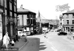
The bridge carries the Padiham road over Sabden Brook into the village.
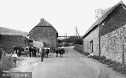
The view is northwards, towards Chideock, and the mixed herd of cattle - including long-horns - had crossed an ancient packhorse bridge on their way into the hamlet from the eastern pastures.
Ulverston's railway station, dating from 1878, is below the wall to the left - this view was taken from the railway bridge.
This photograph, taken from the east bank of the river, south of the Barley Mow pub, manages to exclude George Gilbert Scott's rather fine 1864 seven-arched brick bridge over the river.
As we look back towards Cookham from near the viewpoint of photograph No 77588 towards the bridge onto Odney, since rebuilt, the Thames is beyond the trees with its two channels.
This view of the basin from its entrance lock adjacent to the Trent, shows a nearby warehouse and the Crown Inn, now the Waterfront Inn, across the water.
It was also important in draining the nearby Isle of Axholme and the two steam pumping stations once controlled the river level.
In the early 19th century, the colliery at Brereton nearby was connected by rail to a wharf, which enabled coal to be transported along the Trent and Mersey canal.
Initially the village developed along a road constructed on a causeway across the marshes between the castle and a possible wharf near Bramber Bridge.
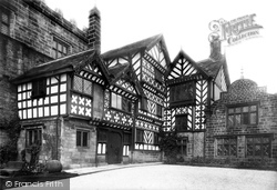
A comfortable Tudor farmhouse beside a 15th-century pele, Turton Tower is associated with Humphrey Chetham, remembered for the free library, school and hospital that he founded in Manchester.
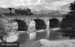
Built around 1840 to carry the London and North Western railway line north through Lancashire, this splendid six-arch bridge strides across the River Wyre just below Scorton Lakes.
Winter skaters used to risk their lives on the thin ice, and fishing from the bridge has long been a popular activity here.
It is separated from the enclosed village green by the Winn Brook, which is spanned by five little bridges before it reaches the Exe.
Go back into town and cross the Pulteney Bridge with its small shops into Argyle Street.
During the 13th century tolls were paid by those passing under the bridge as well as by those passing over it.
Places (17)
Photos (38)
Memories (1928)
Books (0)
Maps (520)


