Places
36 places found.
Did you mean: street or streetly ?
Those places high-lighted have photos. All locations may have maps, books and memories.
- Heathfield, Sussex (near Cade Street)
- Street, Somerset
- Chester-Le-Street, Durham
- Adwick Le Street, Yorkshire
- Scotch Street, County Armagh
- Friday Street, Surrey
- Potter Street, Essex
- Boughton Street, Kent
- Newgate Street, Hertfordshire
- Streetly, West Midlands
- Shalmsford Street, Kent
- Green Street Green, Greater London
- Boreham Street, Sussex
- Park Street, Hertfordshire
- Cade Street, Sussex
- Appleton-le-Street, Yorkshire
- Hare Street, Hertfordshire (near Buntingford)
- Romney Street, Kent
- Trimley Lower Street, Suffolk
- Streetly End, Cambridgeshire
- Hare Street, Hertfordshire (near Stevenage)
- Brandish Street, Somerset
- Colney Street, Hertfordshire
- Langley Street, Norfolk
- Silver Street, Somerset (near Street)
- Street, Yorkshire (near Glaisdale)
- Street, Lancashire
- Street, Devon
- Street, Cumbria (near Orton)
- Street, Somerset (near Chard)
- Bird Street, Suffolk
- Black Street, Suffolk
- Ash Street, Suffolk
- Broad Street, Wiltshire
- Brome Street, Suffolk
- Penn Street, Buckinghamshire
Photos
24,921 photos found. Showing results 4,061 to 4,080.


Your search returned a large number of results. Please try to refine your search further.
Maps
1,622 maps found.
Books
3 books found. Showing results 4,873 to 3.
Memories
6,667 memories found. Showing results 2,031 to 2,040.
Speed
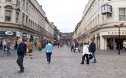
In relation to Reform Street and the city square on Friday/Saturday nights. We boys and our latest girlfriends (only if you had a car) used to meet and have a drag race either up Reform Street and back or a race from city square out under the ...Read more
A memory of Dundee in 1966 by
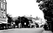
Church Street Weybridge
This is a view looking toward the High Street - what looks like two brick memorials (on the left) is the entrance to the cottage hospital. On the opposite side of the road is the bus stop where I use to catch the bus to ...Read more
A memory of Weybridge in 1965 by
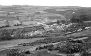
Torrington Fondly Remembered
I have a lot of memories, some good some not so good. I arrived in Torrington employed as a fireman by British Rail, this was a year or two before the demise of steam and indeed the Torrington /Barnstable branch ...Read more
A memory of Taddiport in 1959 by
The Gayways Pop Band Venue,Northampon
Does anyone remember the Gayways club in Northampton, High Street? I used to go there to see pop bands like Dave Dee, the Hollies and numerous other rock and pop groups! It had nothing to do with actually ...Read more
A memory of Northampton in 1967 by
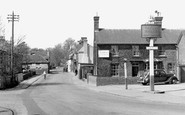
Borough Cottages 1, 2, 3 And 4 And Borough Farm On Bolford Street
I am currently trying to research into the history of our home. It is now called 'The Borough' and is located at the bottom of the hill on Bolford Street towards Cutler's Green, ...Read more
A memory of Thaxted by
The War Memorial.
Just a few years after this photograph was taken they moved the war memorial to the junction of Theobald Street and Shenley Road; almost to the spot where this photographer was standing. I was a cub scout with our meeting room ...Read more
A memory of Borehamwood by
School Days
I lived in the High Street in Ferndale from 1948 to 1961, my parents had a grocery/cafe next door to Margaratelli's fish shop. They were good years and I have lots of great memories. Ann Rasmussen, Marilyn Coopey and myself went to ...Read more
A memory of Ferndale in 1953 by
Living In Brentford In The 50's & 60's.
Hi my name is Barbara Ottewill (Nee Hutchinson). I have just had a very enjoyable walk down memory lane by reading articles about growing up in Brentford, written by Alf Winkworth, Eunice Burridge and Pat ...Read more
A memory of Brentford by
Hett Hills
I lived at what is now Old County View at Hett Hills from 1959 to 1963. My sister and her husband - Sam Wears, had a house built in the garden next door to us. There was a square of about 6 houses behind us which were demolished ...Read more
A memory of Hett Hills in 1959 by
My Early Chidhood
I was born at 32 Pisgah Road which was the bottom end cottage of a row of three opposite Pisgah Chapel. The cottages had no back entrances. There was a pathway running in front of the three cottages with an outside toilet ...Read more
A memory of Talywain in 1945 by
Captions
5,435 captions found. Showing results 4,873 to 4,896.

The street lighting by the chemist was a new innovation, only introduced in 1900 after the generating station opened in Commercial Road.

It is possible, though, that the actual Ravern Tavern was located in Southgate Street.

The parish church of St Peter, with its solid flintstone tower dominating the high street shops and mid-morning traffic in this picture, was originally built by the Normans alongside the spacious

The wide High Street gave Broadway its name; the road was built to cover two streams that flow either side of the old road.

Presumably, however, the Star was able to benefit from the railways too, with Foregate Street Station being just across the road.

In this High Street view there is a dairy, Preston's Library (where you could borrow a novel to enjoy whilst lounging in your deckchair), and a branch of International Stores, which quickly saw off old-style

Here we see Eccles Town Hall in Church Street; at this time it was still its own master, but threatened with take-over even then by big brother Salford.

But no one would dare leave a hand cart in the middle of the street today, as these children have!

Traffic is still sparse in the town's main shopping street, but parking regulations (different sides on alternate days) were in force.

Beaumont Street is named after the family of Viscount Allendale; here stands the great Abbey Church of St Andrew that makes Hexham important.

By this time New Street had been diverted behind the building and Church Close created.

Looking back towards Boutport Street in 1903, Brook's is still a cafe. It became Bromley's Restaurant in the 1940s until it closed at the end of the 1960s.

The workaday appearance of the street shows how it had been overtaken by the success of the resort.

We are looking from Market Square south-east into Walton Street. The Bell had been reworked in 1919, and is still much the same.

Wide streets denote a planned town. The main drainage scheme at St Anne's was inaugurated by William J Porritt on 18 August 1892; the first sod was cut with a silver and ebony spade.

Looking down the main street, we see the old post office (right), now two cottages. The new post office is in the Bull Inn, to the right, next to the tin-roofed church of St Thomas.

The town was laid out north and west of the Abbey precincts, with the Market Place at the junction of High, Magdalen, Benedict and North Load Streets.

The George Hotel, top left, spans the entrance to the Market Arcade in Devonshire Street. It led into a covered market built between 1860 and 1866, a venue much used for meetings and entertainment.

Attempts to make amends include pedestrianising the High Street, but many of the buildings seen in this view, particularly on the left- hand side, have gone, including the 1880s Barclays Bank

There are excellent parking facilities for vehicles in this part of the High Street.

This village comprises little more than this cluster of charming cottages just off Watling Street, but it has associations with two noted authors.

The High Street turns north, and it and the town end abruptly at the River Great Ouse, which flows through meadows liable to flooding.

The broad verges and continuous avenue of trees bring green, open space to the High Street and make it an attractive place to explore.

The village has been given a sweeping bypass, Broughton Way, on its north side, reducing the volume of traffic negotiating Main Street and the area around St Mary's Church and Old Mill
Places (385)
Photos (24921)
Memories (6667)
Books (3)
Maps (1622)

