Merry Christmas & Happy New Year!
Christmas Deliveries: If you placed an order on or before midday on Friday 19th December for Christmas delivery it was despatched before the Royal Mail or Parcel Force deadline and therefore should be received in time for Christmas. Orders placed after midday on Friday 19th December will be delivered in the New Year.
Please Note: Our offices and factory are now closed until Monday 5th January when we will be pleased to deal with any queries that have arisen during the holiday period.
During the holiday our Gift Cards may still be ordered for any last minute orders and will be sent automatically by email direct to your recipient - see here: Gift Cards
Places
36 places found.
Those places high-lighted have photos. All locations may have maps, books and memories.
- North Walsham, Norfolk
- North Berwick, Lothian
- North Chingford, Greater London
- Harrogate, Yorkshire
- Whitby, Yorkshire
- Filey, Yorkshire
- Knaresborough, Yorkshire
- Scarborough, Yorkshire
- Clevedon, Avon
- Weston-super-Mare, Avon
- Richmond, Yorkshire
- Selby, Yorkshire
- Ripon, Yorkshire
- Scunthorpe, Humberside
- Pickering, Yorkshire
- Settle, Yorkshire
- Skipton, Yorkshire
- Saltburn-By-The-Sea, Cleveland
- Norton-on-Derwent, Yorkshire
- Rhyl, Clwyd
- Chester, Cheshire
- Llandudno, Clwyd
- Grimsby, Humberside
- Durham, Durham
- Nailsea, Avon
- Southport, Merseyside
- Brigg, Humberside
- Colwyn Bay, Clwyd
- Redcar, Cleveland
- Bath, Avon
- Grange-Over-Sands, Cumbria
- Cleethorpes, Humberside
- Sedbergh, Cumbria
- Barrow-In-Furness, Cumbria
- Barmouth, Gwynedd
- Dolgellau, Gwynedd
Photos
2,570 photos found. Showing results 1,581 to 1,600.
Maps
9,439 maps found.
Books
Sorry, no books were found that related to your search.
Memories
1,550 memories found. Showing results 791 to 800.
Bristol City Docks The History
Bristol's great heritage started from humble beginnings. An Anglo-Saxon settlement by the name of Brigstowe steadily grew into a thriving port. After the Norman invasion of 1066, a castle was built in what is now known ...Read more
A memory of Bristol by
Bassetts Farm
I am an American, but back in the autumn of 1971 - during my 18 months of travel around Europe and North Africa - I spent three months working and living at Bassetts Farm, owned by the Pemble family. Thirty-eight years later it ...Read more
A memory of Horsmonden by
Bristol, High Street And The Blitz 1940
Bristol's High Street scene of many strirring events in Bristol's history the heart of the city was destroyed and lost forever in 1940. As a city with docks and industry at its heart, Bristol was a natural ...Read more
A memory of Bristol in 1940 by
Born At Cothill Farm And Schooled In Duns
I was born at Cothill Farm in 1947, about 4 miles from Duns. I attended Duns Primary School and Berwickshire High School. My father (James) retired in 1965 at age 70, he and my mother located to the west coast ...Read more
A memory of Duns in 1965 by
Fastest Ferret Gets Guinness World Record
On 11 July 1999, At the North of England Ferret Racing Championships held in Blythe, Northumberland, UK, an Albino Ferret called 'WARHOL' owned by Jacqui Adams of CHIRNSIDE, Berwickshire, ran the 32ft Tube ...Read more
A memory of Chirnside in 1999 by
Heather And Gorse Clog Dancers Entertain In Totnes
Tuesday 11th December was a frosty clear night but the crowds of late night Christmas shoppers filled Totnes town centre to enjoy the candlelight, carol singers, buskers and stalls lining both sides ...Read more
A memory of Totnes in 2007 by
Roadhouse Family Pre 1840
I have never had the pleasure of visiting Monk Fryston but my eldest son Brett did while he was in school here in Canada. He was part of the Harrogate Music Festival in the 80's. Dear friends, Pam & Harry Roebuck of ...Read more
A memory of Monk Fryston by
Ollerton By The Sea
my family moved to ollerton in september of 1957,from ushaw moor near durham.the move had been delayed by the birth 5 weeks earlier of my sister patricia,she arrived on my birthday,so the children of the family had had to stay ...Read more
A memory of Ollerton in 1957 by
Houseboats In The Picture Of Bursledon Bridge
In the photo are several houseboats and yachts moored up to the bank on the LHS of the picture, which was 'Deacon's Boat Yard' (no relation to me!). I lived on the large white motor torpedo boat (when ...Read more
A memory of Bursledon in 1974 by
The 1960s
I lived my early years here, until the 1970's, having been born in Wells and brought home to Cheddar as a baby. I have many family ancestral links to Cheddar via my father's parents. In the late 1800's-early 1900's my great-grandfather John ...Read more
A memory of Cheddar by
Captions
2,645 captions found. Showing results 1,897 to 1,920.
All the way north from Burnham to Brean Down, the six miles of road behind the sand dunes and beaches has a string of bungalows, chalets, shops, caravan parks, amusement parks and holiday camps, as well
On 18 July 1844 the London and North Western Railway Company began work to extend the railway from Lancaster to Carlisle.
Much of 18th-century Stamford's trade came from its location on the Great North Road, and it had numerous coaching inns.
Heading north-west roughly parallel to the River Witham, we reach two small towns on either side of the River Bain, which meets the Witham a mile away at Dogdyke.
North Walsham has a long history as a weaving town producing a lightweight cloth; there were also foundries here manufacturing farming machinery and implements, which were sold all over the area from farming
In the distance is the broad concrete bridge installed in 1927-28 carrying the four-lane by-pass south to Belmont and north towards London.
Many people visit the Black Boy Inn, which has expansive views northwards across the vale towards North Marston.
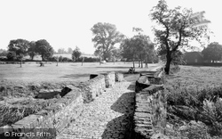
This was the original roadway into the village, now reduced in stature to a footpath, as the road now crosses the water to its north. This is a rather romantic monument to the past.
William Ransom, born in 1826 in the house at the north end of Bancroft, studied at Isaac Brown's Quaker Academy at the Triangle, Hitchin.
Much of Borth consists of a single street with houses on both sides that gradually spread between the railway station at the north end of the village to a group of fishermen's houses built in the lee of
This picture was taken eastwards from the north side of East Street, from Mrs Alice E Gale's musical instrument emporium and fancy repository on the corner with Barrack Street (left).
This view is from the Buckinghamshire bank, looking north from the A4 Bath Road immediately east of the bridge.
Tall yew hedges grow along the north and west paths, creating its distinctive look.
Turton Tower lies four miles south of Darwen, and four miles north-east of Bolton.The villages of Turton and Turton Bottoms are next to the Tower.Turton Tower is basically two buildings, a pele
The nave, and the north aisle with its cat-slide roof, were restored in 1891, but are originally of the 15th century. The vicar in 1906 was the Rev Arthur Pannell.
Dean Row chapel is one of a series of very similar Dissenter chapels built in North East Cheshire soon after the 1688 Toleration Act, testimony to the strong Nonconformist tradition that had developed
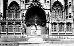
Judgement, the south porch of Lincoln Cathedral led into the richly carved Angel Choir, the east arm of the cathedral built for St Hugh's shrine; it was probably used by pilgrims, who would leave by the north
On the north side of St Paul's Square is the old corn exchange, an uncompromising Victorian building whose foundation stone was laid in October 1872.
This view is from Harnham Hill, looking north eastwards across the Avon and an area of farmland which is just beginning to become built-up as the suburb of Harnham.
Holy Trinity is in North Tidworth, the centre of the civilian area. A small 13th-century building, Holy Trinity is rather hidden away, but it is the village's jewel.
The market town of Bedale is a few miles to the north-east of Masham.
The Square or old Market Place of Elham adjoins the church yard on the north side, and a weekly market was held here until the 18th century.
In 1896 the Liverpool & North Wales Steamship Co introduced a summer service from Llandudno.
This pleasant market town lies just inland from the chalets and caravans of the 'honky-tonk' north coast between Rhyl and Colwyn Bay.
Places (9301)
Photos (2570)
Memories (1550)
Books (0)
Maps (9439)


