Places
5 places found.
Those places high-lighted have photos. All locations may have maps, books and memories.
Photos
9 photos found. Showing results 41 to 9.
Maps
28 maps found.
Books
1 books found. Showing results 49 to 1.
Memories
192 memories found. Showing results 21 to 30.
Triggered A Few More Memories
Waterloo in the 1940s to 1950s My early memories are of Waterloo where I used to live at Winchester Avenue until 1958. My father died there in 1989. On College Road there were air raid shelters which me and ...Read more
A memory of Waterloo by
Peartree Close
I was born in Burgess Hill in 1955 and lived at 18 Peartree Close. There was a rough track behind the house with rear access to garages, and we spent loads of time playing up and down this track and in the woods beyond. I used ...Read more
A memory of Burgess Hill in 1955 by
A Day At The Seaside Littlehampton C 1955
I cannot remember how old I was when we started going to the south coast of England for a Sunday trip, but it was when my father sold his Norton motorbike and bought a Golden Flash with a sidecar ...Read more
A memory of Littlehampton in 1955 by
Childhood In Benham Valence
It was in April 1950 that I was born in the Victorian wing of Benham Valence - actually in the flat above the garages - a very primitive dwelling with no bathroom or indoor toilet. Unfortunately the whole wing was ...Read more
A memory of Benham Park in 1950 by
Dunsmore People And Happenings Remembered
PREFACE TO THE SECOND EDITION In 1995, when the first edition of this history was published, it seemed incredibly optimistic to have had three hundred copies printed for a market which was ...Read more
A memory of Dunsmore by
Wonderful Memories Growing Up In Bassaleg
I lived in Bassaleg from the age of 3, (1955), when Church Crescent and surrounding area was being developed. I lived in Church Crescent with my family until I left for Manchester in 1976. I went to the ...Read more
A memory of Bassaleg in 1966 by
Some Childhood Years In Sorbie 1932 T0 1937
The family moved from Reay in Caithness to Sorbie in 1932 - I was 2 years old and had a sister who was 12 years old and a brother, 10 years old, so there was a huge difference in ages and I was brought up as ...Read more
A memory of Sorbie in 1930 by
Wartime Camp At Horton Chapel
I was a child living in a large house next to the river at Horton Chapel adjacent to a bridge. In the Second World War in 1944 prior to Normandy, a squadron of Canadian Engineers camped next to the river and built a ...Read more
A memory of Chartham in 1944 by
The Raf Estate
We lived on the RAF estate in Ickenham during the late 1950s, in a semi-detached house at 14 Nettleton Road. Every RAF home mirrored the next; their furnishings were also identical. You could move from Scotland to England (which we had ...Read more
A memory of Ickenham in 1957 by
Fair Green
I lived in that stange area of Mitcham known as Lonesome, situated between the level crossing at Eastfields and the bottom of Streatham Vale. It was a sort of 'No Man's Land'. My schooling from 1951- 1957 took place first at the wooden ...Read more
A memory of Mitcham in 1958 by
Captions
98 captions found. Showing results 49 to 72.
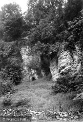
Billy Banks Wood, prominent in views from Castle Walk, is ancient 'hanging' woodland clinging to limestone rock on the south bank of the River Swale just west of Richmond Castle.
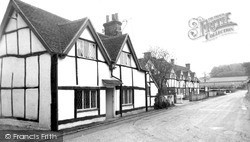
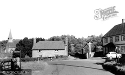
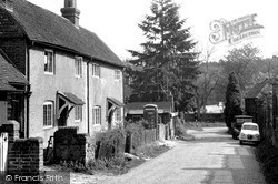
On the lane south from the crossroads the last two houses on the left are timber-framed, the White Cottage on the left with original framing in the side elevation and fake to the front.
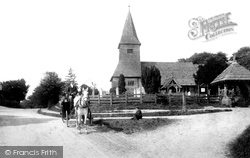
The church of St Peter, with its 14th-century tower made entirely of wood and supported inside by a framework of huge oak timbers, also has a 13th-century chancel and a south aisle added a hundred years
Now merged with Dorking, North Holmwood is one of three small villages along the west side of the large and mostly wooded Holmwood Common - the other two villages are Mid Holmwood and South
Billy Banks Wood, prominent in views from Castle Walk, is ancient 'hanging' woodland clinging to limestone rock on the south bank of the River Swale just west of Richmond Castle.
South of the A39, we climb from lush pastures towards Exmoor and the well-wooded Holnicote Estate and Dunkery Hill, much of which are owned by the National Trust.
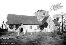
The south side of St Margaret`s Church is seen looking across the churchyard from Church Lane.
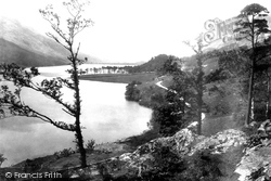
We are looking south from Lower Gatesgarth.The pines of Crag Wood are prominent in the centre of the photograph, while the slopes of Dodd sweep up the lake shore beyond.
Prickend marks the end of one expanse of land that stretches from Petts Wood in the south and to Summer Hill in the west.
At intervals on Severn Side, both north and south, steps leading from the sandstone quays were constructed.
Nestled in the rear slopes of the North Downs, the village derives its ancient name from the Saxon word 'wudmeresthorn', meaning 'thornbush by the boundary of the wood', and was mentioned in the Domesday
Now around to the south-west side of Glastonbury, where Wearyall Hill lies between the town and the river Brue. The name is a corruption of 'Wirral Hill', a deer-park established by the Abbots.
Farley Green is situated towards the south end of Albury parish, and its fields are carved out of the surrounding greensand woods.
South of Farnham, on the greensand heathland, there are two famous and immensely popular lakes, Frensham Great Pond and Frensham Little Pond.
Moving on north from Dunsfold, we come to Hascombe, a most attractive and tranquil village set in a curving wooded valley in the greensand hills.
The Frith photographer's desire to take views of post offices has led him to ignore the beautifully-situated village centre around its green and also the good 1879 church, designed, built and
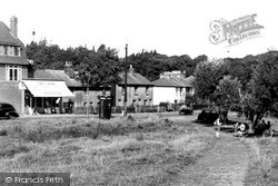
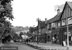
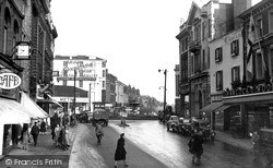
Hancock & Wood and Roberts shoe shop are almost all that remain of this 1950s scene.
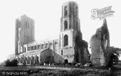
The ruin on the south-east of the church was the abbey's chapter house. Never fully completed, the west tower is 142ft 6ins high; the north porch has a groined roof with well-carved bosses.
The Heath, extending from Kenwood House in the north to an area around Parliament Hill in the south, occupies some 800 acres; it has been popular with artists and authors (and the Gordon Rioters) since
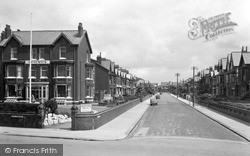
We are standing in South Promenade, with the Chadwick Hotel on the corner. Lightburn Avenue was named after the second lighthouse at St Anne's.
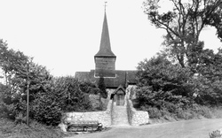
It is rumoured that the timbers supporting the belfry came from ships of the Armada, but they are more likely to have grown in the nearby woods. The chancel and south aisle were added later.
In 1672, following the Declaration of Indulgence, licences to preach in Dorking were issued to James Fisher and John Wood, who formed the Independent Congregational Church.
The tower was thought to date from the 12th century, but repairs in the winter of 1994 revealed a much earlier window, dating from about AD 980, in the south wall of the ringing chamber on the second
The statue of John Cobden can been seen in the middle of the square: this bronze statue, by Marshall Wood, was paid for by public subscription and was presented to the town on 23 April 1867 by the President
Places (5)
Photos (9)
Memories (192)
Books (1)
Maps (28)


