Places
26 places found.
Those places high-lighted have photos. All locations may have maps, books and memories.
- Cemmaes Road, Powys
- Six Road Ends, County Down
- Road Weedon, Northamptonshire
- Severn Road Bridge, Gloucestershire
- Roade, Northamptonshire
- Berkeley Road, Gloucestershire
- Harling Road, Norfolk
- Road Green, Devon
- Builth Road, Powys
- Cross Roads, Yorkshire
- Steele Road, Borders
- Cross Roads, Devon
- Four Roads, Dyfed
- Road Green, Norfolk
- Biggar Road, Strathclyde
- Clarbeston Road, Dyfed
- Five Roads, Dyfed
- Eccles Road, Norfolk
- Grampound Road, Cornwall
- Morchard Road, Devon
- Wood Road, Greater Manchester
- Four Roads, Isle of Man
- St Columb Road, Cornwall
- Clipiau, Gwynedd (near Cemmaes Road)
- New Road Side, Yorkshire (near Silsden)
- New Road Side, Yorkshire (near Cleckheaton)
Photos
14,329 photos found. Showing results 521 to 540.
Maps
476 maps found.
Books
5 books found. Showing results 625 to 5.
Memories
11,058 memories found. Showing results 261 to 270.
Aust Farm
I was born in Aust Farm in 1952 as it was my mother's home. It was on the road to Black Rock and my grandfather farmed the fields up to the river. I think the farm's name has changed now. My mum was Winifred Watkins and married my dad ...Read more
A memory of Portskewett by
Hainton
I hope, I think I am the first to write - I lived in Hainton 1951/54. Our dad worked on the farm just up the road (Stockman). I went to the little school in Hainton. Headmistress - Mrs Slingsby. Do not remember her deputy, but Miss Officer ...Read more
A memory of Hainton by
Bluebells
My godmother and her parents lived 'forever' at Gravel Road, just up from the small shop on the Park Avenue end. With a marvellous garden of flowers, fruit and poultry; a walkway tunnel of Quince, a black & white tiled pathway to ...Read more
A memory of Farnborough in 1950 by
The King And Queen Visit Queen's Road
Some time soon after the Second World War, with our next door neighbours, we walked down to Queen's Road to watch the King and Queen drive by. We stood near Evan Cook's Depository. I assume that their Majesties ...Read more
A memory of Peckham in 1946 by
College Road
Whilst staying with my Grandparents (Weekes) of College Road, I liked to play down the bottom of the road with my friends (I was about 8 years of age at this time) - playing steppy stones in the mud of the river - a very dangerous thing ...Read more
A memory of Northfleet in 1950 by
Special Memories Pier And Baths
When I was 9 we lived in a new block of flats (at that time) opposite the Pier and just across the road from the baths. I used to walk to Stanwell Rd School through the Park which was always beautiful. I actually never ...Read more
A memory of Penarth by
John Mansfield School In 70's
Hi my name is Maria I went to John Mansfield School Lived Dogsthorpe road. Love to hear from you if you were there? :)
A memory of Peterborough by
The Barbary's Denby Rd
Hi I have just been given a batch of school reports belonging to my mother Patricia Barbary. Two reports are from Hearnville Road school 1949 & 1952. The rest is when she attended The Rosa Bassett School, Streatham. ...Read more
A memory of Balham by
Barnett Family
Hi, just trying to find out more information on my family - mother was Edna Barnett, who was the youngest child of Fred and Catherine (Cass) Barnett who lived on Trealaw Road. Mum was the youngest of 9 surviving children with her eldest ...Read more
A memory of Trealaw by
Error And My Memory/Memories Of Sonning Common...
Not sure if it is an error, but 'Brinnds Corner' is spelt 'B-R-I-N-D-S C-O-R-N-E-R' after the butchers shop, (now an off-licence), on the corner of Peppard Road/Wood Lane and Brinds Close which was ...Read more
A memory of Sonning Common by
Your search returned a large number of results. Please try to refine your search further.
Captions
5,036 captions found. Showing results 625 to 648.
We are looking north along Wallasey Village, with the bollards at the top of Leasowe Road visible on the left. The cobbled street to the immediate left, just beyond the chemists, is Lycette Road.
She paid for a water pipeline to be laid from a spring near Sarn to a water tap on the corner of Derwen Road and Court Road.
Climbing westwards, the Taunton to Barnstaple road crosses the well-treed and young River Tone Valley at Waterrow.
The road to London passes through The Green, which was preserved by the 1810 Act of Parliament that enclosed the rest of the former common land of the parish for agriculture.
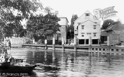
Originally, the road crossed a bridge to its left, but since 1832 the present superb suspension bridge has taken the road to the right, allowing the hotel to steadily expand towards the western
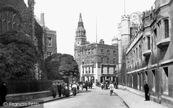
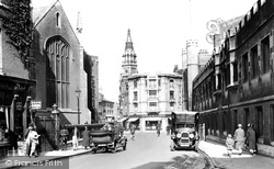
On the right-hand side of the road is First Court, the entrance to Christ's College, founded in 1505 by Lady Margaret Beaufort, mother of Henry VII.
On the right hand side of the road is First Court, the entrance to Christ's College, founded in 1505 by Lady Margaret Beaufort, mother of Henry VII.
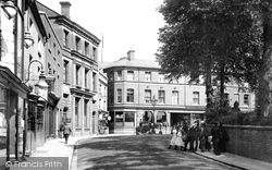
This view of the unpaved main crossroads at the junction of the High Street and Waterloo Road gives a clear impression of the original narrowness of the eastern section of the thoroughfare, with the old
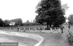
The large shelter and the Jubilee fountain replaced the grand wrought iron gates of Torbay House as the focal point of Torbay Road.
Opened in 1928, it replaced a previous Fortune of War (now a printer's on the Billericay road), which had itself been founded, supposedly, by a soldier returning from the Napoleonic Wars.
The road to the left leads to the pub, the school, the village hall and the church, and the road to the right to Sedgebrook and the A52 to Nottingham.
In the era of the stage coach, the George Hotel was classed as the best hotel on the Great North Road, and it is still one of the best in the area.
Further west, the High Street meets Abingdon Road (right) and Steventon Road (left) in a small green.
We look eastwards down Church Street from the Main Road on the south side of the Talbot Arms and Doon Beg (far left).
All the buildings have been demolished on that side, and the road curving round (Buckwell Street) is now a cul-de-sac.
Further north, at the A245 Parvis Road junction, the photographer looks back down High Road with Lloyds TSB on the left and the Dutch-gabled fire station of 1885 on the right, complete with its siren
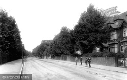
This view, along the Portsmouth Road, formerly the A3, shows the late Victorian expansion of Kingston past Surbiton.
This view was taken at the crossroads of Woodfield Road, Barnett Wood Lane and Craddocks Parade, the 1930s three- storey flats over shops.
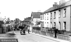
Extra road traffic has also made the road outside the busy village stores and post office (just to the left of the car) a frequent bottleneck.
This photograph was taken a century ago, and a world away from the same road today, which seems at times like a public motor-racing circuit - it is now part of the Ashford ring road.
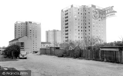
Boundary Street was still a rough road when these flats were new. Today the flats` distinctive roofline has been renewed; the approach road is metalled now, and there are houses to the left.
From further up Bear Street we see what was demolished to allow the new road through. Beyond the bow windows is now mechanised mayhem.
It sits beside the old Roman road of Watling Street, and later benefited from toll-roads and railways.
Winifred Holtby lived in this road while she was writing her novel 'South Riding'.
Places (26)
Photos (14329)
Memories (11058)
Books (5)
Maps (476)


