Places
2 places found.
Those places high-lighted have photos. All locations may have maps, books and memories.
Photos
11 photos found. Showing results 101 to 11.
Maps
10 maps found.
Books
Sorry, no books were found that related to your search.
Memories
102 memories found. Showing results 51 to 60.
Watchfield/Naafi/Aerodrome Notes
This was the NAAFI shop that served the military quarters at Watchfield, which housed the then many miltary and civilian staff of the Royal Military College of Science, and some of the students at the college, many ...Read more
A memory of Watchfield by
Memories Of Greenford
My parents home was in Costons Avenue in Greenford, I was born there in 1937 and lived there for 30 years. The rear of our house looked out to trees which grew on the boundary of Perivale Park some eighty yards away across the ...Read more
A memory of Greenford by
Childhood
My Mum, Dad and I moved to the new council houses in Boundaries Road (built on a bombsite) in 1957 when I was 1 year old, so obviously my first memories are of Balham. Dad went to work and Mum and I went shopping every day. These are some of ...Read more
A memory of Balham by
Growing Up In Selsdon
I was 9 when we returned from Australia in the summer of 1967, we lived at 37 Farley Road after three different houses in Littleheath Road all belonging to friends of my parents, who conveniently were away on holiday by consecutive ...Read more
A memory of Selsdon by
A Grand Opening
We lived briefly in Ferndale Crescent (nr 35). This was defined as Uxbridge then but the boundaries were never quite clear and have become even more blurred with the march of time. It must have been around '57 when we moved in and the ...Read more
A memory of Cowley in 1957 by
Home
I was born on this road in 1957 at number 21 and well remember it looking like this for years as my friends and I grew up here. There were no hedges, or very few then, and I still remember the concrete posts with two strands of galvanised ...Read more
A memory of Killamarsh in 1960 by
Memories Of Edmonton
I grew up in Park Avenue, Edmonton near Pymms Park. My gran and grandad Bert and Dolly Uff owned the "oil shop" at 247 Fore Street and my sister Ginny and I used to help out in the shop on Saturdays and in the school holidays. ...Read more
A memory of Edmonton by
The White House
My parents bought the White House - a thatched terrace of 6 cottages in the Main Street opposite 'Thatchers' Shop. I believe I only lived in this village for about three years between the age of 7 and 10. The 'White House' had a ...Read more
A memory of Owslebury in 1957 by
Fifties And Sixties
we moved into Boundary close 1954. I remember a huge storm 1955 when the Norwood Road was flooded in front of willesdon dairies from where we used to get our milk. Using the swings on the Green which was flanked ...Read more
A memory of Norwood Green in 1961 by
Stretford, Barkway Road.
I loved living in Stretfrod, although I lived at the other end of Stretford, on the Urmston boundary. I can remember those days very well. My mum had an account at Cromptons grocery shop, where she would get most of her ...Read more
A memory of Stretford in 1958 by
Captions
233 captions found. Showing results 121 to 144.
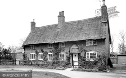
This is an almost ideal two- storey chocolate box cottage, with its thatched roof and door hood, small pane timber casement windows, and a profusion of flowers and creepers adorning the boundary
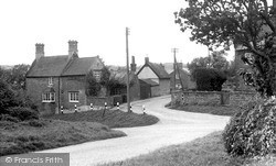
Close to the Warwickshire county boundary and its near neighbour Lower Boddington, Upper Boddington has changed a good deal since this photograph was taken.
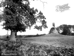
Most of the Long Walk, including the Copper Horse, is within the boundary fence of a Deer Enclosure.
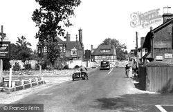
It continued to develop in the 20th century, establishing itself as a convenient and popular inland resort within the boundaries of the New Forest.
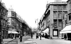
Looking north from New Bond Street, this late 19th-century view captures well the quality of Milsom Street, one of the earlier streets laid out beyond the boundaries of the original walled town.
The Swan pub dates from the 1870s and, apart from the loss of the boundary wall and railings, remains, as do the cottages.
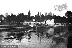
At one time the abbey boundary wall stood along the river bank.
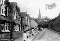
The spire of St Mary's church soars above the town, and to the right is the boundary wall of Petworth Park, the great mansion built by the Duke of Somerset towards the end of the 17th century.
The River Welland is the boundary between it and Northamptonshire.
Fluctuating Lancashire and Yorkshire boundaries have confused and annoyed villagers.
Across the Colne the main road to Pinner reaches Batchworth Heath, just before the old Middlesex county boundary.
Nestled in the rear slopes of the North Downs, the village derives its ancient name from the Saxon word 'wudmeresthorn', meaning 'thornbush by the boundary of the wood', and was mentioned in the Domesday
Blacko Tower (just visible on the top of the hill), marking the boundary of Pendle Forest, was built by Jonathan Stansfield in 1891.
Barnoldswick is pronounced 'Barlick' by the locals.This is another village that has moved with boundary changes.
Nork is a suburb that merges south into Burgh Heath in the large triangle between Reigate Road, Brighton Road and Fir Tree Road, the north boundary of Nork.
As the River Frome marked the boundary, the Red Lion was once in Minchinhampton parish, and the locals took advantage of the different pub closing time!
does the ancient 'Jurassic Trackway' run on a north-south line to the east of the village towards Tilton-on-the Hill, but a Neolithic road from Leicester, eastwards towards Ingarsby, skirts the northern boundary
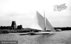
Little remains of the Benedictine Abbey except this gateway, though traces can be found of the foundations (known by marshmen as groundsels) of the boundary wall and of a cruciform church.
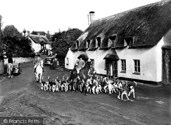
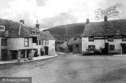
The boundary walls on the left are in Blue Lias rubble stone left unpainted, while the lean-to at the left of Manor Cottage behind the huntsman has its rubble thickly limewashed.
Charlwood was in Surrey until the 1970s administrative boundary changes.
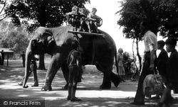
She was looked after by an Indian mahout, and in those days, before the zoo had the proper boundary fences that it has today, he was regularly to be seen taking Molly for walks in the
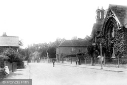
Here are buildings of the second half of the 19th century, with an object lesson to be observed in the treatment of boundary walls and railings - all neat and carefully designed.
It is an ideal centre for exploring the Isle of Purbeck, and there is much of interest within the village boundary.
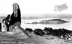
The nearby vil- lage of Kingsand still has a stone showing where the boundary used to lie.
Places (2)
Photos (11)
Memories (102)
Books (0)
Maps (10)


