Places
6 places found.
Those places high-lighted have photos. All locations may have maps, books and memories.
Photos
25 photos found. Showing results 1 to 20.


Maps
20 maps found.


Books
Sorry, no books were found that related to your search.
Memories
382 memories found. Showing results 1 to 10.
Personal Reflections
I was born in Sandleaze, Worton in 1957. I was brought up at 1 Mill Road near the Marston boundary. I remember many things about the village especially the Rose and Crown Pub and the Mill. I remember with pride the ...Read more
A memory of Worton by
Living In Queens Avenue And Going To School
I was three when we moved to Muswell Hill in 1951. My parents had both been in the forces and it was difficult to find accommodation for a family. My grandmother knew a Mr. Wood, he was a judge. His ...Read more
A memory of Muswell Hill in 1953 by
Happy Childhood
I lived with my grandma Elizabeth (Lizzie) Bignell at No 10 Ten Cottages from 1943 to around 1948. The houses were Estate owned (and still are) and my grandad Robert Bignell worked at the manor house first as a shepherd and ...Read more
A memory of Wormleighton in 1946 by
Early Memories
My birth on 30 Nov 1946 at 34 Oldberry Road, Burnt Oak, is where it all started for me, but my mother & her parents moved into the house when it was built for the LCC. She's 89 now, but recalls that she, as a 9-yr-old in 1928, ...Read more
A memory of Burnt Oak in 1946 by
Happy Times
As children we were very priviliged to be part of the village community. We spent many carefree hours playing and making camps in the woods and fields, sometimes we would venture further but had to keep a watchful eye for the ...Read more
A memory of Turners Hill in 1965 by
The Slate Islands Easdale
THE SLATE ISLANDS By Walter Deas Some 24k (15 miles) south and west of Oban lies an area with interesting old ...Read more
A memory of Easdale in 2005 by
Hilly Fields
Situated at the top of our road, as young children Hilly Fields was something quite magical. During winter time we would trek our home made sledges over to toboggan hill and hurtle down to the brook at the bottom of the hill at ...Read more
A memory of Enfield in 1950 by

Number 2 Montague Terrace
Barbara Brian. I loved reading your memories of Montague Terrace and I thank you for them. Were you the young Miss Andrews that rode that posh bicycle and lived behind the shop and did your dad at times teach tap ...Read more
A memory of Bishopstoke in 1930 by
Mill Street Clowne. 1950
The gentleman pushing a cart in the foreground of this picture is my grandfather, Ernest Pearce (1895-1970). The cart was used to transport bundles of sticks that he cut for sale as firewood. They were sold for 4d a bundle. ...Read more
A memory of Clowne in 1950 by
Madeley As It Was
I was born in 1949 in Victoria Road, Madeley and have many memories of life as it was in the 1950's onwards. I remember Jones' buses, Pooles the cobblers, Carters, Stodd's the Drapers, Shums the chemist, and most ...Read more
A memory of Madeley in 1949 by
Captions
50 captions found. Showing results 1 to 24.
The land was previously part of the Greenhead Hall estate. The new park boasted two lakes, one of which is now a rose garden.

As early as 1869 he called a public meeting to win support for the acquisition of the Greenhead estate, including Gledholt Glen (now known as T P Woods after former owner, T P Crosland), to prevent

The Green Man is a common pub name (and church carving), deriving from an ancient fertility figure, though his exact significance is uncertain.

Camberwell Green is seen from the bottom of Denmark Hill. Approaching is an LCC ambulance; on the left a tram, about to go out of service, heads towards Walworth Road.

An open-top bus heading for Redhill via Epsom overtakes a lone cyclist outside the Green Man public house (right), with its swinging sign showing a figure dressed in forester's green.

Newton Poppleford is a good base for exploring the Vale of the Otter, with footpath, bridleways and ancient green lanes heading out to all points of the compass.

The eight daily coaches would have passed the Bull and Horseshoes at Potter Street, the Queen's Head at Churchgate Street, the Green Man at Mulberry Green and the George at the end of the High Street.

This small green is at the north end of the village - the Bull's Head pub stands on the left out of the picture.

This busy view looks north along Grafton Street, which links St Stephens' Green to the Liffey. In the foreground, the road curves to the left round Trinity College.

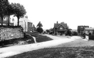
The Green has always been a focus for village life, and has several fine old buildings surrounding it.

The King's Head, on the corner of the green, was a favourite stop for race-goers on their way to the Newmarket races.

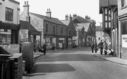
Tesco, then offering the once very popular Green Shield Stamps, has today moved to a larger site. But Beckenham Toys is still in the High Street.

The town climbs increasingly steeply away from the sea to the west of the Wish Tower, with an expansive green- sward, known as the Western Lawns, between the much lower promenade and the buildings fronting

This medieval port stands at the head of the Camel estuary. Sailing ships from Bristol once plied up and down its channel and berthed at the town wharves.

This view looks north-west down Ennerdale from Great Gable's sister peak, Green Gable.

The Square, the building located at the head of the slipway, was once the village post office and is now part of the Mermaid restaurant.

The Nag's Head public house was one of many around Stafford controlled by Joule's Brewery of Stone, established in the 18th century and closed in 1972.

The village green is now fenced and council-owned. The road is heading towards the old Cerebos salt factory on the outskirts of the village.

It remains one of the leafier suburbs, though in 1936 the city council destroyed much of its appeal by demolishing the lovely old cottages which clustered round the green.

The Square, the building located at the head of the slipway, was once the village post office and is now part of the Mermaid restaurant.

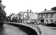
The about-turn view of the last picture, this shows the unmistakable path beaten across The Green to the Queen's Head.
It remains one of the leafier suburbs, though in 1936 the city council destroyed much of its appeal by demolishing the lovely old cottages which clustered round the green.

This bowling green is close to the sea. Bowls was, for many years, regarded as a sport for older men, but it is now popular with both women and young men.

Ardleigh Green Road reaches the Southend Arterial Road (A127) and beyond is Squirrel's Heath Road heading for Harold Wood.
Places (6)
Photos (25)
Memories (382)
Books (0)
Maps (20)

