

Places
36 places found.
Those places high-lighted have photos. All locations may have maps, books and memories.
- Pentre-cwrt, Dyfed
- Pentre Halkyn, Clwyd
- Pentre, Mid Glamorgan
- Ton Pentre, Mid Glamorgan
- Pentre, Powys (near Llangynog)
- Pentre, Powys (near Guilsfield)
- Pentre, Powys (near Bishop's Castle)
- Pentre, Dyfed (near Pontyates)
- Pentre, Powys (near Newtown)
- Pentre, Clwyd (near Mold)
- Pentre, Clwyd (near Ruabon)
- Pentre, Shropshire (near Chirk)
- Pentre, Clwyd (near Hawarden)
- Pentre, Clwyd (near Chirk)
- Pentre, Clwyd (near Ruthin)
- Pentre, Clwyd (near Mold)
- Pentre, Shropshire (near Oswestry)
- Pentre, Powys (near Welshpool)
- Pentre, Clwyd (near Mold)
- Pentre, Shropshire (near Forton)
- Pentre Broughton, Clwyd
- Pentre Gwynfryn, Gwynedd
- Pentre Maelor, Clwyd
- Pentre-clawdd, Shropshire
- Pentre Galar, Dyfed
- Pentre Llifior, Powys
- Pentre-cefn, Shropshire
- Pentre-Gwenlais, Dyfed
- Pentre-Poeth, Dyfed
- Burntwood Pentre, Clwyd
- Pentre Berw, Gwynedd
- Pentre Hodre, Shropshire
- Pentre Llanrhaeadr, Clwyd
- Pentre-celyn, Clwyd
- Pentre Cilgwyn, Clwyd
- Pentre Morgan, Dyfed
Photos
98 photos found. Showing results 2,321 to 98.
Maps
316 maps found.
Books
2 books found. Showing results 2,785 to 2.
Memories
1,253 memories found. Showing results 1,161 to 1,170.
Swan Walk Albion Way Under Construction
In this aerial view the early stages of Swan Walk's construction are visible, along with Albion Way that is near completion and which was opened the following year by the Queen. Between the late 60s and early ...Read more
A memory of Horsham in 1974 by
Barkingside
I have lived in Fullwell Avenue, Barkingside all my life. I was born in 1949. Who remembers where in the high road was W H Smith or Pollacks or where Sainsbury's was orginally? How about the garden centre that was opposite the old ...Read more
A memory of Barkingside by
Whitethorn Morris Dance At The 2007 Chippenham Folk Festival
It rained. It truly rained absolutely all day. Although Whitethorn Morris were booked for three dance spots in the street plus an Arena show there was no chance whatever for either the ...Read more
A memory of Chippenham in 2007 by
Summer Holidays
My grandparents lived in Little Common for as long as I can remember. My family spent many summer holidays at Grandma & Grandad's. In the early sixties we would take the train from Letchworth to King's Cross, a taxi to ...Read more
A memory of Little Common in 1960 by
Memories Of Rothwell In The Sixties
I lived in Rothwell from the age of 5 leaving to come to Australia in 1969 at the age of 16. I think regularly now of how the village would have changed so much since I left. I remember being a bridesmaid ...Read more
A memory of Rothwell in 1969 by
A Well Remembered Toy Shop
Oh yes, the War was on during this time. Shops were open their regular hours. The locals bought their necessities and everyone came and went as usual. The general feeling was 'To Hell With Hitler, we will carry on ...Read more
A memory of Woodford Green in 1941 by
Growing Up In Grappenhall 1980s And 1990s
Having grown up in Grappenhall I've seen it develop with time, but its managed to keep its identity, even though there's been a growing demand for redevelopment in the area. Within the space of a few ...Read more
A memory of Grappenhall in 1990 by
Guntrip Family
My mother and father moved into number 1 Church Lane, just seen on the right of the picture, in the 1950s. Four children were born in that house and were christened in the church. It remained our family home until ...Read more
A memory of Whitchurch by
Swangate Centre
All the buildings on the left of the picture (nearly all Co-Op shops) were demolished to make way for the new Arndale Centre (now Swangate). Most of the local population still mourn the passing of this part of the old town. The ...Read more
A memory of Wellingborough in 2007 by
Dagenham Civic Centre At Bull Lane
This is the view from the other side of Central Park, the main road ran alongside and Heath Park estate where we lived was opposite. I remember my dad and me waiting for a 103 bus to take us to Romford Market and me ...Read more
A memory of Dagenham in 1955 by
Captions
3,593 captions found. Showing results 2,785 to 2,808.

The Parade is Nork's local shopping centre, a left turn off Fir Tree Road; Eastgate on the left, out of camera shot, has large three-storey blocks of 1930s flats.

At the east end of the village, the village green has the war memorial at its centre.

The area near the village green is still the centre for visitors. There are cafes, souvenir shops and workshops for the famous serpentine stone which became popular in Victorian times.

The Red Lion Inn shown here at the centre of the picture survives where others, such as the Bell (on the left) have not; public houses sprang up alongside the canal route which opened to great national

The stone flaming urn of the war memorial, designed by Sir Edwin Lutyens, holds centre stage at the crossroads in this attractive village built exclusively in the native Cotswold stone.

The church stands in the background, and a social centre/parish hall was opened between it and the school in 1968.

Note the Beach Cafe (left) and the groynes on Charmouth beach; we are looking eastwards to Cain's Folly (centre) and Golden Cap (right). Offshore are the Mouth Rocks.

The lintels to the right of the picture have been shaped, with mortises beaten into the stone; the upright stone to the centre right has been vertically tapered to avoid optical distortion.

Looking southwards through the desirable heart of the town`s northern suburb, we can see No 50 further down the street (left of centre) and Nos 53 to 59 (far right) on the other side.

Looking east from the western end of the village, we can see the road junction beside what has become a single Burwell Cottage (centre). Rectory Lane used to be called Duck Street.

The town centre is dominated by its very large triangular market place, which in its turn is visually overwhelmed by the mighty church steeple, completed in 1460 and universally known as the Boston Stump

The fountain and statue in the fernery (centre) was made by Joseph Durham in 1868.

On the corner of the green is the 18th-century Swan Inn (centre right), while nearer is a pair of Victorian cottages dated 1870.

We are looking westwards down East Hill, towards the parish church (centre).

The memorial seat commemorates the six agricultural labourers who met beneath the sycamore tree (centre) in 1834, and were transported to Australia for taking an illegal oath during an initiation

By the late 1800s there were three shops here; one of them, Grice the chemist's (in the centre), was to occupy these premises for many years to come.

It is just possible to make out three carved heads under the large window in the centre - in fact there are four heads here altogether, one of which depicts Queen Victoria.

Today the Town Hall, beyond, could be described as a shell fronting the new Crown Centre shopping arcade, which was built in the 1980s.

The newer Bournemouth International Centre, with its 3500 capacity auditorium, has now joined the Pier Theatre and the Wessex and Tregonwell Halls to make the city the entertainment capital of the

In the centre of the view is Anne's Corner, a picturesque house with timber-framing to the upper floor.

The view shows the centre of Domesday Anstige, as the road drops down from the heights of Bradgate Park.

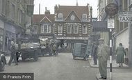
The cab rank and shelter have, of course, gone; further along to the right is now the grossly porticoed entrance to the Angel Place Shopping Centre.

At the centre of the town is the old Market House with its shallow arched openings and weather-vaned bellcote.

The rambling building at the centre of the photograph is The Cowheards pub.
Places (57)
Photos (98)
Memories (1253)
Books (2)
Maps (316)

