Places
26 places found.
Those places high-lighted have photos. All locations may have maps, books and memories.
- Cemmaes Road, Powys
- Six Road Ends, County Down
- Road Weedon, Northamptonshire
- Severn Road Bridge, Gloucestershire
- Roade, Northamptonshire
- Berkeley Road, Gloucestershire
- Harling Road, Norfolk
- Road Green, Devon
- Builth Road, Powys
- Cross Roads, Yorkshire
- Steele Road, Borders
- Cross Roads, Devon
- Four Roads, Dyfed
- Road Green, Norfolk
- Biggar Road, Strathclyde
- Clarbeston Road, Dyfed
- Five Roads, Dyfed
- Eccles Road, Norfolk
- Grampound Road, Cornwall
- Morchard Road, Devon
- Wood Road, Greater Manchester
- Four Roads, Isle of Man
- St Columb Road, Cornwall
- Clipiau, Gwynedd (near Cemmaes Road)
- New Road Side, Yorkshire (near Silsden)
- New Road Side, Yorkshire (near Cleckheaton)
Photos
14,329 photos found. Showing results 3,501 to 3,520.
Maps
476 maps found.
Books
5 books found. Showing results 4,201 to 5.
Memories
11,058 memories found. Showing results 1,751 to 1,760.
Growing Up In Buckhurst Hill 60's 70's
I used to live in The Meadway, and went to St Johns infants School-a few memories of playing on 'the boxes' at play/lunchtime. These were actually old beer crates, and long before health and safety spoiled ...Read more
A memory of Buckhurst Hill by
Richardson 3 Upper Close
Born 25 Dec1938 at numder 3. I have three sisters and a btother who were also born there. Iwenr to the primary school till Dec 1953 then worked at Forest Row garage until I moved to Australia Dec 1954.Ican remember a lot ...Read more
A memory of Forest Row by
Hernville School And Honeywell Shool
My name was Ann Lawrance I lived in a prefab in Calbourne Road from 1945 till about 1956 I went to Hernvile Primary School then Honeywell Secondary school in the Royal ...Read more
A memory of Balham by
Gorton Streets
Does anyone remember Dearoak st, I think it was just around the corner from the baths off queens road
A memory of Gorton by
Hipperholme When I Was A Child.
"The little wooden hut next to the pub ,might have been Peter Manning's paper shop, but the "other wooden hut adjoining it was a chip shop when I was a kid and Mr. Ainley had it then. He also had a tiny little place ...Read more
A memory of Hipperholme by
Hounslow, Memories Of Bulstrode Girls School
I too went to Hounslow town Junior school from age 7, then on to Bulstrode Girls School. Mrs Collins was head teacher. We had Mrs Johnstone for geography, Mrs Davies for English , Mrs Balls for history, miss ...Read more
A memory of Hounslow by
David Buckland From Kestrel Road To Caustons Then Corfu
I was born in Kestrel Road in 1945 went to Chamberlin Road school then on to North end and from there got an apprenticeship at Sir Joseph Causton, Had many a memorable year working there but ...Read more
A memory of Eastleigh by
Iverson F.C.
In the early sixties I played football for a local Kilburn team call Iverson F.C. which was managed by Alf Taylor for many years. Alf and his wife Ethel and daughter Pat lived in Ariel road which was a turning off of Iverson ...Read more
A memory of Kilburn by
Little Switzerland
I remember going there on many occasions in the late 50’s and early 60’s. Catching the bus from Hessle Road (we lived in Bean Street) and this was a great day out for kids “in the country” The method we used of getting to the quarry ...Read more
A memory of Hessle by
Quest For A Steep Hill In Dronfield With Post Office And Shops And Junction At The Bottom In Early 1960s....
Does anybody know which road it would have been? Up to age 3 I lived at Coal Aston between 1957 and 1960. I have a vague memory of my Mum pushing me in the pram and myself walking on this steep road.....
A memory of Dronfield by
Your search returned a large number of results. Please try to refine your search further.
Captions
5,036 captions found. Showing results 4,201 to 4,224.
The post office on the left is now a house; the post office has moved across the road into Read the tobacconist's next to the Gedling Wine Stores on the corner of Waverley Avenue – this shop is now
Newark enjoyed great prosperity in the 18th century through industrial growth and through its status as a coaching town on the Great North Road.
Long Row leads westwards uphill into Chapel Bar, now truncated by the Maid Marian Way roundabout junction with Derby Road.
With five roads feeding into it, this famous junction (close to the access to the Queensway Tunnel under the River Mersey) is one of the busiest in the region.
The Eclipse pub on the right, built in typical Surrey 1930s road-house vernacular, is now a Caffe Uno.
East from Claygate and across the Hogsmill river valley, the route reaches Ewell, now by-passed by the A24 London to Worthing road.
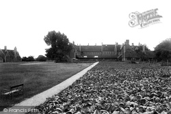
North-east of the village and north of the A415 Abingdon Road is a large complex of austere Gothic- style buildings. This is now the European School, and not much softened with age.
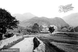
This very early postcard view of the Borrowdale Hotel, with Grange Crags behind, shows the Lake District as it was before the tourist invasion really took hold.The traffic-free minor road meanders
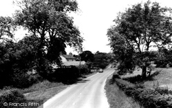
The 1950s and 1960s were ideal decades for taking to the quiet country roads and villages to enjoy the exhilaration of motor-car driving.
Further down, towards Bancroft and Nightingale Road, the tannery and other industrial works poured their waste into the river. Only the lavender works may have offset the obnoxious smell of the Hiz!
Hall in commemoration of Queen Victoria's Jubilee brought applause in 1897, when the council had the opportunity to purchase the land and remove the shop which was an obstruction in the road
Every possible mode of transport can be seen at the junction on the A47 main road to Yarmouth from Norwich.
Bowling's the ironmongers moved to Grove Road in the 1920s, and their shop became a branch of the Midland Bank. This has since been converted to a pub called 'The Old Bank'.
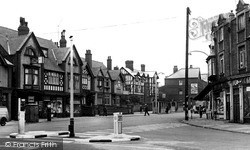
This view is at the junction of Woodside and Rickmansworth Roads and looks south-west towards Oakfield Corner.
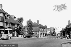
Before the by-pass this was the main road through the town; it is now pedestrianised.
This is the centre of Milford, with the road to Keyhaven and the coast on the right by the Midland Bank.
But the two lines of vehicles waiting for the traffic lights to change on this stretch of the A232 linking Cheam to Sutton and Croydon give a foretaste of the steadily increasing road usage in decades
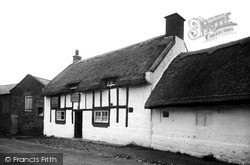
This lovely thatched, half-timbered inn has stood on this site, alongside the connecting road from Birkenhead to Neston, since 1611.
Like W164301 (page 43), this was taken from Leasowe Road, but from the opposite corner some fifty-five years later.
Beyond, in the centre of the picture, is the Totnes Road development of 1890, showing the movement away from detached villas to semi-detached houses.
The modern expansion of Groby as a Leicester suburb is to be glimpsed as the main road swings to the right towards Coalville.
The rest of the village follows the high road above the River Ribble.
The inner relief road, the John Adams Way, has made a tremendous difference to this scene, and only the River Witham is the same.
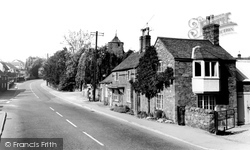
The Crown Inn and Restaurant (the white building to the left of the road) is still there, as are the other houses. This photograph looks towards Market Rasen.
Places (26)
Photos (14329)
Memories (11058)
Books (5)
Maps (476)


