Places
36 places found.
Those places high-lighted have photos. All locations may have maps, books and memories.
- Chatsworth House, Derbyshire
- Osborne House, Isle of Wight
- Brambletye House, Sussex
- Ickworth House, Suffolk
- Kingston Lacy House, Dorset
- Boscobel House, Shropshire
- Preshute House, Wiltshire
- Bolton Houses, Lancashire
- Brick Houses, Yorkshire
- Quaking Houses, Durham
- Water Houses, Yorkshire
- Bottom House, Staffordshire
- New House, Kent
- Mite Houses, Cumbria
- Lyneham House, Devon
- Church Houses, Yorkshire
- Dye House, Northumberland
- Spittal Houses, Yorkshire
- Street Houses, Yorkshire
- Tow House, Northumberland
- Halfway House, Shropshire
- Halfway Houses, Kent
- High Houses, Essex
- Flush House, Yorkshire
- White House, Suffolk
- Wood House, Lancashire
- Bank Houses, Lancashire
- Lower House, Cheshire
- Marsh Houses, Lancashire
- Chapel House, Lancashire
- Close House, Durham
- Guard House, Yorkshire
- Hundle Houses, Lincolnshire
- Hundred House, Powys
- Thorley Houses, Hertfordshire
- School House, Dorset
Photos
6,747 photos found. Showing results 5,081 to 5,100.
Maps
370 maps found.
Books
Sorry, no books were found that related to your search.
Memories
10,363 memories found. Showing results 2,541 to 2,550.
Nans House
Mr grandparents lived at 80 Dudley Road. This property was many years earlier a public house (I think it was called the Raven or the Blackbird). It was next to the railway line. To this day it has helped to give me a love of steam engines. I ...Read more
A memory of Lye in 1962
Hilton Village
My father, Dennis Jepson, lived in Hilton, at the time the Manor was still in operation. He remembered having to doff your hat to the Lord of the Manor, if he were seen in the streets of Hilton. My father was about 8 at ...Read more
A memory of Hilton by
Memories Of Stanford Le Hope
I too have many memories of Stanford-le-Hope. I was born in Orsett hospital. My mother came from South Wales whilst my father came from Ashford in Middlesex. The reason they came to live here was my aunt and ...Read more
A memory of Stanford-le-Hope
Wrens Warren Camp School
In 1949 I was a pupil at Wrens Warren Camp School near Colemans Hatch. The school was housed in long huts which I believe to have been used in the war. It was a school for children who had been ill and needed some ...Read more
A memory of Colemans Hatch in 1949 by
My Father Worked At This Shop
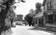
My father Ron Burchell worked at the shop seen in this photograph. The Burchell family had lived in the village for generations. The owner of the shop was Edward Grinstead and his wife Millie who was my godmother. ...Read more
A memory of Bury in 1940 by
Bury Church And Ferry
On this picture you can see the steps used by the ferry man from the 1920s to the 1940s. He used a pole to steer the punt from the Bury bank to the Amberley bank. The punt was attached to a chain which stretched across the ...Read more
A memory of Bury in 1940 by
My Days At Salfords School
I was at the old Salfords school from 1951 to 1957 just before it moved to the new site in Copsleigh Avenue. We started in Miss License's class where I remember playing in sand trays and writing on slates. She was a very ...Read more
A memory of Salfords in 1951 by
This Was My Home In 1969 For A Few Years.
I used to live in the first house on the left side of the photo 'Thurlestone Cottages 1890', in 1969 for a number of years. The house was then called 'Thatchways'. The smaller cottages attached to the main ...Read more
A memory of Thurlestone in 1969 by
Lords Saddle & Harness Makers
My ancestors lived in Thrapston from the early 1800s to 1917. They were saddle and harness makers, does anyone have any pictures of the shop? I believe it was near to the King's public house.
A memory of Thrapston in 1900 by
Evacuee
I was an evacuee in Middlestown in WWII, from East London. The first time was with my Mother and we were billeted in a small cottage which backed on to a barn belonging to a farm run by Mr and Mrs Cowan. We were there for approximately a ...Read more
A memory of Middlestown in 1943 by
Your search returned a large number of results. Please try to refine your search further.
Captions
6,914 captions found. Showing results 6,097 to 6,120.
The building with the lady leaning out of the window (six buildings from the right) is still standing; it housed the post office until 1963, when the present post office opened.
The Prince Albert public house is at the end of the road, hidden by trees.
Terraces extend down Mallams, and houses have reached Modbury Mead (centre).
The Crown Inn and Restaurant (the white building to the left of the road) is still there, as are the other houses. This photograph looks towards Market Rasen.
In front of one of these houses stood the community's well. This was cemented over in the 1950s. It was 175 feet deep, and was notorious for breaking its rope and losing the bucket.
Behind the trees, with only the chimney pots visible, are the purpose-built school houses, Garlands, The Knoll and Hillside. Football Lane runs sharply downhill to the right.
It originally started as just five women students assembling in a house in Cambridge to be tutored by Mrs Jemima Clough; as the establishment grew, it moved into a building in the suburb of Newnham, taking
In the distance, on the right, is Bank Parade house, once the home of Sir James Mackenzie (1853-1925).
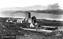
Iona was chosen by St Columba in AD 563 as the site for a religious house from where he could carry out his missionary work.
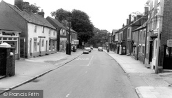
The camera looks north-south along the High Street as it crosses the Leicester to Nottingham railway, and at a not unattractive group of houses and shops ranging in date from the 18th
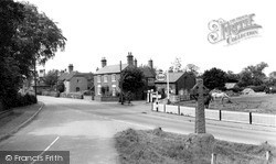
The houses of the late 18th and early 19th centuries are almost picturesque behind hedges and walls, with a restrained petrol sign being all that is needed to alert drivers to the garage's presence - petrol
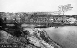
Taken long before the days of amusement arcades and the bandstand, this photograph shows that Pier Road and the Crag consisted solely of dwelling houses, probably occupied mainly by the fishing community
At the far side of the meadows stand the Bath Houses. These were founded by local surgeons in 1722, but were rebuilt a hundred years later.
In the distance we can see scaffolding on a house - it was destroyed by fire in September 1929.
Lombard Street is one of the least changed streets in this delightful market town, a tangle of narrow lanes and alleys winding to the east of the towering walls of Petworth House's grounds.
Set in remote and well-wooded rolling countryside west of and utterly remote from Crawley, Rusper has a gently curving main street with many good houses and cottages.
All around are the ruins of engine houses and copper mines. The Celtic St Cleer's well is situated in a somewhat suburban part of the village, surrounded by bungalows.
A corner of the 13th-century castle can be seen at the top right of the picture, though our main subject is the country house built by Thomas Mansel Talbot in the 1770s and its 19th-century additions.
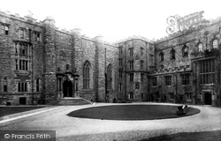
The keep is 14th-century; it was rebuilt in 1840 to house students following the creation of Durham University in 1832. The castle was turned into a university college a few years later.
The attached manor house was erected in 1614.
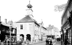
A tragedy for Chesham was the demolition in 1965 of the Market House (or Town Hall) in the alleged interests of those great behemoths, the motor car and the lorry.
Designed in the 1760s by the splendidly-named architect Stiff Leadbetter for William Drake, it replaced a 1630s house and was completed and decorated by Robert Adam.
Hewitts, the Free Church of 1913 and the hall beyond were demolished in 1963 and replaced by the tawdry flat-roofed three-storey Sycamore House flats, offices and shops.
Beyond the building on the right, Yew Tree House with its yew tree, is the pub and church, the latter with its fine 130ft-high 15th-century spire and the Sir John Jefferay monument to the builder
Places (80)
Photos (6747)
Memories (10363)
Books (0)
Maps (370)


